Country:
 City:
City:


The walk starts alongside the RN67, in the Bois de Saint-Roch.
From Chaumont: leave the town, heading towards Troyes. The road passes under the viaduct twice; then, after the traffic lights, take the third exit at the roundabout, heading towards Arc-en-Barrois and the motorway. Park at the entrance to the first track on the left.
From the motorway: head towards Chaumont; park at the entrance to the first track on the right after the Route de Saint-Roch.
(S/E) Cross the road carefully and follow the track opposite heading south-west, into the forest.
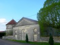
As you emerge from the forest, you’ll see the Ferme du Fays and its dovecote. You’ll then arrive at the farm.
(1) Take the path on the left to return to the RN67. Cross the road very carefully and enter the woodland to the right of the junction.
(2) After 50 metres, follow the path branching off to the left. At the end of the path, after walking alongside a wall, you’ll come out onto a tarmac road (D101a). After crossing it carefully, follow it to the left for about fifty metres.
(3) At the far end of the field, enter the copse on the right. There you will find a path which you should follow to the right, keeping a short distance from the field. Before reaching the end of the copse, the path climbs to the left then immediately turns at a right angle to the left.
At the end of the path, you’ll come out onto a track. Carry on straight ahead. Ignore the two paths on either side. The track then gradually turns to the right to join a well-maintained track.
(4) Carry on to the right, heading north, along this track which runs some distance from the edge of the woodland. Stay on it until the ground begins to rise more noticeably. When the track levels out again, ignore a track branching off to the left.
(5) A few metres further on, leave the track for a path that branches off to the right and then descends quite steeply. Just before reaching a small valley, the path turns left then right. Then ignore a path on the left and a track on the right to reach a small lane.
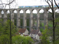
(6) Follow this lane to the left, then take the first path on the right about twenty metres further on. Stay on this path until you reach a tarmac road. There, take a good forest track to the left, ignoring the road. Follow it until you see the viaduct on the left. Then find a path branching off to the left of the main track and take it; after a few dozen metres, you’ll reach a viewpoint overlooking the Chaumont Viaduct.
(7) You can sit on large rocks to admire the scenery or have a picnic. Then continue to the right, heading east then south, until you reach the end of the track. Turn sharply left to reach the Suize Valley. From there, follow a track in the same direction, heading north, and carry on straight ahead until you reach the viaduct.
Immediately after the viaduct, take the path running alongside it, heading left. Just before the road, turn left to pass under the viaduct again and find a footpath running alongside the road. Then take the first path on the left that leads into the forest.
(8) Stay on the main path, which veers slightly to the left, leaving a small path on the right – this
is shown on the map further south than it actually is. Stay on the main path right through to the finish (S/E).

 Visorando Member
 Moderate