A circular walk starting from Zimmerplatz

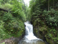
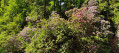
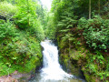
This circular walk takes you past the Gerolsdsau waterfalls, the Kreutzfelsen rock and the Hinterer-Wald forest. You’ll follow a stream lined with rhododendrons (in bloom in mid-May), past a series of small waterfalls, then on to a superb viewpoint at the Kreutzfelsen rock. You’ll also pass through a beautiful forest.

Details

1112025
Creation:
Last update:
Last review:
  • Walking
    Activity: Walking
  • ↔
    Distance: 11.62 mi
  • ◔
    Average duration: 7h 10 
  • ▲
    Difficulty: Difficult

  • ⚐
    Back to start: Yes
  • ↗
    Ascent: + 2,136 ft
  • ↘
    Descent: - 2,136 ft

  • ▲
    Highest point: 2,244 ft
  • ▼
    Lowest point: 755 ft

Photos

Description of the walk

Park in the Zimmerplatz car park.

(S/E) Take the middle path, which climbs gently towards Geroldsau. Ignore the paths branching off to the left.

(1) At the four-way junction, go straight on. Ignore a path leading down to the right.

(2) After a right-hand bend, go down the path on the right, then shortly afterwards turn left and follow the grassy path down to the village of Geroldsau. Continue along Laisenbergweg until you reach the main road.

(3) Turn right, then after about 60 m head up Geroldsauerstaße, which runs alongside the River Grobbach.

(4) Turn left, cross the bridge and continue along the road towards Büthof.

(5) Head down the path on the right and follow the river.

(6) Turn left and head towards the Bütthof restaurant.

(7) Cross the stream again on the left to reach Wasserfallstraße. Turn right onto this road and follow it for a few metres. Take the path leading uphill to the left. Cross a track and continue along this path. You will reach the Bernickelhutte mountain hut.

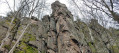
(8) Take the path on the left which leads to the Kreutzfelsen rock.

(9) Return to the previous junction.

(8) Take the track straight ahead towards the Scherrhof. At a right-angled junction, join the Sperrstichweg.

(10) Turn right onto this path. Continue along this path, ignoring all the paths on your left and right. You’ll come to a four-way junction.

(11) Take the path on the left, which leads downhill. You will reach the banks of the Eberbach stream.

(12) Take the path slightly to the left towards the Scherrhof. Follow the stream until it joins its tributary.

(13) Turn left and immediately take a path that climbs to the right. This leads directly to the Scherrhof.

(14) Head back down the path (tarmacked at the start) on the left. You’ll cross the Eberbachweg path.

(15) Turn left onto it. You’ll reach the junction where the two streams meet.

(13) Take the same path as on the way up to return to the junction with the stream you passed earlier.

(12) Head down the path on the left, following the Eberbach stream and then the Harzbach towards the Wasserfälle. Walk past the Urbachhütte shelter.

(16) Keep straight on along the path that runs alongside the streams. Reach the junction for Schwanenwasen (signs on a low wall).

(17) Cross the bridge on the left. After the bridge, turn immediately right towards the Bütthof. The path runs along the left bank of the Grobbach. You’ll reach the Bütthof restaurant.

(7) Carry on along the same path to the bridge junction.

(6) Stay on the left bank of the stream heading towards the waterfall car park and Zimmerplatz. Keep to this left bank and follow it. Walk above the stream. Pass in front of the Wannacker Hutte before reaching the waterfall car park.

(18) From the car park, you can walk down the path to see the Brahmsbrunnen. Return to the car park.

(19) Cross the road and follow the small path down towards Malschbach. Walk back up the road, then follow the path to the Zimmerplatz car park (S/E).

Waypoints

  1. S/E : mi 0 - alt. 1,181 ft - Zimmerplatz car park.
  2. 1 : mi 1.01 - alt. 1,089 ft - Crossroads of the four paths.
  3. 2 : mi 1.37 - alt. 1,020 ft - Path on the right.
  4. 3 : mi 1.76 - alt. 758 ft - Turn right.
  5. 4 : mi 1.96 - alt. 791 ft - Bridge over the Grobbach
  6. 5 : mi 2.11 - alt. 850 ft - Waterfall Trail.
  7. 6 : mi 3.01 - alt. 1,063 ft - Bridge over the Grobbach
  8. 7 : mi 3.06 - alt. 1,066 ft - Bütthof Restaurant
  9. 8 : mi 3.81 - alt. 1,759 ft - Bernickelhütte shelter
  10. 9 : mi 3.86 - alt. 1,729 ft - Kreutzfelsen Rock
  11. 10 : mi 4.14 - alt. 1,739 ft - Sperrstichweg
  12. 11 : mi 4.84 - alt. 1,886 ft - Crossroads of four paths
  13. 12 : mi 5.17 - alt. 1,814 ft - Eberbach stream
  14. 13 : mi 5.46 - alt. 2,021 ft - Scherrhof Trail
  15. 14 : mi 5.82 - alt. 2,244 ft - Scherrhof
  16. 15 : mi 6.24 - alt. 2,169 ft - Eberbachweg
  17. 16 : mi 7.81 - alt. 1,463 ft - Urbachhütte mountain hut
  18. 17 : mi 8.44 - alt. 1,247 ft - Bridge
  19. 18 : mi 10.26 - alt. 922 ft - Car park
  20. 19 : mi 10.48 - alt. 896 ft - Path to Malschbach
  21. S/E : mi 11.62 - alt. 1,181 ft - Zimmerplatz car park.

Notes

There are several refuges along the route: the Bütthof and Scherrhof restaurants, and the Kreutzfelsen and Urbachhütte refuges.
Refreshments are available at the Bütthof (open all year round) and the Scherrhof (closed on Tuesdays)
The Bütthof can provide information by telephone on when the rhododendrons are in bloom.

Worth a visit

The village of Malschcach and the surrounding meadows.
The waterfalls and rhododendrons.
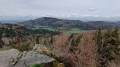
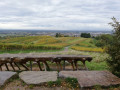
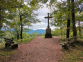
The view from the Kreutzfelsen.
Beautiful forest.
The charming town of Baden-Baden is nearby.

Reviews and comments

4.5 / 5
Based on 2 reviews

Reliability of the description
5 / 5
Ease of following the route
4.5 / 5
Route interest
4 / 5
bernard.gross
bernard.gross

Overall rating : 4.3 / 5

Date of your route : Jul 28, 2026
Reliability of the description : ★★★★★ Very good
Ease of following the route : ★★★★☆ Good
Route interest : ★★★★☆ Good
Very busy route : No

A lovely walk, mostly through the woods (perfect in hot weather!), with a beautiful view at Kreutzfelsen
Quite a few people along the stream, but no one after that.
It’s fairly easy to follow the route, but you need to be very careful at point 2: the start of the path is obscured by vegetation

Machine-translated

Other walks in the area

For more walks, use our search engine .

The GPS track and description are the property of this route's author. Please do not copy them without permission.