Circular Plättig to Herrenwieser See via Badenerhöhe

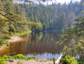
Cross a nature reserve via the Wildnispfad (a wild trail littered with dead trees) and the Luckspfad (Lynx Trail). Walk along the ridges of the Badener Höhe and the Seekopf. Descend to the idyllic glacial lake, Herrenwieser See.

Details

n°20362350
Creation:
Last update:
Last review:
  • Walking
    Activity: Walking
  • ↔
    Distance: 10.05 mi
  • ◔
    Average duration: 6h 10 
  • ▲
    Difficulty: Difficult

  • ⚐
    Back to start: Yes
  • ↗
    Ascent: + 1,821 ft
  • ↘
    Descent: - 1,804 ft

  • ▲
    Highest point: 3,291 ft
  • ▼
    Lowest point: 2,425 ft

Photos

Description of the walk

Park in the Obere Plättig car park.

(S/E) From the car park, cross the Schwarzwaldhochstrasse. Follow the tarmac path, to the left of the hotel, towards Badener Höhe.

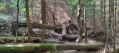
(1) Turn right onto the Wildnispfad, then immediately left. You’ll reach a meditation platform. Continue along the Wildnispfad.

(2) At a left-hand bend, where the Wildnispfad descends towards a wider path, leave the Wildnispfad to the right, taking a little-used path that winds through the forest.

(3) At the picnic area, turn right onto the Brautsteinweg, heading towards Badener Höhe. Ignore a path on the right.

(4) At the Herrenwieser Sattel junction, carry on towards Herrenwieser See.

(5) Carry on straight ahead towards Badener Höhe.
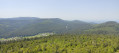
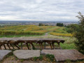
At the Badener Höhe picnic area, climb the 168 steps to the top of the Friedrichs Turm. Panoramic view of the Black Forest.

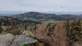
(6) Continue towards Herrenwieser See. Ignore a path on the right, then immediately turn right. Ignore a path on the right. Pass by the monument to Philipp Bussemer, creator of the ridge trail. After a viewpoint, descend towards the lake along a very rocky path.

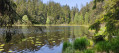
(7) Turn right at the T-junction and, shortly afterwards, turn right and walk round the lake. The lake and its surroundings form a nature reserve.

(8) At the far end of the lake, head down the path on the right which runs alongside the Seegraben stream. Ignore a path on the left.

(9) Turn left onto the mountain bike track. Ignore a path on the right, then another on the left, and shortly afterwards turn right.

(10) Turn left onto an unmarked dirt track. Continue straight on at the fork.

(11) At the Badener Sattel Hütte, follow the grassy path marked with a Blue Diamond to the left of the hut. Turn right.

(5) Turn right onto the gravel path.

(4) At the Herrenwieser Sattel junction, carry straight on along the path leading downwards. At the Mittelfeldhütte, cross the path and head towards An Urbach. Turn left.

(12) At the right-hand bend, take the quiet, unmarked grassy path. Ford the Urbach Stream and turn onto the path on the left.

(13) Turn right onto a mountain bike track. Ignore a path on the right.

(14) Shortly afterwards, turn right towards Untere Plättig. Take a look at the Wllsackfelsen on the left, then continue along the path.

(15) Turn left onto the Luckspfad. Cross a path and continue along the Luckspfad.

(16) At the fork, continue along the Wildnispfad. Turn left onto the path leading to the car park.

(1) Cross the Schwarzwaldhochstrasse and head for the car park (S/E).

Waypoints

  1. S/E : mi 0 - alt. 2,513 ft - Obere Plättig car park
  2. 1 : mi 0.21 - alt. 2,595 ft - Junction of the circular loop
  3. 2 : mi 0.84 - alt. 2,674 ft - Unmarked trail
  4. 3 : mi 1.21 - alt. 2,680 ft - Picnic area
  5. 4 : mi 2.09 - alt. 2,917 ft - Herrenwieser Sattel junction.
  6. 5 : mi 2.58 - alt. 3,153 ft - Path to Scherrhof
  7. 6 : mi 2.94 - alt. 3,291 ft - Badener Höhe
  8. 7 : mi 4.25 - alt. 2,838 ft - Junction towards Herrenwieser See
  9. 8 : mi 4.86 - alt. 2,782 ft - Downhill path
  10. 9 : mi 5.18 - alt. 2,484 ft - Mountain bike trail
  11. 10 : mi 5.91 - alt. 2,805 ft - Dirt track
  12. 11 : mi 6.09 - alt. 2,917 ft - Badener Sattel Hütte
  13. 12 : mi 8.01 - alt. 2,493 ft - Grassy path
  14. 13 : mi 8.54 - alt. 2,582 ft - Mountain bike trail
  15. 14 : mi 8.67 - alt. 2,552 ft - Head towards Untere Plättig
  16. 15 : mi 9.02 - alt. 2,461 ft - Luckspfad
  17. 16 : mi 9.6 - alt. 2,530 ft - Wildnispfad
  18. S/E : mi 10.05 - alt. 2,513 ft - Obere Plättig car park.

Notes

There are no water sources along the route.
Shelters at Badener Höhe, Herrenwieser See and Mittelfeldhütte (between points (4) and (12)).
Wear sturdy footwear (stony sections).

Reviews and comments

4.3 / 5
Based on 2 reviews

Reliability of the description
4 / 5
Ease of following the route
4.5 / 5
Route interest
4.5 / 5
Vincent Lieutier
Vincent Lieutier

Overall rating : 4 / 5

Date of your route : Apr 07, 2026
Reliability of the description : ★★★★☆ Good
Ease of following the route : ★★★★☆ Good
Route interest : ★★★★☆ Good
Very busy route : No

A lovely walk. Please note that a section at the start, in the woods, no longer appears to be open to walkers.

Machine-translated

Les M&M's
Les M&M's

Overall rating : 4.7 / 5

Date of your route : Jul 28, 2024
Reliability of the description : ★★★★☆ Good
Ease of following the route : ★★★★★ Very good
Route interest : ★★★★★ Very good
Very busy route : No

A very nice hike.
Note: at point 2, you leave the Wildnispfad at a point where it is marked by ropes; you have to climb over the rope to get onto the little path, which is not very visible.

Machine-translated

Other walks in the area

For more walks, use our search engine .

The GPS track and description are the property of this route's author. Please do not copy them without permission.