


Refine your search for walks in Truinas
Truinas walks


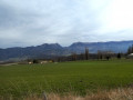
 From the Serre de Tourasson to the Col de Vesc between Rimandoule, Roubion and Jabron
 Visorando Member
 27.35 mi
 +2,441 ft
 -2,441 ft
 3 hrs
 Moderate
 Departure from Truinas (Drôme)
A picturesque walk, mainly along minor roads, starting from the Church of Saint-Jean-Baptiste in Truinas. The route features climbs, winding sections and, of course, descents, offering magnificent views along the way.
The view of the Trois Becs and the Montagne de Couspeau accompanies you for much of the route as you pass through the village of Poët-Célard and its renovated castle, the Château de Saint-André, the Col de Vesc, the church and the Château de Comps.
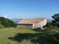
 Montagne de Saint-Maurice
 3.35 mi
+1,335 ft
-1,319 ft
2h 40
 Difficult
Departure from Comps (Drôme)
On the border between Baronnies and Diois, Saint-Maurice is famous for its chapel and ridges. There is a beautiful view to the north with the forest of Saoû, the Trois Becs at Roche Colombe, the Grand Delmas and the Couspeau mountain in the background, and the Lance mountain to the south.
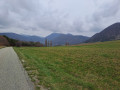
 Comps, tour of the Jabron Valley
 11.03 mi
+1,499 ft
-1,486 ft
2 hrs
 Easy
Departure from Comps (Drôme)
A route taking in small roads and paths that allow you to discover the varied landscapes surrounding the village of Comps and the upper reaches of the Jabron Valley, from the Col de Ventebrun to the church at Comps via the Col de Boutière and the Col de Vesc.
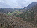
Comps, around the Montagne des Ventes
 13.71 mi
+1,893 ft
-1,886 ft
3 hrs
Moderate
Departure from Comps (Drôme)
A walk along small roads, tracks and paths, offering a chance to explore the varied landscapes surrounding the village of Comps, at the head of the Jabron valley, via its church and a circuit around the Montagne des Ventes.
Bois de Vache - Saoû Forest
 Local authority4.04 mi
+558 ft
-564 ft
2h 20
Easy
Departure from Le Poët-Célard (Drôme)
The hilltop village of Le Poët-Célard offers a journey back in time as you wander through its medieval streets leading up to the castle. Then discover the local area, including the Château de Saint-André.
Tour of the Poët and Saint-Maurice Mountains
 20.32 mi
+2,717 ft
-2,717 ft
4 hrs
Moderate
Departure from Rochebaudin (Drôme)
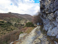
This route takes you along small roads, forest tracks and footpaths, allowing you to discover different landscapes and villages. Starting from Rochebaudin, the route passes through the Col du Perthuis, the Col de Ventebrun, Dieulefit, Poët-Laval, the Grand Pas quarry and Eyzahut.
Bisquerle trail starting from Rochebaudin
 3.85 mi
+1,201 ft
-1,201 ft
2h 50
Moderate
Departure from Rochebaudin (Drôme)
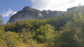
Starting from Rochebaudin, this hike crosses Les Blanchons to reach the foot of Rocher de la Tournelle. It then follows the Bisquerle trail, passes Pied Berthon (possible route to Eyzahut), and joins the DieulefitGRP® (long-distance footpath), allowing you to return to the village via a forest path along the Viarrand ravine.
Short Protestant route – Dieulefit-Bourdeaux region
3.13 mi
+384 ft
-381 ft
1h 45
Easy
Departure from Bourdeaux (Drôme)
A gentle walk offering a route through the countryside and a visit to the old village of Bourdeaux (La Viale).
Montagne des Ventes
 3.36 mi
+1,224 ft
-1,250 ft
2h 35
Moderate
Departure from Comps (Drôme)
This is a short hike, mostly through wooded areas with regular openings offering beautiful views of the Dieulefit and Bourdeaux countryside. In particular, you can see the Romanesque church and the 12th-century (private) castle of Comps, the entire Saoû Forest, from Roche Colombe to Trois Becs and the Couspeau Mountain.
Bois Sec and banks of the Roubion in Francillon
 3.07 mi
+384 ft
-400 ft
1h 45
Easy
Departure from Francillon-sur-Roubion (Drôme)
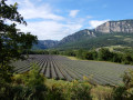
This is an easy walk to stretch your legs while enjoying a beautiful variety of landscapes: panoramic views of the majestic syncline of the Saou Forest, dry pine forests, the cool banks of the Roubion inviting you to take a dip, and even lavender fields to finish off before crossing the pretty village of Francillon.
Bois Sec and Vaire - Saoû Forest
2.78 mi
+354 ft
-354 ft
1h 35
Easy
Departure from Francillon-sur-Roubion (Drôme)
After swimming in the Roubion, you can finish the descent at nightfall: Vaire is a remarkable platform for stargazing, at the foot of the southern slope of the Saoû syncline.
Please note: the route is impassable when the Roubion is in flood.
Serre Antoine - Saoû Forest
 7.33 mi
+1,417 ft
-1,421 ft
4h 35
Moderate
Departure from Mornans (Drôme)
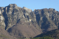
Sheltered by the imposing wall of the Saoû perched syncline, you will pass close to the ruins of Pradas and also enjoy unobstructed views over the Roubion valley.
⚠️ Between 1 July and 15 September, Prefectural Order DDT-SEF-2026-0176 of 4 June 2026 concerning temporary restrictions on access to the Saoû forest and the Ambel plateau in the event of a fire risk, assessed on a daily basis. A map is published every evening (around 5.30 pm) for the following day.
Saint-Maurice via the Combe
 8.33 mi
+1,785 ft
-1,791 ft
5h 25
Moderate
Departure from Dieulefit (Drôme)
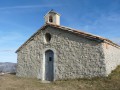
On the border between the Baronnies and the Diois, Saint-Maurice is famous for its chapel and ridges. There is a beautiful view to the north with the forest of Saoû, the Trois Becs at Roche Colombe, the Grand Delmas and the Montagne de Couspeau in the background, and to the south, the Montagne de la Lance and, on a clear day, Mont Ventoux.
Saint-Maurice via the ridges
 7.23 mi
+1,693 ft
-1,699 ft
4h 50
Moderate
Departure from Dieulefit (Drôme)
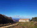
The Montagne de Saint-Maurice is famous for its chapel and ridges. This route offers beautiful views of the Trois Becs, the Grand Delmas and the Montagne de Couspeau to the north, and the Montagne de la Lance to the south. On clear days, you can even see Mont Ventoux.
Montagne de Saint-Maurice via the track and the valley
 9.64 mi
+1,749 ft
-1,755 ft
2 hrs
Moderate
Departure from Dieulefit (Drôme)
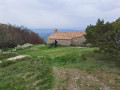
Montagne de Saint-Maurice is famous for its chapel and ridges. This route takes you there via a track suitable for vehicles and offers a lovely view with a magnificent 360° panorama, with the Trois Becs, Grand Delmas and Montagne de Couspeau to the north, Montagne de la Lance to the south and, on a clear day, Mont Ventoux. The return journey follows a path through a beech forest, at the bottom of a wild valley.
Montagne de Saint-Maurice via the track
 11.80 mi
+1,752 ft
-1,759 ft
2 hrs
Moderate
Departure from Dieulefit (Drôme)
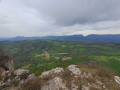
Montagne de Saint-Maurice is famous for its chapel and ridges. This route takes you there via a track suitable for vehicles, allowing you to enjoy a lovely viewpoint with a magnificent 360° panorama: to the north, the Trois Becs, the Grand Delmas and Montagne de Couspeau; to the south, Montagne de la Lance; and on a clear day, Mont Ventoux.
Le Pradou - Roche Rousse
9.05 mi
+2,907 ft
-2,897 ft
6h 40
Difficult
Departure from Mornans (Drôme)
This wild hike allows you to discover the south-eastern ridge of the Saoû Forest, passing by the peaks of Pradou and Roche Rousse with views of the southern Drôme mountains as far as Mont Ventoux.
Please note that the route passes through a quiet zone for wild animals. It is forbidden to use it between Pas de Floréal (6) and the bottom of Pré de l'Âne (8) between 15 May and 15 July.Specific signage and a diversion from the GR®9 have been put in place to guide users, seehere.