


 Country:

 City:


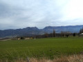


Start at the little Church of Saint-Jean-Baptiste, situated at the junction of the D245 and D521. Park in front of the hedge or in front of the cemetery, about fifty metres away.
(S/E) With your back to the hedge, turn left onto the D245, towards Félines-sur-Rimandoule. Follow this small road, which is narrow in places, with care until you reach the junction with the D192.
(1) Take a sharp right-hand bend towards Bourdeaux. Ignore the turn-offs to the various hamlets on either side and continue until you reach a ‘Stop’ sign situated between two houses.
(2) Carry on straight ahead onto the D192, towards Bourdeaux. Head for the Col de Boutière.
(3) Between the recycling bins and the D538, take the D233, a small road on the left, towards Pascalin. Pass the restaurant and look for the start of the Chemin de Péquimbert on the left.
(4) Take this track and, at the three-way junction that follows on thefirst plateau, keep to the right. Then climb a short but steep slope, reach asecond plateau and continue to the end of the tarmac road (Serre de Tourasson).
(5) Turn round and head back to the D233.
(4) Take a sharp left-hand bend and continue along this road, which runs along the hillside. You’ll reach a junction, by a house on the side of the road, where the Route du Père Bompard branches off to the right.
(6) Follow this road, taking care on the steep descent after the left-hand bend. At the junction at the bottom, turn right, cross a woodland and reach the start of a road on the left, opposite the access path to the house below.
(7) Follow this road to the left – the Chemin des Goix – until you reach a fork. Walk a few metres to the left to enjoy the view over the Saoû Forest. Stop before the tarmac starts to deteriorate.
(8) Turn round and head back to the main road.
(7) Continue downhill to the left until you reach the village of Poët-Célard, with its castle overlooking the village.
(9) Pass the town hall, continue down the hill for a few metres, then, on leaving the village, turn right onto the D328a towards Dieulefit. Begin the climb, pass the campsite and, when you reach the slight incline, look out for the Château de Saint-André below and join the D538.
Don’t hesitate to take the Chemin de Boudonne for a few metres, just past the château, to get a better view of it.
(10) Continue downhill to the left along this busier road. After thesecond hairpin bend, you’ll reach the start of the D191a on the right.
(11) Follow this road uphill, towards Comps, until you reach the next junction.
(12) Turn left onto the D191, towards Orcinas, and head for the hamlet.
(13) Turn right onto the D191, towards Comps. Pass the Orcinas town hall and, along a gently ascending stretch, reach the junction with the D223.
(14) Turn left to climb up and back to the Col de Vesc.
(15) After taking in the view, return to the previous junction.
(14) Continue along the D223 to the left, towards Comps.
(16) At the junction with the D547, turn left onto it towards Dieulefit and take thefirst path on the right. Follow this path to reach the church.
(17) Turn round and head back to the junction with the D223.
(16) Carry on straight ahead on the D547, towards Bourdeaux. Pass the Comps town hall and then the entrance to the castle (private), and at the end of the straight stretch, you’ll come to a three-way junction.
(18) Turn left towards Dieulefit and continue to the junction with the D538 at the Col de Ventebrun.
(19) Continue left, towards Dieulefit, on this busier road. Note the Château de Comps on its promontory to your left. You’ll reach the Col du Perthuis at the next junction.
(20) Turn right onto the D110, towards Félines-sur-Rimandoule.
(21) Turn right onto the D245, towards Truinas. At the bottom of the descent, cross the bridge over the Rimandoule and follow the road uphill to the church (S/E).

 Visorando Member

 Local authority
 Difficult

