Refine your search for walks in Tréméreuc
Tréméreuc walks


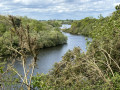
 A viewpoint overlooking the Haut Frémur in Tréméreuc
 Visorando Member
 4.32 mi
 +279 ft
 -292 ft
 2h 15
 Easy
 Departure from Tréméreuc (Côtes-d'Armor)
The upper reaches of the Frémur flow at the bottom of a lush green valley where, from a mere trickle, it transforms into a pretty river that feeds the Bois Joli dam, which serves as the water reservoir for the Dinard conurbation.The path descends to the valley floor, then climbs to form a balcony overlooking the valley, offering lovely views.The setting is peaceful, with its meadows, shaded paths and the golf course, just a few kilometres from Dinard.
The hedgerows and ponds of the Frémur at the start of the Rues
 6.68 mi
+210 ft
-217 ft
3h 15
 Moderate
Departure from Ploubalay (Côtes-d'Armor)
The Pleurtuit ponds, fed by the Frémur, are a delight for anglers and stretch out in deep meanders through peaceful countryside, just a few kilometres from the Dinard-Saint Malo conurbation.
They provide the drinking water supply for the entire urban area thanks to the Bois Joli dam, which was filled in 1992
The path marked in yellow circles the area; it can be accessed from various starting points, including the hamlet of Les Rues.
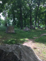
The Druid Cemetery at Pleslin-Trigavou
 3.92 mi
+174 ft
-200 ft
1h 55
Easy
Departure from Pleslin-Trigavou (Côtes-d'Armor)
Legend has it that fairies, who were supposed to deliver these stones to Mont Saint-Michel but were too tired, abandoned them here in the Champ des Roches, where the druids used to gather.Sixty-five menhirs dating from 2000 BC are gathered here, forming Brittany’sthird-largest megalithic site, which has been a listed site since 1887.The site has been planted with 60 different species of oak.
A picturesque walk past the Bois Joli dam
 3.94 mi
+135 ft
-131 ft
1h 55
Easy
Departure from Pleurtuit (Ille-et-Vilaine)
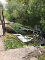
Located 5 km from Dinard, this route – which is easily suitable for families – runs along the western bank of the Bois Joli Dam reservoir. The route starts at the foot of a concrete embankment fitted with an eel ladder; the reservoir is a popular spot for anglers.After following the lower reaches of the Frémur, the route winds through the Breton bocage, passing through the pretty hamlet of La Ruais and its wash house. You then return to the riverbanks, against which the massive dam stands out. The idyllic path follows the contours of the reservoir.
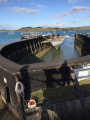
The garden of Minihic-sur-Rance and its dry dock at La Landriais
 5.26 mi
+272 ft
-285 ft
2h 40
Easy
Departure from Le Minihic-sur-Rance (Ille-et-Vilaine)
From the beautifully landscaped public garden, there is a remarkable view of the Rance and its right bank, from which the village of Saint-Suliac stands out. From the garden, you can easily reach Garel Beach and the Landriais shipyard with its specific equipment: the above-ground wooden dry dock, via the cliff-top path.
The wet Guérouse valley winds through the undergrowth that makes up the Domaine du Pièton.
A circular loop along the banks of the Rance, starting from Minihic
 Association / Club / Walk leader
 11.75 mi
+594 ft
-607 ft
5h 55
Moderate
Departure from Le Minihic-sur-Rance (Ille-et-Vilaine)
This walk combines the routes suggested on Visorando around the Minihic, forming a double circular route around the Minihic and Langrolay further south. It is a pleasant walk along the banks of the Rance, with Mont Gareau, Saint-Suliac and the Pointe du Puits opposite. The path overlooks the Rance and offers numerous viewpoints. The route passes by the Landriais shipyards and dry dock, to the north of the Minihic. On the return journey, there are sunken paths via Langrolay and the Chapel of Sainte-Anne in Saint-Buc, dating from 1631. The walk is well shaded in summer and late spring.
The mills of the Rance - The foreshores
 9.53 mi
+594 ft
-610 ft
4h 55
Moderate
Departure from Le Minihic-sur-Rance (Ille-et-Vilaine)
The first tidal mill on the Rance was built in 1181 (Moulin du Lupin near Rothéneuf). These mills flourished between the 16th and 17th centuries. Today, few of these renewable energy sources remain. This route allows you to see the remains of two mills (Fosse Mort and La Herviais) and to stroll through this estuary, which is ideal for the construction of mills.
Circular walk starting from Le Minihic-sur-Rance
7.01 mi
+315 ft
-338 ft
3h 30
Moderate
Departure from Le Minihic-sur-Rance (Ille-et-Vilaine)
This route is a combination of sections from routes already suggested by Visorando. Thefirst section follows the Rance along theGR®34C, whilst thesecond completes the circular route through the countryside, mostly along shaded paths through the woodland. Halfway along this circular route, the route passes through Langrolay-sur-Rance, where you can take a short break at a very pleasant bar.
The balconies of Minihic-sur-Rance
 7.12 mi
+423 ft
-453 ft
3h 40
Moderate
Departure from Le Minihic-sur-Rance (Ille-et-Vilaine)
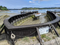
One of the classic walks in the Rance Basin. The path overlooks the Rance and offers numerous colourful views of the water, the riverbanks and river life. An opportunity to walk alongside the Minihic shipyards. A return via the sunken paths and the shaded valley of Saint-Buc takes us back to the Sainte-Anne Chapel, dating from 1631.
Very breezy and shaded in summer, very bright and open in early spring. High tide, low tide: you never see the same landscape.
Circular walk starting from Langrolay via La Souhaitier and Plouer
6.85 mi
+650 ft
-650 ft
3h 45
Moderate
Departure from Langrolay-sur-Rance (Côtes-d'Armor)
A pleasant walk along the banks of the Rance and through the countryside. A circular route of around 11 km with the option to adjust the length.
Pointe de Cancaval and La Malouinière du Montmarin
 3.52 mi
+105 ft
-108 ft
1h 45
Easy
Departure from Pleurtuit (Ille-et-Vilaine)
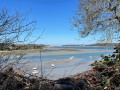
Jutting out into the Rance estuary, Pointe de Cancaval offers beautiful views of the right bank: from Saint-Servan to Saint-Malo, the dam and the moorings dotted along the coast.
During the walk, you will notice La Malouinière de Montmarin and its remarkable garden, which is one of the most beautiful private residences, and two tidal mill sites that bear witness to the industrial past linked to the tidal range.
The mills of the Rance - Le Poudouvre
 10.34 mi
+705 ft
-696 ft
5h 20
Moderate
Departure from Pleurtuit (Ille-et-Vilaine)
The Rance once had many tide mills on its banks. Today, with the passage of time, erosion and lack of maintenance, little remains. This circuit allows you to discover the coastline, countryside, coastal path, remains of the Montmarin mills, the new mill and the dam that uses the movements of the tides for its tidal power plant.
Plouër-sur-Rance in shades of green and blue
 8.63 mi
+653 ft
-656 ft
4h 30
Easy
Departure from Plouër-sur-Rance (Côtes-d'Armor)
A lovely walk along the banks of the Rance and through the beautiful Bois de Rochel forest. This walk combines various routes suggested by Plouër-sur-Rance Town Hall.
It begins as a blue trail along the banks of the Rance, where the landscapes and views change with every tide. After passing through hamlets with traditional stone houses, it continues as a green trail through the forest, where beech and chestnut trees over 25 metres tall never fail to impress and where sunken paths await the walker.
Take care in winter, as some sections may be damp. But in summer, don’t hesitate – with its open, airy and shaded route, it offers a chance to enjoy a pleasant coolness in the heart of nature.
Circular walk via Pointe de Cancaval from La Richardais
 5.03 mi
+157 ft
-174 ft
2h 25
Easy
Departure from La Richardais (Ille-et-Vilaine)
The route takes you along the banks of the Rance between La Richardais and the hamlet of Créhen, via the Pointe de Gronget. The Pointe de Cancaval offers a beautiful view of the Rance, the dam of the same name and the town of Alet towards Saint-Malo.