Country:
 City:
City:


Start at the large car park by the community hall.
(S/E) Follow Rue de Général de Gaulle (D114) towards the church. Go round the church on the right or left and you’ll reach a roundabout at the east end of the church.
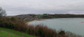
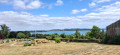
(1) Turn right onto Rue de Bonsecours, and immediately turn right into a public park to enjoy a lovely view of the Rance with Saint-Suliac in the background. Leave the park on the other side and turn right to reach a T-junction (oratory) straight away.
(2) Turn right here to join the coastal path.
(3) Turn left and follow the path, signposted GR®34-37, which runs alongside the Rance. Pass Minihic beach. At the car park, the path splits in two: veer right to head down to the banks of the Rance (may be submerged at high tide). You’ll reach Pointe du Crapaud.
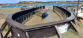
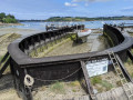
(4) Head north, pass Pointe du Ton and reach the Landriais shipyards (a restored dry dock still in use).
(5) As you cross the beach (take a detour at high tide), on the quay you’ll find the Oratory of Notre-Dame des Terre-Neuvas.
(6) Climb the steps to the left of the oratory and continue to the right between the houses to rejoin the path, which winds through the woodland northwards towards Pointe des Hures (views of Solidor and the dam). After Pointe des Hures, make your way slowly back down towards the beach.
(7) Pass the car park on your left and head back up the valley opposite along the track. Follow the GR® signposts. Further on, the track turns into a path through the woodland before joining a road. The signposting changes to yellow as the GR® ends. Continue straight ahead, veering slightly to the left, along Rue de la Vallée aux Renards. Carry on to Rue du Général De Gaulle. Continue along the street, going round the roundabout on the right.
(8) At the junction with Rue Bel Air, turn right (Oratoire de Taluet is on the right). After about 150 metres, at a gate, take the narrow path on the left. You’ll come out onto Rue Monseigneur Dies; follow it to the right. Take the first path on the right, the Chemin de la Fontaine Guyomard. You’ll arrive at the Lavoir des Prés.
(9) Continue along the path, then turn left then right to reach a crossroads opposite an old water tower.
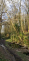
(10) Take the tree-lined path on the left. Shortly afterwards, it turns southwards and reaches Rue de la Croix de Pelan. Cross the street and head slightly to the left. Do not continue straight ahead into the cul-de-sac of Rue de la Huliais; at the bend, turn left onto the path.
(11) Pass the wash house and continue along the path which runs alongside a stream, then crosses it via a footbridge, to reach the bottom of the valley at a junction on the D114, opposite the Grand Val shipyard.
(12) Turn right and walk for about 150 metres. At the pedestrian crossing, take the forest path on the right; it will veer right and climb up to Rue des Vallées in the Rabinais housing estate. At the end of the street, turn right, then left, and turn left again towards Rue de la Rabinais.
(13) At the end of the street, at the wayside cross, turn right towards the Chapelle Sainte-Anne in St-Buc. Continue along the road towards Langrolay. Cross the bridge and take the woodland path on the right, immediately after the ‘Côtes d’Armor’ sign. Follow it to the hamlet of La Bourgaudière.
(14) Cross the hamlet along the road. At the crossroads on leaving the hamlet, turn left, following the signposts to reach a wooded path. Follow this path until you come out onto the Route de Dinard.
(15) Then turn right and walk along the roadside on the verged path. At the bend, leave the road and continue straight on along the path under the trees. The path leads out onto a road.
(16) Turn left here and carry on to Langrolay town hall. After passing it, turn right onto the Allée de la Rogourdaine and head downhill to the Ville és Rats stream.
(17) Do not cross it, but turn left towards the Rance. Continue along the path beside the Rance and, after the Plage du Roue car park, rejoin the GR®. Follow the road for about a hundred metres, then take the signposted path on the right. Pass the Pointe du Châtelet and the Pointe de Trégondé to reach the Ruisseau de la Houssaye, keeping to the right.
(18) Cross the stream via the bridge and continue along the coastal path. Following the Rance, pass the boat graveyard before reaching the junction with the D144.
(12) Turn right and cross the Grand Va shipyard, which you passed earlier. Follow the path along the beach to reach the car park (S/E).
 Visorando Member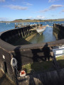
 Easy
Easy 
 Association / Club / Walk leader