Circular walk starting from Le Minihic-sur-Rance

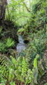
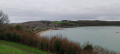
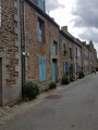
This route is a combination of sections from routes already suggested by Visorando. Thefirst section follows the Rance along theGR®34C, whilst thesecond completes the circular route through the countryside, mostly along shaded paths through the woodland. Halfway along this circular route, the route passes through Langrolay-sur-Rance, where you can take a short break at a very pleasant bar.

Details

n°22226586
Creation:
Last update:
Last review:
  • Walking
    Activity: Walking
  • ↔
    Distance: 7.01 mi
  • ◔
    Average duration: 3h 30 
  • ▲
    Difficulty: Moderate

  • ⚐
    Back to start: Yes
  • ↗
    Ascent: + 315 ft
  • ↘
    Descent: - 338 ft

  • ▲
    Highest point: 197 ft
  • ▼
    Lowest point: 16 ft

Description of the walk

Park behind the church at Minihic-sur-Rance.

(S/E) Take a path to the left of the town hall and head downhill to reach the River Rance.

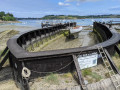
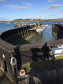
(1) Turn right onto theGR®34Ctowards Dinan. Pass the Grand Val shipyard and join the D114.

(2) Follow it to the left for a few metres and, after a small bridge, turn left onto the path through the woodland leading to the Tanet shipyard.

(3) Continue along theGR®34C, following the River Rance. Cross the Ruisseau de la Houssoy via a footbridge. At Pointe de Trégondé, turn right, walk along the Grève de Morlet, then pass the Pointe du Châtelet to reach Plage du Roue.

(4) Continue to follow theGR® until you reach the Ruisseau de la Ville Ès Rats.

(5) Leave theGR® here, cross the stream and take the Allée de Rigourdaine. Head up towards Langrolay-sur-Rance, then turn left into the Rue des Rochettes and continue along the Rue de la Croix Boissière.

(6) Cross the D114 and continue to La Bourgaudière.

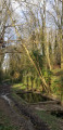
(7) Turn left to join the path through the woodland. Then follow the Ruisseau de la Houssaye to reach the crossroads at Chapelle Saint-Buc.

(8) Turn left onto the road leading to La Rabinais. At the end of the village, enter a woodland and you’ll reach the bank of a stream.

(9) Turn right, walk alongside the stream at a distance, cross it and return to the original junction on the D114 that you passed on the way out.

(2) Keep to the left on the path, marked in yellow, until you reach a Y-junction.

(10) Take the small path on the far right, which climbs alongside a wall to the village of Minihic-sur-Rance. Then veer right, pass in front of the sports hall and turn left to reach the car park at the church in Minihic-sur-Rance (S/E).

Waypoints

  1. S/E : mi 0 - alt. 125 ft - Car park - Église Saint-Malo (Le Minihic-sur-Rance)
  2. 1 : mi 0.36 - alt. 33 ft - Rance riverbank – GR34C
  3. 2 : mi 0.83 - alt. 33 ft - Junction of the circular loop
  4. 3 : mi 1.21 - alt. 30 ft - Tanet Shipyard
  5. 4 : mi 3.14 - alt. 30 ft - Roué Beach - Rance (fleuve)
  6. 5 : mi 3.44 - alt. 33 ft - Ville Ès Rats stream
  7. 6 : mi 4.01 - alt. 164 ft - Crossing the D114
  8. 7 : mi 4.6 - alt. 197 ft - The hamlet of La Bourgaudière
  9. 8 : mi 5.44 - alt. 59 ft - Chapelle Sainte-Anne (Saint-Buc)
  10. 9 : mi 6.07 - alt. 56 ft - Stream
  11. 10 : mi 6.69 - alt. 85 ft - Y-junction
  12. S/E : mi 7.01 - alt. 128 ft - Car park - Église Saint-Malo (Le Minihic-sur-Rance)

Always be cautious and plan ahead when you're outdoors. Visorando and the author of this route cannot be held responsible for any accidents occurring on this route.

The GR® and PR® markings are the intellectual property of the Fédération Française de Randonnée Pédestre.

Reviews and comments

5 / 5
Based on 1 review

Reliability of the description
5 / 5
Ease of following the route
5 / 5
Route interest
5 / 5
co35490
co35490

Overall rating : 5 / 5

Date of your route : Jul 12, 2022
Reliability of the description : ★★★★★ Very good
Ease of following the route : ★★★★★ Very good
Route interest : ★★★★★ Very good
Very busy route : Yes

A very pleasant walk with varied scenery. The route is well signposted.
We did this walk in July; it’s likely to be more challenging in winter on certain sections.

Machine-translated

Other walks in the area

For more walks, use our search engine .

The GPS track and description are the property of this route's author. Please do not copy them without permission.