Tour of the Causse Méjan

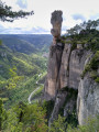
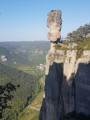
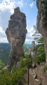
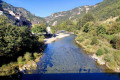
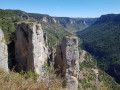
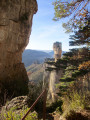
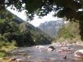
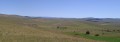
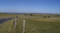
A truly beautiful six-day hike on the Causse Méjan. This route does not cover the entire Causse but takes you around its western section and across its centre. Along the way, you’ll enjoy wide open spaces and superb views of the Gorges de la Jonte and the Gorges du Tarn. You’ll come across few other people on this hike, but the encounters with local farmers are warm and friendly.

Details

n°83258
Creation:
Last update:
Last review:
  • Walking
    Activity: Walking
  • ↔
    Distance: 56.22 mi
  • ◔
    Average duration: 6 days 
  • ▲
    Difficulty: Difficult

  • ⚐
    Back to start: Yes
  • ↗
    Ascent: + 7,831 ft
  • ↘
    Descent: - 7,805 ft

  • ▲
    Highest point: 3,750 ft
  • ▼
    Lowest point: 1,309 ft

Photos

Stages of the route

This route needs several days, find the details below:

  1. S
  2. 2
  3. 3
  4. 4
  5. 5
  6. E

Notes

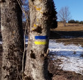
The walk follows theGR® 6 and 60 (red and white markings), as well as theGRP® Tour du Causse Méjan (red and yellow markings). A 1:25,000 map is required.

The individual stages are rated as Moderate or Difficult. For the entire circuit, as there is no intermediate rating, I have chosen ‘Difficult’ to reflect the stages rated as such.

I recommend completing this route in the direction described here (anti-clockwise). This is because the hike involves climbing twice from the valley up onto the Causse and descending twice from the Causse back down into the valley (each time involving a vertical ascent of around 500 metres). It so happens that by far the steepest section is between the hamlet of La Caxe and the Tarn Valley (stage 5), and it seems preferable to tackle this on the descent rather than the ascent.

Good walking boots are essential. You must bring warm clothing and rainwear. As long sections of the route are exposed, bring sun protection depending on the season and your own sensitivity to the sun.

Water sources are very scarce throughout this route; on some stages, there are none at all. Make sure you carry sufficient supplies for each stage.

Opportunities to buy provisions are unevenly distributed along the route: plentiful at Le Rozier and Meyrueis, limited elsewhere. There are a few opportunities (indicated in the descriptions of the relevant stages) to buy farm-produced or artisanal cheeses or farm-style cured meats. It is also possible to order packed lunches from the lodges or hotels you stay at (please enquire).

Accommodation in a stopover lodge or hotel every night (contact details on the information sheets for the various stages).

Hike undertaken by the author from 30 July to 4 August 2013.
Worth a visit

- The wide open spaces of the Causse.
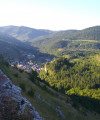
- Cliffs overlooking the Gorges de la Jonte: superb views, vulture spotting.
- Panoramic views of the Gorges du Tarn.
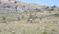
- Przewalski’s horse reserve near Nivoliers.
- Karstic cave Armand.

Always be cautious and plan ahead when you're outdoors. Visorando and the author of this route cannot be held responsible for any accidents occurring on this route.

The GR® and PR® markings are the intellectual property of the Fédération Française de Randonnée Pédestre.

Reviews and comments

5 / 5
Based on 1 review

Reliability of the description
5 / 5
Ease of following the route
5 / 5
Route interest
5 / 5
Netra
Netra ★

Hello,

None of the stages involve any technical difficulty. There are no tricky sections in the sense that one would expect in the mountains. The only section that requires a little more attention than the others is on the penultimate stage (from Mas-Saint-Chély to Les Vignes), the steep descent between points (11) and (12).

The stages classified as ‘difficult’ are so rated because of their distance (> 20 km) or a combination of considerable distance and elevation gain. They are classified in this way according to the Visorando rating system, which is designed for a very broad and diverse audience.

I haven’t walked the Stevenson Trail, but it seems to me that this hike takes place in terrain similar to the Causse Méjan in terms of difficulty (though the landscapes are different). However, I don’t know whether your stages on the Stevenson Trail were shorter or longer, with more or less elevation gain, than those on the Causse Méjan.

Ultimately, the notion of difficulty depends on one’s own abilities… You therefore need to compare the characteristics of the different stages (distance, elevation gain) with what you’re used to tackling.

I hope this answer helps.

Machine-translated

Ralph78
Ralph78

Hello
I’d like to know whether the 6-day Tour des Causses Mejean, with its so-called difficult stages, is feasible for people who aren’t experienced hikers?
We’ve only ever done a 6-day hike on the Stevenson Trail five years ago, carrying our own rucksacks
Are the so-called ‘difficult’ stages particularly challenging and unsuitable for occasional or non-professional walkers, or not?
Thank you for your help
Kind regards
Ralph

Machine-translated

Bennett
Bennett

Overall rating : 5 / 5

Date of your route : Aug 10, 2021
Reliability of the description : ★★★★★ Very good
Ease of following the route : ★★★★★ Very good
Route interest : ★★★★★ Very good
Very busy route : No

A trip taken in mid-August 2021 in... 3.5 days!
Day one: set off from Le Rozier at around 8.00 am, and arrived at La Viale… at around 2.30 pm after a one-hour lunch break. It was too early to stop there, especially as I was on my own with my tent. So I carried on to Les Hérans, a hamlet just before the Aven Armand, where I pitched camp. During the night, I witnessed a thunderstorm rumbling over the Jonte. It was the first time I’d been almost at the same level as the clouds from which the lightning was striking. Very impressive and beautiful!
The next day, I set off around 7 am and walked to Nivoliers, without going via Meyrueis (it’s just a round trip and I’ve got everything I need in my rucksack), stopping for lunch in Aures. I camped in the centre of the village, near the restaurant, on the plot of land that the shop owner (who sells excellent fruit juices!) kindly and generously makes available to travellers, whether in tents or campervans.
The next day, I set off around 7 am once again, and walked to La Caxe, stopping for a bite to eat in Rieisse. I camped by the side of the path.
The following day, I set off once again at around 7 am for the final half-day’s walk. I arrived in Le Rozier in the early afternoon, which gave me time for a well-deserved meal out!
So I completed this route in 3.5 days. Over the first three days, I walked about 25 km, carrying my rucksack with my tent and food (almost entirely self-sufficient). It’s a lovely walk, but I didn’t find it difficult.
The scenery is truly beautiful; I was surrounded by peace and quiet – exactly what I was looking for – and I only came across a few other walkers.
All the hamlets were inhabited (as is to be expected in summer) and I was able to get fresh water wherever I stopped. Everyone was really friendly and welcoming.
It’s a walk I’d highly recommend, even though – for me, at least – it was much quicker than expected (I can’t imagine doing a section like Nivoliers–Mas Saint Chély as my only walk of the day, especially as I wasn’t carrying too much, given that the itinerary states you spend the night in a lodge).
In any case, thank you very much for this description – it was what made me decide to go, and it was really lovely!

Machine-translated

Netra
Netra ★
• Edited:

Hello,

I can’t download the overview sheet either (I get an ‘Error’ message). Sorry about that… I think it’s a general issue with the multi-stage route sheets.

However, you can download the guides and maps for each stage individually (I’ve just tested it with the first one).

I really enjoyed hiking on the Causse Méjan; I hope you’ll enjoy it too!

Machine-translated

AlexandreG34
AlexandreG34

Hello,
I’d like to go on this walk on 19 June and would appreciate access to the route description and map for that. Unfortunately, I’m unable to download them – there must be an error on the website. Would it be possible to send them to me by email, for example?
Many thanks in advance,
Alexandre

Machine-translated

Netra
Netra ★
• Edited:

Hello Claire, and thank you for your message.

I’m the author of this route and I understand your query. I myself hesitated over which rating to choose: let’s say an M+ or a D- would have been appropriate.

This route comprises six stages, with an average of 15 km in horizontal distance and 440 m of elevation gain per stage. According to our grading system, a day hike with these characteristics would fall on the borderline between M and D.

When you look at the details, out of six stages, only two are unambiguously not classified as ‘Difficult’ (the4th and6th). The other four feature a significant elevation gain (the 1st), a considerable distance (the 2nd,3rd and5th), exposed sections (the 1st) or a steep descent (the 5th). This is why the route as a whole has been classified as Difficult.

Machine-translated

ClaireBu
ClaireBu

Why is this hike rated as difficult? Is it because of its length, the elevation gain or the exposed sections? Thank you

Machine-translated

BruVel1486
BruVel1486

I’m particularly wondering about the accommodation options for this six-day route?

Right, thank you for clarifying that.
If we manage to go ahead with this walking trip (6 days on the Causse Méjean) at the end of May, we’ll be sure to let you know what we think.

Kind regards, Bruno V.

Machine-translated

Netra
Netra ★

I’m particularly wondering about the accommodation options for this six-day route?

I am the author and I can confirm that there is accommodation at each stage, the details of which I have provided. Of course, it is advisable to check that these options are still available. And in any case, it is wise to book well in advance.

Machine-translated

FLOCH
FLOCH ★

Hello,

No problem!
At each stage, the author specifies the available accommodation options.
Kind regards

Machine-translated

BruVel1486
BruVel1486

I’m particularly wondering about the accommodation options for this six-day route?

Machine-translated

Other walks in the area

For more walks, use our search engine .

The GPS track and description are the property of this route's author. Please do not copy them without permission.