From Meyrueis to Nivoliers via Aures

A stage that allows you to fully appreciate the wide open spaces of the Causse! A very pleasant walk, with some beautiful views along the edge of the plateau.

This walk is part of a multi-day hike: Tour du Causse Méjan

Details

83248
Creation:
Last update:
Last review:
  • Walking
    Activity: Walking
  • ↔
    Distance: 9.59 mi
  • ◔
    Average duration: 5h 45 
  • ▲
    Difficulty: Moderate

  • ⚐
    Back to start: No
  • ↗
    Ascent: + 1,575 ft
  • ↘
    Descent: - 797 ft

  • ▲
    Highest point: 3,750 ft
  • ▼
    Lowest point: 2,359 ft

Photos

Description of the walk

Start at the La Draille stopover lodge, just outside (to the north of) the village of Meyrueis.

Red and white markings

(S) From the stopover lodge, head for the roundabout on the right. Take the D986 (towards La Borie, Aven Armand) roughly opposite. After a sharp bend to the left, take a path that branches off to the right and heads uphill. Pass in front of some old ruined buildings and reach a small road.

Red and Yellow + Yellow markings

(1) Turn right onto the road that runs along the plateau and leads to the hamlet of Pauparelle.

(2) Continue along a track, which you’ll soon leave to take a path on the right (north). Climb up through the pastures to reach the edge of the plateau. Continue north-north-east to the junction of a road and the path leading up from Salvinsac (beautiful view).

Red and yellow markings

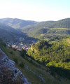
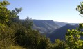
(3) Carry on straight ahead eastwards along the road. At a junction, turn right to follow the edge of the plateau: you’ll reach a superb viewpoint over the Causse (to the left) and the valley below (to the right).

(4) Continue east-north-east along the road until you reach Aures.

(5) At the junction, leave the road and take the path opposite. Heading north-east, pass the old hamlet of Mielgues (ruins), reach the edge of a wood and arrive at the junction of the GR®60 and the GRP®.
Red and white markings

(6) Let the GRP® head off to the right and turn sharply left. The path heads westwards then veers northwards, climbing gently. Reach the edge of a forest and arrive at a pass, the highest point of the entire route (1,142 m).

(7) From the pass, the path heads north or north-west until the finish. Continue through the forest, crossing a firebreak.

(8) At a fork, take the path on the right. N.B. Be careful, as the path on the left, which leads to La Bégude Blanche, is wider and more obvious: this is not the path you should follow.

(9) On leaving the forest, you’ll reach one of the Przewalski’s horse enclosures, which you must cross for a very short distance (read the information boards carefully). The path descends steeply, running alongside the enclosure. You’ll come to a small road which, heading due north, leads to Nivoliers (E).


Waypoints

  1. S : mi 0 - alt. 2,385 ft - Meyrueis - Gîte de la Draille
  2. 1 : mi 0.96 - alt. 2,799 ft - Small road
  3. 2 : mi 1.55 - alt. 3,091 ft - Pauparelle
  4. 3 : mi 3.16 - alt. 3,366 ft - Viewpoint
  5. 4 : mi 3.98 - alt. 3,556 ft - Le Cayla
  6. 5 : mi 4.92 - alt. 3,419 ft - Aures
  7. 6 : mi 5.86 - alt. 3,576 ft - Junction of the GR60 and GRP trails
  8. 7 : mi 7.16 - alt. 3,747 ft - Unnamed pass directly below the - Serre de Cap
  9. 8 : mi 7.99 - alt. 3,510 ft - Junction
  10. 9 : mi 8.35 - alt. 3,488 ft - Przewalski’s horse enclosure
  11. E : mi 9.59 - alt. 3,136 ft - Nivoliers

Notes

Nivoliers – Stopover lodge, Auberge du Chanet: 04 66 45 65 12.

Hike undertaken by the author on 1 August 2013.

Worth a visit

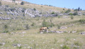
Before reaching Nivoliers, the path runs alongside one of the enclosures of the Przewalski’s horse reserve (9), where you can observe the horses from varying distances depending on their location and activity.

Always be cautious and plan ahead when you're outdoors. Visorando and the author of this route cannot be held responsible for any accidents occurring on this route.

The GR® and PR® markings are the intellectual property of the Fédération Française de Randonnée Pédestre.

Reviews and comments

5 / 5
Based on 2 reviews

Reliability of the description
5 / 5
Ease of following the route
5 / 5
Route interest
5 / 5
Echli
Echli

Overall rating : 5 / 5

Date of your route : Jul 25, 2024
Reliability of the description : ★★★★★ Very good
Ease of following the route : ★★★★★ Very good
Route interest : ★★★★★ Very good
Very busy route : No

A short but interesting walk – and it’s well worth taking the extra detour via the GR at the end.

Machine-translated

NIALA71
NIALA71

We opted for a 4-day route on the Causse Méjean, with no set timetable:
Meyrueils – La Viale
La Viale – Les Vignes
Les Vignes – Mas St Chely
Mas St Chely – Meyrueils
The route is planned for late July.

Machine-translated

Netra
Netra ★

Good evening, Martine 42,

Thank you for your comments – I’m glad you enjoyed the walk! As for the La Draille lodge in Meyrueis, I can confirm that it’s a lovely place (I imagine it’s the same manager as when I stayed there myself).

Machine-translated

martine42
martine42

Overall rating : 5 / 5

Date of your route : May 22, 2015
Reliability of the description : ★★★★★ Very good
Ease of following the route : ★★★★★ Very good
Route interest : ★★★★★ Very good

As planned, we completed the route, starting at Meyrueis (we didn’t have enough time to do the full 6-day route). It was magnificent! Each day offered a completely different landscape and its own unique appeal. The Mas St Chély–Les Vignes stage was a bit long and tough towards the end, especially when passing through the Roc de Serre, but we have no regrets – the view over the Tarn Gorges is superb! And we’d saved about 2 km by staying overnight in Caussignac (Mas St Chély) at the Hôtel de la Grive.Just one minor downside: I found the stages to be 1 to 2 km longer according to my GPS and a friend’s pedometer, but apart from the descent down the cliff at Les Vignes, the stages were easy and we took our time over them:there are so many beautiful things to see along the way, whether it’s the scenery or the houses with their slate roofs, not to mention the vultures that would appear as soon as we stopped for a picnic! I think I’ll do this route again sometime, and what’s more, the people at the lodges were very friendly, especially on the drovers' road in Meyrueis. By the way, I’ve heard there’s a path that leads directly from the drovers' road to the GR without having to go via the road – we’d need to ask the owner. Thanks again for this route!
Martine42

Machine-translated

Other walks in the area

For more walks, use our search engine .

The GPS track and description are the property of this route's author. Please do not copy them without permission.