From Nivoliers to Mas-Saint-Chély: exploring the megaliths

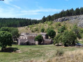
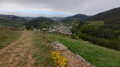
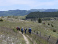
A transitional stage, with little change in altitude. Still the wide open spaces of the Causse, with a few megaliths along the way.

This walk is part of a multi-day hike: Tour of the Causse Méjan

Details

n°83250
Creation:
Last update:
Last review:
  • Walking
    Activity: Walking
  • ↔
    Distance: 8.03 mi
  • ◔
    Average duration: 4h 10 
  • ▲
    Difficulty: Moderate

  • ⚐
    Back to start: No
  • ↗
    Ascent: + 509 ft
  • ↘
    Descent: - 469 ft

  • ▲
    Highest point: 3,389 ft
  • ▼
    Lowest point: 3,035 ft

Photos

Description of the walk

Starting from the Nivoliers stopover lodge. The route heads more or less consistently north-west or north from the starting point to the junction ofthe GRP® andGR®60trails, then south-west to the finish.

Red and white markings

(S) Coming from the stopover lodge, take the road on the right.

(1) After about 200 m, take a path on the left, running alongside pastures. Climb a gentle slope and then descend, again gently, until you reach Le Fraisse (buildings on the right-hand side).

(2) Turn right and then immediately left. At a fork, take the path on the right. Pass close to a menhir. Cross the D16 and continue north. The slope becomes steeper and you reach the top of a small hill (unnamed on the IGN map).

(3) Cross a track and head down towards the north to reach a crossroads. Take the road opposite heading north, which you follow for 2 km.

Red and yellow markings

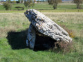
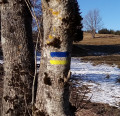
(4) Leave the road and theGR®60to join theGRP®, i.e. turn sharply left. Pass in front of a small dolmen.

(5) Continue south-west, ignoring a path branching off at right angles to the left, and at a fork, take the left-hand path. You’ll reach the edge of a wood, which you follow for about 600 m.

(6) At the crossroads, turn left, then immediately right onto a path leading to Mas-Saint-Chély. The hotel is situated at the southern end of the village (E).
Waypoints

  1. S : mi 0 - alt. 3,133 ft - Nivoliers
  2. 1 : mi 0.22 - alt. 3,110 ft - Junction
  3. 2 : mi 1.58 - alt. 3,117 ft - Le Fraisse
  4. 3 : mi 3.84 - alt. 3,327 ft - Unnamed hill
  5. 4 : mi 5.46 - alt. 3,383 ft - Junction of the GRP and GR60 routes
  6. 5 : mi 5.74 - alt. 3,376 ft - Dolmen du Buisson
  7. 6 : mi 7.26 - alt. 3,219 ft - Crossroads at elevation 980
  8. E : mi 8.03 - alt. 3,179 ft - Mas-Saint-Chély (Causse Méjan)

Notes

In Mas-Saint-Chély:
- Hotel and restaurant: 04 66 48 52 14.
- Bakery.

Walk undertaken by the author on 2 August 2013.

Worth a visit

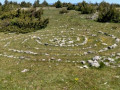
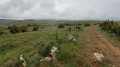
A dolmen and two menhirs by the side of the path (marked on the IGN map).

Always be cautious and plan ahead when you're outdoors. Visorando and the author of this route cannot be held responsible for any accidents occurring on this route.

The GR® and PR® markings are the intellectual property of the Fédération Française de Randonnée Pédestre.

Reviews and comments

Netra
Netra ★

Hello,

Along the route, there are both lodges and hotels (or, if you prefer, there aren’t lodges everywhere). When I did this tour in the summer of 2013, we stayed at the following places:
- Hotels: Le Rozier; Mas-St-Chély; Les Vignes.
- Lodge: La Vialle; Meruyeis; Nivoliers.

Whilst I can’t guarantee it, I believe all these places have a capacity of more than 10 guests, provided you book a little in advance.

I’ll have a rummage through my ‘archives’ for the contact details of the lodges and hotels and send them to you via a private message.

Machine-translated

martine42
martine42

Hello
I’d like to suggest this route to my hiking friends for May–June – can the lodges accommodate around ten people over the six stages?
Thanks in advance – I’m already dreaming about it!!!
Martine

Machine-translated

Other walks in the area

For more walks, use our search engine .

The GPS track and description are the property of this route's author. Please do not copy them without permission.