Country:

 City:
City:


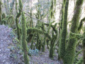
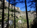
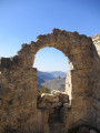
At Le Rozier, park in the car park to the right of the D944, after taking the mandatory detour that goes round the church and the town hall. During the high season, this car park fills up very quickly, so you will need to use the parking spaces along the road on the left, which leads back to the church, or the other signposted car park to the left of that same road.
(S/E) Follow the D944 to the right, towards Meyrueis, using the pavement on the right. Turn right, cross the bridge over the Jonte, and follow the road uphill for a few dozen metres. Turn left onto the narrow tarmac road of Côte Saint-Jean, at a sign pointing to the Ermitage Saint-Michel. You will soon reach a three-way junction with a signpost.
PR®°°®°° yellow signposting, in very good condition
Leave the tarmac and take the path on the left; turn right at the fork that appears immediately (old wooden sign), and follow a lovely path lined with dry stone walls. Return to the tarmac road and turn left, heading uphill, following the sign for “Ermitage Saint-Michel – Champignon Préhistorique”.
(1) Look out for the return path on the left, and head straight on, leaving the tarmac behind for a stony path leading straight ahead. You will then begin a long, steep and gruelling climb, reaching a junction where you must continue to the right, staying on the signposted path. After a short, welcome stretch of level ground, you will reach another junction.
(2) Turn left, climbing the embankment as indicated by the clearly positioned yellow marker, and complete the final stretch of the climb to a large clearing marked by a large cairn.
(3) Head left onto a wide, stony path that continues to climb, but at a much gentler gradient. You’ll reach the television mast and the magnificent, secure viewpoint with a bench on your left.
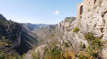
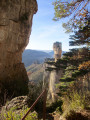
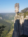
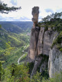
(4) Take a moment to enjoy the magnificent view of the entrance to the Gorges de la Jonte, overlooked on the opposite slope by the high cliffs of the Corniche du Causse Méjean. Resume the route by going round the mast on the right, and follow the stony track until you reach a change of direction indicated by a signpost. Turn left onto a path leading to the famous isolated rock known as the ‘Prehistoric Mushroom’ – a name it fully deserves given its shape.
(5) Walk alongside it on the right, and continue following the direction of an old wooden sign reading “Ermitage Saint-Michel – Corniche Causse Noir”. This beautiful path follows the contour lines almost exactly and offers several unsecured viewpoints over the River Jonte and the iconic rocks of the Corniche du Causse Méjean, including the ‘Vase de Sèvres’ and the ‘Vase de Chine’. The widest open space is on a rocky outcrop just before you enter the Cirque de Madasse Strict Nature Reserve.
(6) Take the opportunity to admire the Jonte Gorges both upstream and downstream from this area of sharp limestone pavement, as well as the site of the Ermitage Saint-Jean – your next stop – perched on its steep rock face. Continue along the route, leaving the signposted path to the right (towards Saint-Jean-de-Balmes), until you reach a junction.
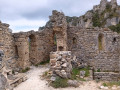
(7) Turn left at the hairpin bend, staying on the signposted path, and reach a small, unnamed pass where a sign indicates the hermitage is 100 m away. Head left, reaching an old wall of weathered stones with a ladder on the right. Climb itcarefully to gain a foothold on the rock, and reach the Saint-Michel Hermitage after a short, easy climb. Continue to the foot of the remains of a wall from the old Château de Montorsier, where a second ladder provides access to the rocky platform overlooking it: the same caution is required.
(8) Return to the pass and head left. The path begins a fairly steep descent and reaches a junction that would be difficult to spot on the ground were it not for the Yellow Cross marking the start of the route to follow.
No signposting
(9) Turnright onto a very faint track that is difficult to make out on the ground. This track then winds its way across unstable terrain, sometimes on a slope where the direction to follow is unclear, especially in sections where the carpet of leaves is thick: the GPX track will be very useful for this section. After an initial fairly steep section, the route veers to the right; the gradient becomes more manageable but finding your way remains tricky until you approach the Jonte. You will then follow an overhanging rock face with an old stone wall on your left. When you’ve almost reached the end of this face, head left over the low stone wall: there’s no visible track at this point. Head towards the river, without losing too much altitude, and you’ll finally reach a well-marked path.
(10) Follow it downhill, passing the stone house known as La Planque, and arrive at the banks of the Jonte, at the double footbridge that allows you to cross it. Just before this, head down to the left to reach the riverbank – which is sandy at this point – and you’ll soon find a well-marked path that runs along the left bank of the Jonte. Continue along this path, which initially stays close to the river before veering away as it climbs. You’ll rejoin the signposted path you left after the Ermitage Saint-Michel.
PR®°°®°° yellow markings
(11) Carry straight on. The path turns into a wide, motorable track that follows the contour lines almost exactly and eventually leads back to the small road where you started.
(1) Head down to the right and follow the outward route in the opposite direction to return to the Rozier car park (S/E).

 Thanks for the suggestion
 Visorando Member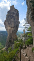

 Very difficult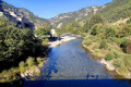
 Moderate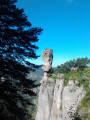
 Tourist office