


Refine your search for walks in Torgnon
Torgnon walks


 Santuario di Gilliarey
 Visorando Member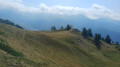
 5.73 mi
 +1,952 ft
 -1,952 ft
 4h 20
4h 20
 Moderate
 Departure from Torgnon (Aosta Valley)
A beautiful route which initially follows the “Petit Monde” stream. The climb continues towards the Cret mountain pasture and joins the track leading to the hamlet of Gilliarey. On the right, a small path leads to the Gilliarey sanctuary. You’ll enjoy a panoramic view of the Valtournenche and the Matterhorn. The return journey follows the same route as the outward journey
Antecima Monte Meabé
 3.47 mi
+2,270 ft
-2,267 ft
3h 35
Moderate
Departure from Torgnon (Aosta Valley)
3.47 mi
+2,270 ft
-2,267 ft
3h 35
Moderate
Departure from Torgnon (Aosta Valley)
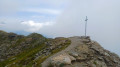
A beautiful route to the Antécime du Meabé, another peak overlooking Torgnon. In good weather, you’ll enjoy panoramic views of the Matterhorn and the Monte Rosa massif. At the start, the path shares the route with the Col Fenêtre trail. From this pass, it’s also possible to reach the Antécime du Meabé.
Tour of the Torgnon mountain pastures
 9.60 mi
+1,204 ft
-1,230 ft
5h 30
Moderate
Departure from Torgnon (Aosta Valley)
9.60 mi
+1,204 ft
-1,230 ft
5h 30
Moderate
Departure from Torgnon (Aosta Valley)
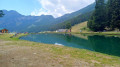
A pleasant route that alternates between mountain pastures and forests. The northern section of the route takes you past peaks exceeding 3,000 metres: Becca de Salé, Pointe du Tsan and Pointes de Chavacour. On the way back, you ’ll pass close to Monte Meabé and Becca d’Aver
Col de Saint Pantaléon from Torgnon
 3.75 mi
+666 ft
-682 ft
2h 20
Moderate
Departure from Torgnon (Aosta Valley)
3.75 mi
+666 ft
-682 ft
2h 20
Moderate
Departure from Torgnon (Aosta Valley)
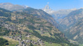
A pleasant route offering several views of the village of Torgnon and the neighbouring peaks: Le Zerbion and Le Tantané. At the small chapel (3), you can enjoy a panoramic view stretching from Valtournenche all the way to the Matterhorn.
Monte Chatelard from Mongnod
 3.52 mi
+919 ft
-915 ft
2h 25
Moderate
Departure from Torgnon (Aosta Valley)
3.52 mi
+919 ft
-915 ft
2h 25
Moderate
Departure from Torgnon (Aosta Valley)
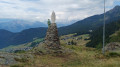
A lovely walk to a small peak overlooking the village of Torgnon. On this rocky outcrop stands a monument dedicated to the Madonna degli Alpini (Our Lady of the Alpine Hunters). At the summit, you’ll enjoy a panoramic view of the southern peaks of the Aosta Valley.
Becca d’Aver – Cima Longhede
 5.40 mi
+2,326 ft
-2,326 ft
4h 30
5.40 mi
+2,326 ft
-2,326 ft
4h 30
 Difficult
Departure from Torgnon (Aosta Valley)
Difficult
Departure from Torgnon (Aosta Valley)
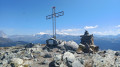
A superb route to the Becca d’Aver, the peak overlooking Torgnon. You’ll enjoy panoramic views of the Matterhorn and the Monte Rosa massif. From the Becca d’Aver, follow the ridge path to reach another peak, the Cima Longhede.
 Pilaz Pass
 4.12 mi
+2,024 ft
-2,021 ft
2 hrs
Moderate
Departure from Chamois (Aosta Valley)
4.12 mi
+2,024 ft
-2,021 ft
2 hrs
Moderate
Departure from Chamois (Aosta Valley)
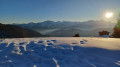
A superb winter route starting from Chamois. At Col Pilaz, you will be surprised to discover the Matterhorn to the north. A giant red bench offers a superb photo opportunity with the Cervinio in the background. On the south side, a magnificent panorama of the Paradis massif awaits you. The village of Chamois is the only car-free village in Italy. It is only accessible on foot, by bicycle or by cable car.
Monte Charvaz circular walk from Chamois
 4.94 mi
+1,729 ft
-1,722 ft
3h 45
Moderate
Departure from Chamois (Aosta Valley)
4.94 mi
+1,729 ft
-1,722 ft
3h 45
Moderate
Departure from Chamois (Aosta Valley)
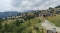
This circular walk above Chamois passes by Monte Charvaz, a viewpoint offering a panoramic view of the western part of the Valtournenche valley. You’ll recognise the mountain range above Torgnon, stretching from Becca d’Aver to Cima Bianca. The return to Chamois follows the course of the stream of the same name.
Monte Tantané
 9.32 mi
+3,320 ft
-3,307 ft
7h 10
9.32 mi
+3,320 ft
-3,307 ft
7h 10
 Very difficult
Departure from Chamois (Aosta Valley)
Very difficult
Departure from Chamois (Aosta Valley)
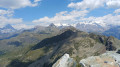
A superb hike to the summit of Monte Tantané. The ascent along the ridge is quite challenging, but once you reach the summit you’ll be rewarded with a magnificent panoramic view, particularly of the Matterhorn and the Monte Rosa massif.
Col Pilaz and Col Champlong, Lago Charey and the Champlong lakes
 6.65 mi
+1,857 ft
-1,864 ft
4h 40
Moderate
Departure from Chamois (Aosta Valley)
6.65 mi
+1,857 ft
-1,864 ft
4h 40
Moderate
Departure from Chamois (Aosta Valley)
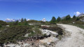
A magnificent hike starting from Chamois. The route is very varied, offering superb panoramic views of the Gran Paradiso massif at the Col du Pilaz. You’ll appreciate the beauty of Lakes Charey and Champlong. From time to time, you’ll catch glimpses of the Matterhorn, which plays hide-and-seek for a good half of the journey.
The village of Chamois is the only car-free village in Italy. It is accessible only on foot, by bike or by cable car.
Punta Falinère
 6.58 mi
+1,880 ft
-3,343 ft
4h 40
Difficult
Departure from Chamois (Aosta Valley)
6.58 mi
+1,880 ft
-3,343 ft
4h 40
Difficult
Departure from Chamois (Aosta Valley)
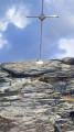
Punta Falinère is the peak overlooking the Chamois slopes. It offers views of its neighbours, the Petit and Grand Tournalin. To the north, you will discover more than 4000 Swiss peaks, including the Dent Blanche d'Hérens and the Matterhorn. To the south, the Grand Paradis will catch your eye.
Barmasse Refuge – Rosaire and Clermont Bivouac
 Association / Club / Walk leader12.36 mi
+5,666 ft
-3,950 ft
10h 35
Very difficult
Departure from Valtournenche (Aosta Valley)
Association / Club / Walk leader12.36 mi
+5,666 ft
-3,950 ft
10h 35
Very difficult
Departure from Valtournenche (Aosta Valley)
High-altitude trail between 2,400 and 2,700 metres. Stop at the Oratorio di Cunei mountain hut to refuel before the final climb to the bivouac. Very well equipped with beds, gas, pots and pans, etc. There is a small lake and the view across the entire mountain range is magnificent.
Rosaire and Clermont campsite – Ollomont
13.68 mi
+4,426 ft
-8,681 ft
10h 10
Very difficult
Departure from Quart (Aosta Valley)
A very long day. The descent to Oyace seems never-ending. On the other hand, once again, the scenery is magnificent and wild. It’s best to have a good rest in Oyace, as the final climb to the Col de Brison is very long. It’s almost over
Perrucco Vuillermoz Refuge - Gandeg Hut
 12.01 mi
+5,302 ft
-4,872 ft
10h 10
Difficult
Departure from Valtournenche (Aosta Valley)
12.01 mi
+5,302 ft
-4,872 ft
10h 10
Difficult
Departure from Valtournenche (Aosta Valley)
Today, discover the giant of the area, the splendid Matterhorn, before seeing it up close in the evening at the Gandeg Cabin.
Tour of the Matterhorn – Stage 7b: Perruco Mountain Hut – Breuil
6.78 mi
+974 ft
-3,930 ft
4h 00
Moderate
Departure from Valtournenche (Aosta Valley)
This is the second part of the classic stage of the Tour du Cervin, running from Prarayer to Breuil. The final section of the route can be avoided if you are tired once you reach the road. It is also possible to head towards Varvoie and Lake Perrères to rejoin the road more quickly.
Place Moulin Lake
 5.75 mi
+1,480 ft
-1,470 ft
3h 55
5.75 mi
+1,480 ft
-1,470 ft
3h 55
 Easy
Departure from Bionaz (Aosta Valley)
Easy
Departure from Bionaz (Aosta Valley)
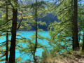
A family walk along the shores of the Place Moulin reservoir. A route skirting this emerald-green lake as you stroll beneath the conifers. At the far end of the lake, the Prarayer Refuge is situated on the Tour du Cervin route; make the most of it to have a bite to eat before retracing your steps. With a bit of luck, you’ll spot some marmots.
Tour of the Matterhorn
 97.02 mi
+38,215 ft
-37,972 ft
10 days
Difficult
Departure from Bionaz (Aosta Valley)
97.02 mi
+38,215 ft
-37,972 ft
10 days
Difficult
Departure from Bionaz (Aosta Valley)
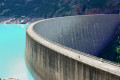
This 10-day tour of the Matterhorn is remarkable. It allows you to walk alongside the 4,000-metre peaks of this Alpine range every day. Located in two countries, Italy and Switzerland, it also allows you to familiarise yourself with three European languages: Italian, German and French in the Valais region of Switzerland.
Important note: Two stages of this route take place partly on glaciers. It is highly advisable to bring crampons and a rope for maximum safety. Crampons will make it easier to walk, and the rope can be used to form a rope team to secure the participants.
La Léchère - Prarayer Refuge
2.77 mi
+515 ft
-472 ft
1h 45
Easy
Departure from Bionaz (Aosta Valley)
A warm-up walk along the right bank of the lake to reach the Prarayer refuge.
Prarayer refuge - Perrucco Vuillermoz refuge
 3.61 mi
+3,625 ft
-696 ft
5 hrs
Very difficult
Departure from Bionaz (Aosta Valley)
3.61 mi
+3,625 ft
-696 ft
5 hrs
Very difficult
Departure from Bionaz (Aosta Valley)
The stage starts in the mountain pastures and quickly enters the high mountains with the passage of the Col de Valcornera.
Rifugio Prarayer - Breuil Cervinia
 10.96 mi
+4,705 ft
-4,738 ft
9h 10
Very difficult
Departure from Bionaz (Aosta Valley)
10.96 mi
+4,705 ft
-4,738 ft
9h 10
Very difficult
Departure from Bionaz (Aosta Valley)
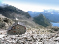
This is a classic stage of the Tour du Cervin, passing through the highest point of the hike, the Col de Valcournera, at an altitude of 3,075 metres.
Hike with a brief description, to be followed with the Visorando app.
More walks in Torgnon
Select a point of interest below: