Antecima Monte Meabé

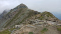
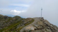
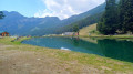
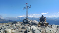
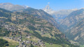
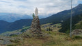
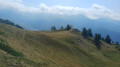
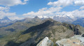
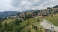
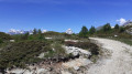
A beautiful route to the Antécime du Meabé, another peak overlooking Torgnon. In good weather, you’ll enjoy panoramic views of the Matterhorn and the Monte Rosa massif. At the start, the path shares the route with the Col Fenêtre trail. From this pass, it’s also possible to reach the Antécime du Meabé.

Details

101449337
Creation:
Last update:
Last review:
  • Walking
    Activity: Walking
  • ↔
    Distance: 3.47 mi
  • ◔
    Average duration: 3h 35 
  • ▲
    Difficulty: Moderate

  • ⚐
    Back to start: Yes
  • ↗
    Ascent: + 2,270 ft
  • ↘
    Descent: - 2,267 ft

  • ▲
    Highest point: 8,340 ft
  • ▼
    Lowest point: 6,070 ft

Photos

Waypoints

  1. S/E : mi 0 - alt. 6,070 ft - Small car park in Chantorné
  2. 1 : mi 0.05 - alt. 6,086 ft - Trail No. 8
  3. 2 : mi 0.33 - alt. 6,414 ft - Trail No. 8
  4. 3 : mi 0.61 - alt. 6,726 ft - Trail No. 8 – Turn right
  5. 4 : mi 1.72 - alt. 8,327 ft - Antecima Monte Meabé
  6. S/E : mi 3.47 - alt. 6,073 ft

Notes

  • To get to Chantorné, in the municipality of Torgnon (Aosta Valley):
    From the Aosta–Turin motorway (A5), take the Châtillon exit. Take the SR46 towards Valtournenche / Breuil-Cervinia. At Antey-Saint-André, turn left towards Torgnon.
    At Mongnod, follow signs for Chantorné (winter sports resort)
  • Small car park in Chantorné
  • The start of this walk is at a smallcar park in Chantorné (hairpin bend)
  • Sturdy walking shoes.
  • No water available along the route.

Other walks in the area

For more walks, use our search engine .

The GPS track and description are the property of this route's author. Please do not copy them without permission.