


 Country:

 City:
City:


To get to Mongnod, in the municipality of Torgnon (Aosta Valley):
From the Aosta–Turin motorway (A5), take the Châtillon exit. Take the SR46 towards Valtournenche / Breuil Cervinia. At Antey-Saint-André, turn left towards Torgnon.
Car park: in the centre of Mongnod
The start of this hike is in Mongnod.
Col de Saint Pantaléon from Torgnon


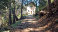
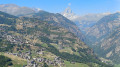
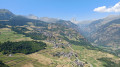
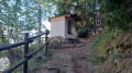
A pleasant route offering several views of the village of Torgnon and the neighbouring peaks: Le Zerbion and Le Tantané. At the small chapel (3), you can enjoy a panoramic view stretching from Valtournenche all the way to the Matterhorn.
Details
Creation:
Last update:
Last review:
–
–
-
 Activity: Walking
 -
 Distance: 3.75 mi
 -
 Average duration: 2h 20
 -
 Difficulty: Moderate
 -
-
 Back to start: Yes
 -
 Ascent: + 666 ft
 -
 Descent: - 682 ft
 -
-
 Highest point: 5,453 ft
 -
 Lowest point: 4,961 ft
Photos
Waypoints
- S/E : mi 0 - alt. 5,062 ft - Mongnod, village car park
- 1 : mi 0.19 - alt. 5,023 ft - Turn left towards Pantaléon
- 2 : mi 0.94 - alt. 5,052 ft - Opposite – Trail No. 13
- 3 : mi 1.72 - alt. 5,315 ft - Small chapel – Viewpoint
- 4 : mi 1.89 - alt. 5,443 ft - Col de Saint Pantaléon (1650 m)
- S/E : mi 3.75 - alt. 5,062 ft - Mongnod, village car park
Notes
Worth a visit
- View of the Matterhorn
- View of the village of Torgnon
- The mountain range separating Valtournenche from Val d’Ayas
Other walks in the area
Monte Chatelard from Mongnod
 Visorando Member
 3.52 mi
+919 ft
-915 ft
2h 25
Moderate
3.52 mi
+919 ft
-915 ft
2h 25
Moderate
 Departure from Torgnon (Aosta Valley)
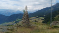
A lovely walk to a small peak overlooking the village of Torgnon. On this rocky outcrop stands a monument dedicated to the Madonna degli Alpini (Our Lady of the Alpine Hunters). At the summit, you’ll enjoy a panoramic view of the southern peaks of the Aosta Valley.
Tour of the Torgnon mountain pastures
 9.60 mi
+1,204 ft
-1,230 ft
5h 30
Moderate
Departure from Torgnon (Aosta Valley)
9.60 mi
+1,204 ft
-1,230 ft
5h 30
Moderate
Departure from Torgnon (Aosta Valley)
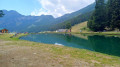
A pleasant route that alternates between mountain pastures and forests. The northern section of the route takes you past peaks exceeding 3,000 metres: Becca de Salé, Pointe du Tsan and Pointes de Chavacour. On the way back, you ’ll pass close to Monte Meabé and Becca d’Aver
Becca d’Aver – Cima Longhede
 5.40 mi
+2,326 ft
-2,326 ft
4h 30
5.40 mi
+2,326 ft
-2,326 ft
4h 30
 Difficult
Departure from Torgnon (Aosta Valley)
Difficult
Departure from Torgnon (Aosta Valley)
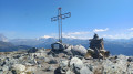
A superb route to the Becca d’Aver, the peak overlooking Torgnon. You’ll enjoy panoramic views of the Matterhorn and the Monte Rosa massif. From the Becca d’Aver, follow the ridge path to reach another peak, the Cima Longhede.
Antecima Monte Meabé
 3.47 mi
+2,270 ft
-2,267 ft
3h 35
Moderate
Departure from Torgnon (Aosta Valley)
3.47 mi
+2,270 ft
-2,267 ft
3h 35
Moderate
Departure from Torgnon (Aosta Valley)
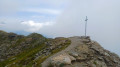
A beautiful route to the Antécime du Meabé, another peak overlooking Torgnon. In good weather, you’ll enjoy panoramic views of the Matterhorn and the Monte Rosa massif. At the start, the path shares the route with the Col Fenêtre trail. From this pass, it’s also possible to reach the Antécime du Meabé.
Santuario di Gilliarey
 5.73 mi
+1,952 ft
-1,952 ft
4h 20
Moderate
Departure from Torgnon (Aosta Valley)
5.73 mi
+1,952 ft
-1,952 ft
4h 20
Moderate
Departure from Torgnon (Aosta Valley)
A beautiful route which initially follows the “Petit Monde” stream. The climb continues towards the Cret mountain pasture and joins the track leading to the hamlet of Gilliarey. On the right, a small path leads to the Gilliarey sanctuary. You’ll enjoy a panoramic view of the Valtournenche and the Matterhorn. The return journey follows the same route as the outward journey
Monte Tantané
 9.32 mi
+3,320 ft
-3,307 ft
7h 10
9.32 mi
+3,320 ft
-3,307 ft
7h 10
 Very difficult
Departure from Chamois (Aosta Valley)
Very difficult
Departure from Chamois (Aosta Valley)
A superb hike to the summit of Monte Tantané. The ascent along the ridge is quite challenging, but once you reach the summit you’ll be rewarded with a magnificent panoramic view, particularly of the Matterhorn and the Monte Rosa massif.
Monte Charvaz circular walk from Chamois
 4.94 mi
+1,729 ft
-1,722 ft
3h 45
Moderate
Departure from Chamois (Aosta Valley)
4.94 mi
+1,729 ft
-1,722 ft
3h 45
Moderate
Departure from Chamois (Aosta Valley)
This circular walk above Chamois passes by Monte Charvaz, a viewpoint offering a panoramic view of the western part of the Valtournenche valley. You’ll recognise the mountain range above Torgnon, stretching from Becca d’Aver to Cima Bianca. The return to Chamois follows the course of the stream of the same name.
Col Pilaz and Col Champlong, Lago Charey and the Champlong lakes
 6.65 mi
+1,857 ft
-1,864 ft
4h 40
Moderate
Departure from Chamois (Aosta Valley)
6.65 mi
+1,857 ft
-1,864 ft
4h 40
Moderate
Departure from Chamois (Aosta Valley)
A magnificent hike starting from Chamois. The route is very varied, offering superb panoramic views of the Gran Paradiso massif at the Col du Pilaz. You’ll appreciate the beauty of Lakes Charey and Champlong. From time to time, you’ll catch glimpses of the Matterhorn, which plays hide-and-seek for a good half of the journey.
The village of Chamois is the only car-free village in Italy. It is accessible only on foot, by bike or by cable car.
For more walks, use our search engine .
The GPS track and description are the property of this route's author. Please do not copy them without permission.

