Col Pilaz and Col Champlong, Lago Charey and the Champlong lakes

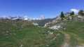
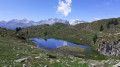
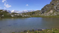
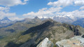
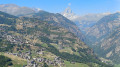
A magnificent hike starting from Chamois. The route is very varied, offering superb panoramic views of the Gran Paradiso massif at the Col du Pilaz. You’ll appreciate the beauty of Lakes Charey and Champlong. From time to time, you’ll catch glimpses of the Matterhorn, which plays hide-and-seek for a good half of the journey.
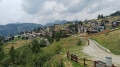
The village of Chamois is the only car-free village in Italy. It is accessible only on foot, by bike or by cable car.

Details

35568072
Creation:
Last update:
Last review:
  • Walking
    Activity: Walking
  • ↔
    Distance: 6.65 mi
  • ◔
    Average duration: 4h 40 
  • ▲
    Difficulty: Moderate

  • ⚐
    Back to start: Yes
  • ↗
    Ascent: + 1,857 ft
  • ↘
    Descent: - 1,864 ft

  • ▲
    Highest point: 7,648 ft
  • ▼
    Lowest point: 5,876 ft

Photos

Description of the walk

From the Aosta–Turin motorway (A5), take the Châtillon exit. Take the SR46 towards Valtournenche / Breuil Cervinia. Stop at the cable car car park in the hamlet of Buisson. Take the Buisson–Chamois cable car.
The start and finish of this hike are on the village square between the Buisson-Chamois cable car station and the town hall.

(S/E) From the town hall, take the Chamois–La Magdeleine track, cross the village and head towards the Torrente Chamois.

(1) Cross the stream and take the track on the right. Continue until you reach a Fork in the road.

(2) Ignore the path on the right which leads down to Chamois aerodrome. Continue left along the La Magdeleine track.

(3) Stay on this track until you reach another Fork in the road.

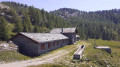
(4) Take the track on the left, which climbs quite steeply. Continue to the Saverou chalet.

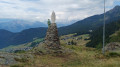
(5) Continue along the Saverou track and turn off towards Lago Pilaz to reach the Col Pilaz fairly quickly.

(6) Take a break to admire the Matterhorn to the north and the Gran Paradiso range to the south. Resume your walk with a fairly steep climb up to Lago Charey.

(7) Take another break by the shores of this magnificent lake. Return to the track and head for another lake, the first Lago Champlong.

(8) Leave the path leading to Col Pillonet on your right. Stay on the track, passing two other smaller lakes, and head for Colle Champlong, which gradually comes into view.

(9) Continue along the track to the Cort mountain pasture.

Signposting: yellow markings

(10) Directly opposite the Alpe Cort building, look out for the start of the path, which becomes increasingly obvious. After a long descent through the forest, rejoin the track that runs alongside the Torrente Chamois.

(11) Follow the stream until you reach the mill bridge.

(1) Follow the path back along the same route you took on the way there to return to the town hall (S/E).

Waypoints

  1. S/E : mi 0 - alt. 5,945 ft - Chamois Town Council
  2. 1 : mi 0.22 - alt. 5,938 ft - Mill bridge over the Torrente Chamois
  3. 2 : mi 0.29 - alt. 5,925 ft - Path on the left
  4. 3 : mi 0.47 - alt. 5,909 ft - Heading towards La Magdeleine
  5. 4 : mi 0.95 - alt. 5,876 ft - Strada Saverou
  6. 5 : mi 1.44 - alt. 6,207 ft - Saverou
  7. 6 : mi 1.98 - alt. 6,444 ft - Col Pilaz
  8. 7 : mi 2.77 - alt. 7,024 ft - Towards Lago Charey
  9. 8 : mi 3.96 - alt. 7,605 ft - Path towards Col Champlong
  10. 9 : mi 4.38 - alt. 7,635 ft - Colle Champlong
  11. 10 : mi 5.27 - alt. 7,152 ft - Alpe Cort
  12. 11 : mi 5.94 - alt. 6,207 ft - Path on the left bank of the Chamois torrent
  13. S/E : mi 6.65 - alt. 5,942 ft - Chamois Town Council

Notes

  • Cable car car park at Buisson: €3 per day. (2023)
  • Buisson-Chamois cable car: €5.50 (return) (2023)
  • Hotel: Maison Cly

Hike undertaken by the author on 25 June 2023.

Worth a visit

  • Chamois.
  • Pilaz Pass.
  • Pillonet Pass.
  • Lake Charey.
  • Champlong Pass.
  • Champlong Lakes.
  • Alpe Cort.

Reviews and comments

5 / 5
Based on 3 reviews

Reliability of the description
5 / 5
Ease of following the route
5 / 5
Route interest
5 / 5
pfla
pfla

Overall rating : 5 / 5

Date of your route : Jul 21, 2026
Reliability of the description : ★★★★★ Very good
Ease of following the route : ★★★★★ Very good
Route interest : ★★★★★ Very good
Very busy route : No

A lovely, easy walk with stunning views

Machine-translated

elememzlldgr
elememzlldgr

Overall rating : 5 / 5

Date of your route : Aug 05, 2024
Reliability of the description : ★★★★★ Very good
Ease of following the route : ★★★★★ Very good
Route interest : ★★★★★ Very good
Very busy route : Yes

A wonderful walk – an easy route with stunning views. Took 3 hours, including plenty of breaks.

Machine-translated

Tiphanie-7
Tiphanie-7

Overall rating : 5 / 5

Date of your route : Aug 14, 2023
Reliability of the description : ★★★★★ Very good
Ease of following the route : ★★★★★ Very good
Route interest : ★★★★★ Very good
Very busy route : No

A lovely walk in the Gran Paradiso, offering stunning views of the mountain range plateau in the Aosta Valley.

Machine-translated

Other walks in the area

For more walks, use our search engine .

The GPS track and description are the property of this route's author. Please do not copy them without permission.