Monte Tantané

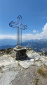
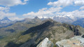
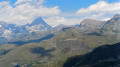
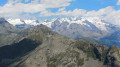
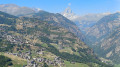
A superb hike to the summit of Monte Tantané. The ascent along the ridge is quite challenging, but once you reach the summit you’ll be rewarded with a magnificent panoramic view, particularly of the Matterhorn and the Monte Rosa massif.

Details

101693456
Creation:
Last update:
Last review:
  • Walking
    Activity: Walking
  • ↔
    Distance: 9.32 mi
  • ◔
    Average duration: 7h 10 
  • ▲
    Difficulty: Very difficult

  • ⚐
    Back to start: Yes
  • ↗
    Ascent: + 3,320 ft
  • ↘
    Descent: - 3,307 ft

  • ▲
    Highest point: 8,904 ft
  • ▼
    Lowest point: 5,869 ft

Photos

Description of the walk

From the Aosta–Turin motorway (A5), take the Châtillon exit. Take the SR46 towards Valtournenche / Breuil-Cervinia. Stop at the cable car car park in the hamlet of Buisson. Take the Buisson–Chamois cable car.
The start and finish of this walk are at the town square, Municipio.

(S/E) From the town square, head towards the Chamois stream.

(1) Cross the bridge and follow the Magdeleine track.

(2) Leave the track and turn left towards the Col Pilaz.

(3) At Col Pilaz, facing east, take the Col Pillonet path for about a hundred metres. Look out for the start of a path on the right signposted Lago Charrey and Arrête du Tantané.

(4) Turn right; after a few rocky sections, you’ll reach a fork in the path.

(5) Be careful: the path branching off to the right is barely visible. Leave the main path leading to Lago Charrey and turn right onto the track, which is quite narrow at the start. Continue through the forest and then across open ground to the Arrête du Tantané.

(6) Begin the ascent of the Tantané (Grade T3). Two tricky sections over rocks before the secondary summit require particular care.

(7) Enjoy the panoramic view from the summit. Descend carefully to the first junction, where you leave the ridge.

(8) Turn right and, following a pleasant path, rejoin the Pillonet Pass track between the lakes of Champ-Long and Charrey

(9) Continue the descent to the Col Pilaz.

(3) Return to the village square by following the outbound route in the opposite direction (S/E)

Waypoints

  1. S/E : mi 0 - alt. 5,938 ft - Municipio Chamois
  2. 1 : mi 0.22 - alt. 5,928 ft - Pont du Moulin
  3. 2 : mi 0.96 - alt. 5,869 ft - To the left
  4. 3 : mi 1.96 - alt. 6,437 ft - Col Pilaz
  5. 4 : mi 2.03 - alt. 6,503 ft - To the right – Lago Charrey/Arrête Tantané path
  6. 5 : mi 2.48 - alt. 7,044 ft - Turn right (no signposting)
  7. 6 : mi 3.66 - alt. 7,448 ft - To the left – Tantané ridge
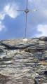
  8. 7 : mi 4.43 - alt. 8,875 ft - Summit of the Tantané
  9. 8 : mi 4.99 - alt. 7,717 ft - To the right as you descend – towards Lago Charrey
  10. 9 : mi 6 - alt. 7,441 ft - Trail
  11. S/E : mi 9.32 - alt. 5,938 ft - Municipio Chamois

Notes

Hike completed by the author on 16 July 2026.

  • From point (6) to point (8), grade T3 (two tricky sections)
  • A quick reminder about route difficulty ratings: see this page.
  • Buisson cable car car park: €4 for the day. (2026)
  • Buisson–Chamois cable car: €7 (return) (2026)

Worth a visit

  • Chamois
  • La Magdeleine
  • Le Monte Tantané
  • Le Zerbion
  • Panoramic view of the Matterhorn, the Monte Rosa massif, and the peaks of the southern Aosta Valley, including Monte Emilius.

Other walks in the area

For more walks, use our search engine .

The GPS track and description are the property of this route's author. Please do not copy them without permission.