


Refine your search for walks in Monte Chatelard (1844 m)
Monte Chatelard (1844 m) walks


 Monte Chatelard from Mongnod
 Visorando Member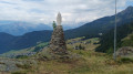
 3.52 mi
 +919 ft
 -915 ft
 2h 25
2h 25
 Moderate
 Departure from Torgnon (Aosta Valley)
A lovely walk to a small peak overlooking the village of Torgnon. On this rocky outcrop stands a monument dedicated to the Madonna degli Alpini (Our Lady of the Alpine Hunters). At the summit, you’ll enjoy a panoramic view of the southern peaks of the Aosta Valley.
Walks near Monte Chatelard (1844 m)
Punta Falinère
 6.58 mi
+1,880 ft
-3,343 ft
4h 40
6.58 mi
+1,880 ft
-3,343 ft
4h 40
 Difficult
Departure from Chamois (Aosta Valley)
Difficult
Departure from Chamois (Aosta Valley)
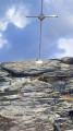
Punta Falinère is the peak overlooking the Chamois slopes. It offers views of its neighbours, the Petit and Grand Tournalin. To the north, you will discover more than 4000 Swiss peaks, including the Dent Blanche d'Hérens and the Matterhorn. To the south, the Grand Paradis will catch your eye.
Barmasse Refuge – Rosaire and Clermont Bivouac
 Association / Club / Walk leader12.36 mi
+5,666 ft
-3,950 ft
10h 35
Association / Club / Walk leader12.36 mi
+5,666 ft
-3,950 ft
10h 35
 Very difficult
Departure from Valtournenche (Aosta Valley)
Very difficult
Departure from Valtournenche (Aosta Valley)
High-altitude trail between 2,400 and 2,700 metres. Stop at the Oratorio di Cunei mountain hut to refuel before the final climb to the bivouac. Very well equipped with beds, gas, pots and pans, etc. There is a small lake and the view across the entire mountain range is magnificent.
Rosaire and Clermont campsite – Ollomont
13.68 mi
+4,426 ft
-8,681 ft
10h 10
Very difficult
Departure from Quart (Aosta Valley)
A very long day. The descent to Oyace seems never-ending. On the other hand, once again, the scenery is magnificent and wild. It’s best to have a good rest in Oyace, as the final climb to the Col de Brison is very long. It’s almost over
Perrucco Vuillermoz Refuge - Gandeg Hut
 12.01 mi
+5,302 ft
-4,872 ft
10h 10
Difficult
Departure from Valtournenche (Aosta Valley)
12.01 mi
+5,302 ft
-4,872 ft
10h 10
Difficult
Departure from Valtournenche (Aosta Valley)
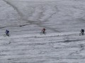
Today, discover the giant of the area, the splendid Matterhorn, before seeing it up close in the evening at the Gandeg Cabin.
Tour of the Matterhorn – Stage 7b: Perruco Mountain Hut – Breuil
6.78 mi
+974 ft
-3,930 ft
4h 00
Moderate
Departure from Valtournenche (Aosta Valley)
This is the second part of the classic stage of the Tour du Cervin, running from Prarayer to Breuil. The final section of the route can be avoided if you are tired once you reach the road. It is also possible to head towards Varvoie and Lake Perrères to rejoin the road more quickly.
Tour of the Matterhorn
 97.02 mi
+38,215 ft
-37,972 ft
10 days
Difficult
Departure from Bionaz (Aosta Valley)
97.02 mi
+38,215 ft
-37,972 ft
10 days
Difficult
Departure from Bionaz (Aosta Valley)
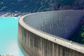
This 10-day tour of the Matterhorn is remarkable. It allows you to walk alongside the 4,000-metre peaks of this Alpine range every day. Located in two countries, Italy and Switzerland, it also allows you to familiarise yourself with three European languages: Italian, German and French in the Valais region of Switzerland.
Important note: Two stages of this route take place partly on glaciers. It is highly advisable to bring crampons and a rope for maximum safety. Crampons will make it easier to walk, and the rope can be used to form a rope team to secure the participants.
La Léchère - Prarayer Refuge
2.77 mi
+515 ft
-472 ft
1h 45
 Easy
Departure from Bionaz (Aosta Valley)
Easy
Departure from Bionaz (Aosta Valley)
A warm-up walk along the right bank of the lake to reach the Prarayer refuge.
Champoluc - Refuge de l'Arp
6.16 mi
+3,829 ft
-988 ft
6h 10
Difficult
Departure from Ayas (Aosta Valley)
Starting from the church square, this hike follows the Evançon torrent before turning left onto Rue de l'Ostrion, which gradually climbs. Passing by the small chapel overlooking the village of Champoluc and the Ayas Valley, you will reach the village of Mascognaz, an authentic and beautiful Walser village. The hike passes through Col de Palasina and then, after a slight descent, you will reach the wild Bataille lakes and then the Arp refuge at 2,400 metres.
Prarayer refuge - Perrucco Vuillermoz refuge
 3.61 mi
+3,625 ft
-696 ft
5 hrs
Very difficult
Departure from Bionaz (Aosta Valley)
3.61 mi
+3,625 ft
-696 ft
5 hrs
Very difficult
Departure from Bionaz (Aosta Valley)
The stage starts in the mountain pastures and quickly enters the high mountains with the passage of the Col de Valcornera.
Rifugio Prarayer - Breuil Cervinia
 10.96 mi
+4,705 ft
-4,738 ft
9h 10
Very difficult
Departure from Bionaz (Aosta Valley)
10.96 mi
+4,705 ft
-4,738 ft
9h 10
Very difficult
Departure from Bionaz (Aosta Valley)
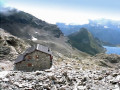
This is a classic stage of the Tour du Cervin, passing through the highest point of the hike, the Col de Valcournera, at an altitude of 3,075 metres.
Hike with a brief description, to be followed with the Visorando app.