Place Moulin Lake

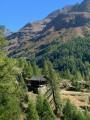
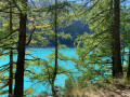
A family walk along the shores of the Place Moulin reservoir. A route skirting this emerald-green lake as you stroll beneath the conifers. At the far end of the lake, the Prarayer Refuge is situated on the Tour du Cervin route; make the most of it to have a bite to eat before retracing your steps. With a bit of luck, you’ll spot some marmots.

Details

27095670
Creation:
Last update:
Last review:
  • Walking
    Activity: Walking
  • ↔
    Distance: 5.75 mi
  • ◔
    Average duration: 3h 55 
  • ▲
    Difficulty: Easy

  • ⚐
    Back to start: Yes
  • ↗
    Ascent: + 1,480 ft
  • ↘
    Descent: - 1,470 ft

  • ▲
    Highest point: 6,598 ft
  • ▼
    Lowest point: 6,417 ft

Photos

Description of the walk

The starting point is a large car park situated above the dam where, for less than €4 (in 2022), you can park for the day.

(S/E) Take the track heading east; the signposts indicate Prarayer.

(1) Pass close to the spillway, topped by cranes that look like metal giraffes.

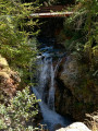
(2) Ignore the path branching off to the left, although it could serve as an alternative route to gain height. The track crosses several streams, which often feature pretty waterfalls.

(3) Join the alternative path that meets the track on the left, then continue north-east along the track that runs alongside the lake. Cross a bridge over the Torrent d’Oren.

(4) Pass a chapel; the path becomes paved as it climbs.

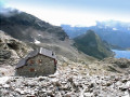
(5) Ignore the path leading uphill to the left and walk past the La Lé farm; continue towards the Prarayer mountain refuge, which is clearly visible at the far end of the lake.

(6) Follow the same path in the opposite direction to return to the car park (S/E).

Waypoints

  1. S/E : mi 0 - alt. 6,516 ft - Car park - Barrage de Place Moulin
  2. 1 : mi 0.14 - alt. 6,535 ft - Dam spillway
  3. 2 : mi 0.26 - alt. 6,588 ft - Track on the right
  4. 3 : mi 1.63 - alt. 6,506 ft - Track x Path - Lago di Place Moulin
  5. 4 : mi 2.33 - alt. 6,516 ft - Chapel
  6. 5 : mi 2.39 - alt. 6,552 ft - T-junction
  7. 6 : mi 2.87 - alt. 6,598 ft - Prarayer Mountain Hut
  8. S/E : mi 5.75 - alt. 6,516 ft - Car park

Notes

There are water points at the start and at the refuge.

Reviews and comments

4.7 / 5
Based on 2 reviews

Reliability of the description
5 / 5
Ease of following the route
5 / 5
Route interest
4 / 5
Pioponeux
Pioponeux

Overall rating : 4.7 / 5

Date of your route : Oct 23, 2024
Reliability of the description : ★★★★★ Very good
Ease of following the route : ★★★★★ Very good
Route interest : ★★★★☆ Good
Very busy route : No

An easy walk suitable for families.
A lovely lakeside spot and a very warm welcome at the bar in the mountain hut at the far end of the lake.

Machine-translated

bruno76joelle
bruno76joelle
• Edited:

Overall rating : 4.7 / 5

Date of your route : May 08, 2024
Reliability of the description : ★★★★★ Very good
Ease of following the route : ★★★★★ Very good
Route interest : ★★★★☆ Good
Very busy route : No

An easy, safe family walk. At the start of May, the lake was at a low water level, so there were few reflections of the mountains on the water’s surface. Car park at the start with toilets: brilliant!
Also highly recommended for the beautiful scenery all along the access road.
Thank you for suggesting this route

Machine-translated

Other walks in the area

For more walks, use our search engine .

The GPS track and description are the property of this route's author. Please do not copy them without permission.