Santuario di Gilliarey

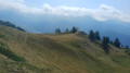
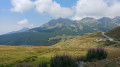
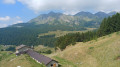
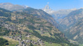
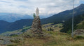
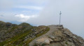
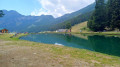
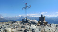
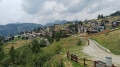
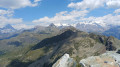
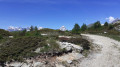
A beautiful route which initially follows the “Petit Monde” stream. The climb continues towards the Cret mountain pasture and joins the track leading to the hamlet of Gilliarey. On the right, a small path leads to the Gilliarey sanctuary. You’ll enjoy a panoramic view of the Valtournenche and the Matterhorn. The return journey follows the same route as the outward journey

Details

101206067
Creation:
Last update:
Last review:
  • Walking
    Activity: Walking
  • ↔
    Distance: 5.73 mi
  • ◔
    Average duration: 4h 20 
  • ▲
    Difficulty: Moderate

  • ⚐
    Back to start: Yes
  • ↗
    Ascent: + 1,952 ft
  • ↘
    Descent: - 1,952 ft

  • ▲
    Highest point: 7,136 ft
  • ▼
    Lowest point: 5,200 ft

Photos

Waypoints

  1. S/E : mi 0 - alt. 5,200 ft - Etirol
  2. 1 : mi 0.12 - alt. 5,295 ft - Trail 107
  3. 2 : mi 0.53 - alt. 5,591 ft - Fork in the road 107/105
  4. 3 : mi 1.02 - alt. 6,037 ft - Trail 105
  5. 4 : mi 1.23 - alt. 6,109 ft - Crossroads
  6. 5 : mi 1.4 - alt. 6,322 ft - Trail No. 107
  7. 6 : mi 1.64 - alt. 6,552 ft - Alpe de Cret
  8. 7 : mi 1.89 - alt. 6,775 ft - Alpe de Tellinod
  9. 8 : mi 2.78 - alt. 7,129 ft - Gilliarey
  10. 9 : mi 2.87 - alt. 7,064 ft - Santuario di Gilliarey
  11. S/E : mi 5.73 - alt. 5,200 ft - Etirol

Notes

  • To get to Etirol, in the municipality of Torgnon (Aosta Valley):
    From the Aosta–Turin motorway (A5), take the Châtillon exit. Take the SR46 towards Valtournenche / Breuil-Cervinia. At Antey-Saint-André, turn left towards Torgnon.
    At Mongnod, follow signs for Triatel then Etirol (please note: the road is very narrow)
  • There is a small car park at the entrance to the hamlet of Etirol.
  • The start of this walk is in Etirol.
  • Sturdy walking shoes.
  • There is no water along the route.

Worth a visit

  • Viewpoint over the Valtournenche: from Zerbion to the Grand Tournalin and Monte Roisetta. At the far end of the valley, the Matterhorn.

Other walks in the area

For more walks, use our search engine .

The GPS track and description are the property of this route's author. Please do not copy them without permission.