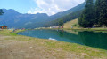
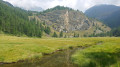
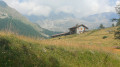
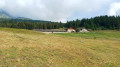
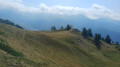
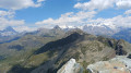
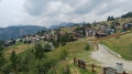
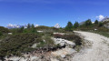
Tour of the Torgnon mountain pastures

A pleasant route that alternates between mountain pastures and forests. The northern section of the route takes you past peaks exceeding 3,000 metres: Becca de Salé, Pointe du Tsan and Pointes de Chavacour. On the way back, you ’ll pass close to Monte Meabé and Becca d’Aver

Details

101551340
Creation:
Last update:
Last review:
  • Walking
    Activity: Walking
  • ↔
    Distance: 9.60 mi
  • ◔
    Average duration: 5h 30 
  • ▲
    Difficulty: Moderate

  • ⚐
    Back to start: Yes
  • ↗
    Ascent: + 1,204 ft
  • ↘
    Descent: - 1,230 ft

  • ▲
    Highest point: 6,932 ft
  • ▼
    Lowest point: 5,935 ft

Photos

Waypoints

  1. S/E : mi 0 - alt. 5,974 ft - Chantorné: Les Montagnards car park
  2. 1 : mi 0.88 - alt. 6,093 ft - Chavannes – Opposite
  3. 2 : mi 1.88 - alt. 6,273 ft - Turn right onto the “Tour des Alpages de Torgnon”
  4. 3 : mi 2.49 - alt. 6,247 ft - Trail No. 1
  5. 4 : mi 3.87 - alt. 6,385 ft - Trail No. 5
  6. 5 : mi 4.31 - alt. 6,627 ft - On the left – Trail No. 5
  7. 6 : mi 4.63 - alt. 6,867 ft - On the right – Please note: the start of the path is not very visible
  8. 7 : mi 4.78 - alt. 6,900 ft - Turn left onto the “Tour des Alpages de Torgnon”
  9. 8 : mi 6.47 - alt. 6,713 ft - Trail No. 1
  10. 9 : mi 8.2 - alt. 6,424 ft - Chantorné Reservoir
  11. 10 : mi 9.31 - alt. 6,250 ft - Turn left towards Chantorné
  12. S/E : mi 9.6 - alt. 5,968 ft - Chantorné: Les Montagnards car park

Notes

  • To get to Chantorné, in the municipality of Torgnon (Aosta Valley):
    From the Aosta–Turin motorway (A5), take the Châtillon exit. Take the SR46 towards Valtournenche / Breuil-Cervinia. At Antey-Saint-André, turn left towards Torgnon.
    At Mongnod, follow signs for Chantorné (winter sports resort)
  • Les Montagnards car park
  • The start of this walk is in Chantorné, near the restaurant ‘Les Montagnards’.
  • Sturdy walking shoes.
  • There is no water available along the route.

Other walks in the area

For more walks, use our search engine .

The GPS track and description are the property of this route's author. Please do not copy them without permission.