


Refine your search for walks in Terrehault
Terrehault walks


 The thousand-year-old yew tree at Jauzé
 Association / Club / Walk leader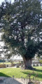
 4.57 mi
 +66 ft
 -66 ft
 2h 10
2h 10
 Easy
Easy
 Departure from Terrehault (Sarthe)
From Terrehault, follow the dirt tracks lined with pollarded trees to the village of Jauzé and its thousand-year-old yew tree.
From Le Tripoulin to La Vive Parence
 Visorando Member
 6.31 mi
+351 ft
-331 ft
3h 10
Easy
Departure from Bonnétable (Sarthe)
6.31 mi
+351 ft
-331 ft
3h 10
Easy
Departure from Bonnétable (Sarthe)
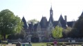
Spared by land consolidation, the commune of Bonnétable, best known for its medieval castle and deciduous forest, is much loved by walkers for its typical sunken paths and pleasant wooded countryside.
The village of Beaufay and the Butte de Montplaisir
 13.33 mi
+459 ft
-446 ft
6h 30
13.33 mi
+459 ft
-446 ft
6h 30
 Difficult
Departure from Beaufay (Sarthe)
Difficult
Departure from Beaufay (Sarthe)
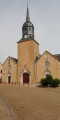
A good twenty kilometres of peaceful walking through the countryside along sunken lanes, with almost 100% of the route on footpaths (less than 1.5 km of tarmac!!!) in the Beaufay countryside.
Around the fortified church of Saint-Georges-du-Rosay
 8.97 mi
+131 ft
-135 ft
4h 15
8.97 mi
+131 ft
-135 ft
4h 15
 Moderate
Departure from Saint-Georges-du-Rosay (Sarthe)
Moderate
Departure from Saint-Georges-du-Rosay (Sarthe)
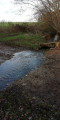
Discover the fortified church of Saint-Georges-du-Rosay and explore the countryside criss-crossed by beautiful sunken paths. The presence of numerous springs means the route remains particularly damp all year round. Sturdy footwear is recommended.
The Butte de Montrentin as seen from Torcé-en-Vallée
6.47 mi
+66 ft
-69 ft
3h 00
Moderate
Departure from Torcé-en-Vallée (Sarthe)
This walk, with little variation in elevation and no great difficulty, will allow you to explore the southern part of Torcé. The paths – sometimes tree-lined, sometimes sunny, and very often sandy – will take you to the foothills of the Butte de Montrentin.
Palet de Gargantua Circuit
 Tourism professional
 5.19 mi
+79 ft
-72 ft
2h 25
Easy
Departure from Torcé-en-Vallée (Sarthe)
5.19 mi
+79 ft
-72 ft
2h 25
Easy
Departure from Torcé-en-Vallée (Sarthe)
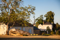
Known successively as Ecclesia de Torciaco, then Torcey and Notre Dame de Torcé, the former parish has been called Torcé-en-Vallée since 1926. The documents first mentioning it relate to the construction of the priory and the church. However, it is clear that Torcé’s history predates this, as evidenced by the megalith located at the western entrance to the village, known as the ‘Dolmen de Torcé’ or ‘Palet de Gargantua’. Human occupation may date back to the Middle Neolithic period.
The Saint-Célerin circulars
 11.94 mi
+305 ft
-292 ft
5h 45
Moderate
Departure from Saint-Célerin (Sarthe)
11.94 mi
+305 ft
-292 ft
5h 45
Moderate
Departure from Saint-Célerin (Sarthe)
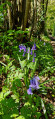
The earliest evidence of human settlement in Saint-Célerin is linked to the discovery of ancient coins, including a Gallic stater (1st or2nd century BC) and a Carolingian hoard dating from around 833, the year the locality of Caliniaco (known in French as Chahanay) was first mentioned.
The Chéronne Valley in Saint-Denis-des-Coudrais
 3.22 mi
+115 ft
-115 ft
1h 35
Easy
Departure from Saint-Denis-des-Coudrais (Sarthe)
3.22 mi
+115 ft
-115 ft
1h 35
Easy
Departure from Saint-Denis-des-Coudrais (Sarthe)
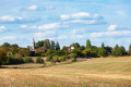
The former parish of Saint-Denis-des-Coudrais developed under the influence of the lords of Chéronne, who held the parish seigneury, until the Revolution. Under the Ancien Régime, the village fell under the jurisdiction of the Perche (right bank of the Chéronne) and the Maine (left bank of the Chéronne). Whilst the local economy was primarily agricultural, deposits of very high-quality white clay were exploited from an early stage to supply the nearby pottery workshops, notably those in Tuffé, Bonnétable and Prévelles. This activity ceased in themid-20th century with the closure of the last workshop in Prévelles in 1962. The place names bear witness to this history: Les Caves, la Fosse (now called Les Merisiers), and les Terres Blanches.
La Fosse aux Saneux in Sillé-le-Philippe
 9.40 mi
+256 ft
-246 ft
4h 35
Moderate
Departure from Sillé-le-Philippe (Sarthe)
9.40 mi
+256 ft
-246 ft
4h 35
Moderate
Departure from Sillé-le-Philippe (Sarthe)
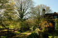
The first mention of the parish under the name “Siliaco Philippi” dates back to the years 1145–1187. From the Middle Ages onwards, the parish seigneury was annexed to the Château de Passais, which itself fell under the barony of Touvoie, owned by the bishops of Le Mans, situated on the border between Savigné-L’Evêque and Saint-Corneille. Sillé-le-Philippe gave rise to the creation of a linear village; long remaining modest in size, it is now expanding due to its proximity to the Le Mans conurbation. This development also benefits the hamlet of Chanteloup (situated on the old royal road from Le Mans to Paris via Mortagne, now the RD 301), which once boasted several cafés and inns.
Tuffé Abbey Circular Walk
 7.09 mi
+167 ft
-157 ft
3h 25
Moderate
Departure from Tuffé (Sarthe)
7.09 mi
+167 ft
-157 ft
3h 25
Moderate
Departure from Tuffé (Sarthe)
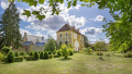
Tuffé-Val-de-la-Chéronne is a new commune formed in 2016 from the merger of the communes of Tuffé and Saint-Hilaire-le-Lierru. Inhabited since the Neolithic period, as evidenced by the Grandes Brières dolmen, Tuffé began to develop in the Early Middle Ages with the founding of an abbey around 650. From the Middle Ages to the Revolution, the monastery of Tuffé was also a large seigneurial estate bearing the title of barony; its power sparked emulation and, at times, rivalry with the neighbouring lay lords of Chéronne. At the end of the 19th century, the railway gave the village a new lease of life; it encouraged the establishment of an industrial estate on which the town’s current economic vitality still partly rests.
The Chéronne stream
8.57 mi
+531 ft
-528 ft
4h 25
Moderate
Departure from Tuffé (Sarthe)
The route through the countryside around Tuffé takes us to the Château de Chéronne and the church of Saint-Denis-des-Coudrais. The Chéronne, which feeds the Tuffé lake, crosses and recrosses the sunken paths several times.
This route is best enjoyed in good weather as the dirt tracks can be quite wet.
The village of Dehault and its hillsides
 5.33 mi
+210 ft
-223 ft
2h 40
Easy
Departure from Dehault (Sarthe)
5.33 mi
+210 ft
-223 ft
2h 40
Easy
Departure from Dehault (Sarthe)
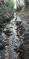
A lovely walk around the village of Dehault, through which the Montreteau flows. A hilly route with some beautiful sunken lanes.
The heights of Dehault
 3.06 mi
+157 ft
-148 ft
1h 35
Easy
Departure from Dehault (Sarthe)
3.06 mi
+157 ft
-148 ft
1h 35
Easy
Departure from Dehault (Sarthe)
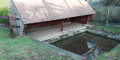
Over hill and dale, following the sunken paths and the Montretaux stream, discover the charming village of Dehault and its landscapes.
In the footsteps of the Crusaders, starting from Lombron
13.61 mi
+515 ft
-509 ft
6h 40
Difficult
Departure from Lombron (Sarthe)
Although local tradition places the first village at Bresteau, the Church of Saint-Martin, rebuilt by the monks of Saint-Vincent in the early 12th century, provides clear evidence of the antiquity of the village of Lombron. This beautiful church, open during the day, is well worth a visit both for the quality of its architecture (Romanesque choir and lantern tower, nave and chapels remodelled in the 14th and 15th centuries on their original foundations) and for its furnishings (16th-century statues including the Crucified Christ, the seigneurial bench of the Montmorency family, lords of Bresteau, terracotta bas-reliefs by Lebrun, circa 1760, 18th-century nave pews, etc.).
The Trognes Route in Boëssé-le-Sec
 7.82 mi
+495 ft
-492 ft
4h 00
Moderate
Departure from Boëssé-le-Sec (Sarthe)
7.82 mi
+495 ft
-492 ft
4h 00
Moderate
Departure from Boëssé-le-Sec (Sarthe)
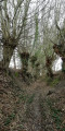
This route through valleys and bocage will allow you to explore the countryside around Boëssé le Sec. You’ll discover a beautiful avenue of pollarded trees.
The Beillé meadow
5.58 mi
+135 ft
-135 ft
2h 40
Easy
Departure from Beillé (Sarthe)
This walk follows the Huisne Valley and crosses the meadow where an American airfield was set up following the liberation of France in August 1944. A sign on site recounts the history of this temporary airfield.
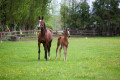
Stud farms and châteaux from Savigné-l'Évêque
 9.24 mi
+62 ft
-62 ft
4h 20
Moderate
Departure from Savigné-l'Évêque (Sarthe)
9.24 mi
+62 ft
-62 ft
4h 20
Moderate
Departure from Savigné-l'Évêque (Sarthe)
A region once densely populated along the ancient road from Le Mans to Évreux, and an important market town under the Ancien Régime, Savigné has long been favoured, due to its proximity to Le Mans, by the city’s notables, who have built or restored bourgeois houses and châteaux, sometimes on medieval seigneurial sites. Thus, as you follow the route, you will see Nuyet, dating from the late18th century, or, from the19th century, the châteaux of Le Rocher (now the town hall), Mortrie and Le Mesnil, where a major stud farm is located.
Around Duneau
2.42 mi
+138 ft
-138 ft
1h 15
Easy
Departure from Duneau (Sarthe)
The village of Duneau is located in a dominant position on the left bank of the Huisne, on a route that has been highly sought-after since prehistoric times. The Pierre Fiche menhir and the Pierre Couverte dolmen, dating from the Neolithic period (around 4000 BC), bear witness to this. These are the only visible archaeological remains among many others covering the periods of Antiquity and the Middle Ages.