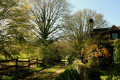
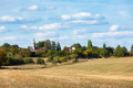
The Butte de Montrentin as seen from Torcé-en-Vallée

This walk, with little variation in elevation and no great difficulty, will allow you to explore the southern part of Torcé. The paths – sometimes tree-lined, sometimes sunny, and very often sandy – will take you to the foothills of the Butte de Montrentin.

Details

7585556
Creation:
Last update:
Last review:
  • Walking
    Activity: Walking
  • ↔
    Distance: 6.47 mi
  • ◔
    Average duration: 3h 00 
  • ▲
    Difficulty: Moderate

  • ⚐
    Back to start: Yes
  • ↗
    Ascent: + 66 ft
  • ↘
    Descent: - 69 ft

  • ▲
    Highest point: 338 ft
  • ▼
    Lowest point: 243 ft

Description of the walk

Park behind the town hall (car park and toilets).

(S/E) As you leave the car park, turn right and walk past the post office. Keep right, heading towards Saint-Célerin, for just under a hundred metres.

(1) Turn slightly right onto a track and follow it south-eastwards to a crossroads.

(2) At the top of the track, turn right and carry on straight ahead until you reach the departmental road (D25), which you follow for 600 metres.

(3) Turn left onto a dirt track which will take you to a road at a place called ‘le Carrefour’ and then on to a place called ‘le Petit Carrefour’.

(4) Turn right onto a section of local road for about 250 m, running alongside a stud farm.

(5) Turn right towards Bois Joli, Petit Noyer and Montrentin. You will now walk alongside the Montrentin hill for about 1 km, then cross the D25 near the recycling centre and reach the Fosse aux Saneux.

(6) At the two cast-iron crosses, turn right onto the long path, which is sunny in the afternoon, until you reach a local road.

(7) At the end of the path, take the local road on the right and cross the Ruisseau du Moulin au Moine. Continue to the hamlet of Préau.

(8) At the junction with the first tarmac road you come to, turn left and head towards Les Aulnays.

(9) Head slightly to the left, cross the Vive Parence and admire the mill. Follow the path running alongside the river. On a clear day, you’ll be able to see the pretty Château des Aulnays on your left. Turn right onto the pleasant, shaded path and continue to the roundabout.

(10) At the roundabout, take a moment to admire the dolmen, then turn right. Cross the Vive Parence once more. On your left, you’ll find a picnic table, and on your right, the wash house and the statue of the Virgin and Child overlooking a well. Walk past the shops and the remarkable church. With a bit of luck, it will be open and you’ll be able to admire the magnificent stained-glass windows depicting the Crucifixion. Just a few more metres straight on and you’ll be back at the starting point (S/E).

Waypoints

  1. S/E : mi 0 - alt. 292 ft - Town hall car park - Église Notre-Dame (Torcé-en-Vallée)
  2. 1 : mi 0.14 - alt. 295 ft - Fork in the path
  3. 2 : mi 0.55 - alt. 315 ft - Torcé Plateau
  4. 3 : mi 1.33 - alt. 266 ft - A picturesque path towards the hill
  5. 4 : mi 2.35 - alt. 318 ft - Le Petit Carrefour
  6. 5 : mi 2.48 - alt. 315 ft - Turn right at the fork
  7. 6 : mi 3.54 - alt. 279 ft - The Saneux Pit
  8. 7 : mi 4.24 - alt. 249 ft - Le Moulin au Moine stream
  9. 8 : mi 4.57 - alt. 259 ft - Crossroads at the hamlet of Préau
  10. 9 : mi 5 - alt. 243 ft - Les Aulnays. Crossing the - Parence (rivière)
  11. 10 : mi 6.21 - alt. 282 ft - Palet de Gargantua (Torcé-en-Vallée)
  12. S/E : mi 6.47 - alt. 292 ft - Town hall car park - Église Notre-Dame (Torcé-en-Vallée)

Worth a visit

If you feel like it, about 400 metres past point (7), a steep path on the left (with a climb of about 30 metres) will take you to the summit of the Butte de Montrentin. Legend has it that Gargantua, tired, sat down there and played at throwing pebbles across the countryside. One of them is said to have landed in Torcé-en-Vallée and become the dolmen.

Reviews and comments

4.8 / 5
Based on 2 reviews

Reliability of the description
5 / 5
Ease of following the route
5 / 5
Route interest
4.5 / 5
User 14994165

Overall rating : 5 / 5

Date of your route : May 18, 2026
Reliability of the description : ★★★★★ Very good
Ease of following the route : ★★★★★ Very good
Route interest : ★★★★★ Very good
Very busy route : No

A lovely walk. We really enjoyed it. Thank you

Machine-translated

PAT727272
PAT727272

Overall rating : 4.5 / 5

Date of your route : Jul 06, 2021
Reliability of the description : Not used / Not applicable
Ease of following the route : ★★★★★ Very good
Route interest : ★★★★☆ Good
Very busy route : No

A lovely walk to do with the family as it’s very flat (suitable even for children on bikes).
The route could be extended by 1.7 km by going via the Montrentin hill (take the Chemin de la Goualonnière then the Chemin de Montrentin), which would add a bit of elevation gain (130 m)!
A short section of the path (between ‘Le Carrefour’ and ‘Le Petit Carrefour’) is not maintained. There’s tall grass, so watch out for ticks depending on the season!
A shame! There’s no view of the castle at ‘Les Aulnays’, but there is a view of the old mill in the same hamlet.
On your way back, do take a look at the restored wash house in Torcé down in the valley.

Enjoy the walk, everyone!

Machine-translated

Other walks in the area

For more walks, use our search engine .

The GPS track and description are the property of this route's author. Please do not copy them without permission.