Terre de jeux 2024 in Wassy

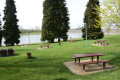
Setting off from the lovely site of Les Leschères, a walk along the old Wassy Canal, and back to Pont-Varin.

Details

n°32801207
Creation:
Last update:
Last review:
  • Walking
    Activity: Walking
  • ↔
    Distance: 6.57 mi
  • ◔
    Average duration: 3h 05 
  • ▲
    Difficulty: Easy

  • ⚐
    Back to start: Yes
  • ↗
    Ascent: + 79 ft
  • ↘
    Descent: - 79 ft

  • ▲
    Highest point: 610 ft
  • ▼
    Lowest point: 522 ft
  • ⚐ Country: France
  • ⚐ City: Wassy (52130)
  • ⚑
    Start/End: N 48.487552° / E 4.948718°
  • ❏
    IGN map(s): Ref. 3016SB
  • Hour-by-hour weather

Description of the walk

Seawall car park.

(S/E) From the sea wall car park, start the walk around the basin in a clockwise direction until you reach the top of the sea wall and join the road leading to the centre of Wassy

(1) Turn left to reach the canal.

(2) Take the footbridge by the social housing blocks to cross the canal and join Rue du Champ d’Heu, then follow it to the left. You’ll reach the three-way junction in Rue de la Gare.

(3) Cross the street and follow the towpath to Rue du Maréchal de Lattre de Tassigny. First turn left then right.

(4) Follow the narrow street that runs alongside the canal and turns into a path. You’ll reach the Route de Pont-Varin (D192).

(5) Turn right and, after 100 metres, turn left onto a stony track. Pass close to some industrial buildings and join the D261 at the entrance to Pont-Varin.

(6) Turn left onto this road, cross the canal and turn left again onto the path running alongside the canal. The return journey to Wassy follows the canal along a grassy path until you rejoin the Pont-Varin road, near the recycling centre.

(5) Cross the road and follow the outbound route in the opposite direction until you reach the Montier-en-Der road (D4).

(4) Cross the road and take the small road opposite known as ‘Chemin sur le Canal’.

(2) At the old railway station, carry on straight ahead to reach Les Leschères (S/E).

Waypoints

  1. S/E : mi 0 - alt. 600 ft - Car park at the sea wall at - Lac des Leschères
  2. 1 : mi 1.67 - alt. 604 ft - Dike Road. Lake Circuit junction
  3. 2 : mi 1.93 - alt. 548 ft - Footbridge. Old railway station. Common junction (outward and return routes)
  4. 3 : mi 2.22 - alt. 554 ft - Rue de la Gare
  5. 4 : mi 2.53 - alt. 561 ft - D4. Common junction (out and back)
  6. 5 : mi 2.87 - alt. 538 ft - D192. Common A/R junction. Bridge over the - Canal de Saint-Dizier à Wassy
  7. 6 : mi 4.05 - alt. 522 ft - D261. End of the circular loop
  8. S/E : mi 6.57 - alt. 600 ft - Car park at the sea wall at - Lac des Leschères

Worth a visit

This walk is scheduled for 24 June 2023 as part of the build-up to the 2024 Olympic Games, but it can be undertaken at any time. This explains its name, and it will retain this name.
This is version no. 2, which is shorter than the previous one and avoids an excessively long journey by road, as the group of walkers is expected to be large.

Reviews and comments

4.7 / 5
Based on 1 review

Reliability of the description
5 / 5
Ease of following the route
5 / 5
Route interest
4 / 5
courjus52
courjus52

Overall rating : 4.7 / 5

Date of your route : Apr 24, 2024
Reliability of the description : ★★★★★ Very good
Ease of following the route : ★★★★★ Very good
Route interest : ★★★★☆ Good
Very busy route : No

A lovely walk along the old canal in fine, cold weather. No particular difficulties. Thanks to the author.

Machine-translated

Other walks in the area

For more walks, use our search engine .

The GPS track and description are the property of this route's author. Please do not copy them without permission.