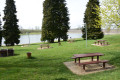
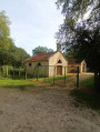
Lac des Leschéres and Belle Faysse Forest

Walk to Lac des Leschères, then through the Belle Faysse Forest. An easy route along a footpath that runs alongside the embankment, followed by a path through the forest. This walk is a shorter route between Lac des Leschères and the Montreuil-sur-Blaise Forest and is suitable for everyone.

Details

104692373
Creation:
Last update:
Last review:
  • Walking
    Activity: Walking
  • ↔
    Distance: 4.79 mi
  • ◔
    Average duration: 2h 15 
  • ▲
    Difficulty: Easy

  • ⚐
    Back to start: Yes
  • ↗
    Ascent: + 82 ft
  • ↘
    Descent: - 85 ft

  • ▲
    Highest point: 686 ft
  • ▼
    Lowest point: 587 ft
  • ⚐ Country: France
  • ⚐ City: Wassy (52130)
  • ⚑
    Start/End: N 48.490428° / E 4.949897°
  • ❏
    IGN map(s): Ref. 3016SB
  • Hour-by-hour weather

Description of the walk

Park in the Lac des Leschères car park.

(S/E) Leave the car park and continue towards the campsite.

(1) Continue along the path that descends to the right and follow it along the lake’s banks. You’ll come to a 90° bend to the right.

(2) Turn left to reach the plain, then continue to the right along the edge of the forest.

(3) Turn right and follow the path which enters the forest and leads onto another, wider, cross-path.

(4) Turn left and walk for about 700 m.

(5) Turn left onto a path at the edge of the village and follow it for about 1.3 km. Continue until you reach a junction at a place called Buisson le Loup.

(6) Turn left and follow the path to reach the plain. Once at the edge of the plain, head left and rejoin the outbound route.

(3) Carry on straight ahead and follow the path you took at the start in the opposite direction to return to the car park (S/E).

Waypoints

  1. S/E : mi 0 - alt. 604 ft - Car park - Lac des Leschères
  2. 1 : mi 0.27 - alt. 607 ft - Junction of the circular loop
  3. 2 : mi 0.77 - alt. 591 ft - Turn, common junction for out-and-back route
  4. 3 : mi 1.17 - alt. 607 ft - Junction of the circular loop
  5. 4 : mi 1.88 - alt. 659 ft - Junction, turn left
  6. 5 : mi 2.28 - alt. 673 ft - Junction, turn left.
  7. 6 : mi 3.11 - alt. 686 ft - Le Buisson le Loup, on the left
  8. S/E : mi 4.79 - alt. 600 ft - Car park - Lac des Leschères

Worth a visit

This walk is organised for (Blue March), a campaign to raise awareness of prostate cancer, which affects thousands of men. This route is suitable for all walkers and presents no particular difficulty.

Other walks in the area

For more walks, use our search engine .

The GPS track and description are the property of this route's author. Please do not copy them without permission.