Country:

 City:
City:


Park in the car park below the Col des Deux (on the left shortly after the pass when coming from Gresse-en-Vercors).
(S/E) From the car park, walk up the road to the pass, then, at the first houses, take the wide path on the right which climbs westwards up a ridge. This path leads up to a crossroads in a clearing; at this point, take the widest path on the left, heading briefly south-west before continuing along a narrower track that climbs the ridge, still heading westwards, towards the Vercors mountain range. On emerging from the forest, a few hairpin bends lead up to the right towards the north and the promontory marked at 1,645m on the IGN map.
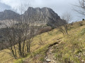
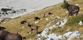
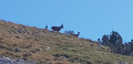
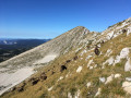
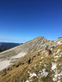
(1) From the promontory, follow the ridge line. The ibex habitat lies directly below this ridge, to the north (Côte Joubert). Then continue along the slope on the path, which now passes through scree. The Pas de Berrièves comes into view (see photo).
(2) At a fork in the path through the scree, leave the path on the right which continues horizontally northwards, and turn left to begin a switchback ascent through easy scree leading to the pass. You will pass a Lorraine cross just before reaching the Pas de Berrièves.
(3) From the Pas, leave the path that descends westwards towards the Jasse du Play, and turn right, heading due north, to follow the ridge of the eastern barrier of the Vercors. Follow this ridge as closely as possible, turning round from time to time to admire the view to the south. You’ll pass the summit of Rocheherbe on your way to the base of Malaval. A slightly slippery, earthy slope (where walking poles or even an ice axe may be useful) leads to the summit.
(4) From the summit cairn, descend northwards along the ridge to reach a small pass marked at 2,012 m on the IGN map.
(5) At the pass, take careful note of the terrain to the west (see visual landmarks in the practical information) as there is no longer any trace of a path and you will need to cross the forest below. Descend due west through the sharp limestone pavement, staying as close as possible to the tops of the west-facing ridges to maintain good visibility. Once you reach the mountain pine forest, visibility decreases and rocky outcrops force you to take a few detours (keep the sun in sight to help with navigation). You will inevitably come acrosstheoldGR®91(old red and white markings), but if you miss it, the actualGR®91is not far below.
(6) Once ontheoldGR®91, take it to the left, heading south-east then south. This will take you to the newGR®91, which is clearly marked in red and white. Follow this route to the Jasse du Play, situated in a meadow bordered by small rocks.
(7) From the Chalets du Play, continue along theGR® to a three-way junction on theGR®, about a hundred metres past the Play shelters.
(8) Turn left onto the least marked path, which climbs due east. This path is well marked with cairns and
the pass known as the Pas de Berrièves can be seen by its alignment towards the Vercors ridge. Follow this path, which winds in wide switchbacks, up to the Pas de Berrièves.
(3) Once at the Pas, leave the path and turn right to head south up the slopes leading to the Sommet de Séguret. Easy slopes lead to the ridge; simply head for its highest point.
(9) At the summit of the Rocher de Séguret, turn back and follow the ridge to the Pas de Berrièves.
(3) Turn right onto the scree and head down towards the east to the junction you passed on the way up through the scree.
(2) Turn north (left) here to join the East Balcony path.
(10) At the junction with the Vercors East Balcony path, turn back along this path, heading right towards the south. Pass above the Source de Berrièves and cross the Alpe de la Côte Joubert, where the ibex are taking a nap at this time of day. The path leads to the promontory.
(1) Follow the route back down the way you came to reach the car park (S/E).


 Visorando Member

 Moderate