Hauts Plateaux du Vercors via the Pas de Berrièves and the Pas de la Ville

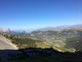
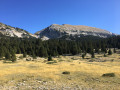
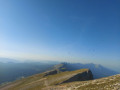
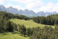
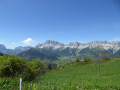
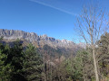
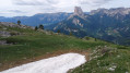
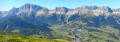
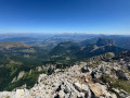
A magnificent circular route on the Vercors High Plateaus. Access via the little-used Pas de Berrièves. Panoramic views to one side over the Chartreuse, the distant Mont Blanc, Belledonne, the Écrins and the Dévoluy. On the other side, views over the vast, wild expanse of the Vercors High Plateaus. The route passes two rare sights: the (not very productive) springs at Le Playe and La Chau. Return via the Pas de la Ville, where you might spot some ibex. You can buy organic cheese at the farm so you don’t go home empty-handed.

Details

41428026
Creation:
Last update:
Last review:
  • Walking
    Activity: Walking
  • ↔
    Distance: 10.42 mi
  • ◔
    Average duration: 7h 55 
  • ▲
    Difficulty: Difficult

  • ⚐
    Back to start: Yes
  • ↗
    Ascent: + 3,606 ft
  • ↘
    Descent: - 3,596 ft

  • ▲
    Highest point: 6,299 ft
  • ▼
    Lowest point: 3,953 ft

Photos

Description of the walk

Park in the small car park at the Col des Deux, situated on the left 100 m past the pass. To get there from Grenoble, turn right at the hamlet of Fruitière, 1.5 km before Gresse.

(S/E) Climb up and cross the Col des Deux. Continue for 100 m until you reach the fork.

(1) Take the path on the right towards the Pas de Berrièves and you’ll come to a Fork in the road.

(2) Keep to the left, leaving the path on the right which leads to Côte Joubert. You’ll reach another fork.

(3) Head up to the right, skirting the meadows, then through the forest, then out into the open on the foothill ridge, until you reach a fork in the path.

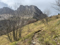
(4) Turn left onto the path which winds steeply upwards through the scree to reach the Pas de Berrièves.

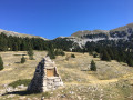
(5) The Jasse du Play hut is visible. Head up to the right along the path skirting the cliff edge to a large cairn to admire the view. Then descend, following the view, to the top of the small grassy valley and turn left to descend towards the Jasse. Join theGR®91again.

(6) Follow it to the right as far as the Jasse du Play.

(7) Retrace your steps.

(6) Follow the red and whiteGR® markings to the Fontaines du Playe.

(8) Top up your water supplies if necessary and if possible (low flow). Continue along theGR® to the Fontaine de la Chau.

(9) Continue along theGR® until you reach a fork in the path.

(10) Leave theGR® and turn left, heading up to the Pas de la Ville.

(11) Then take the path down towards Gresse.

(1) You’ll cross a cross-country path (elevation 1721). Continue downhill until you reach a road. Follow it to the left for about 350 m.

(13) Leave the road and turn left, heading due north, onto the small path towards La Ville until you reach a road.

(14) Walk up to the Pierre Blanche car park.

(15) Take the Montée des Dolomites on the left-hand side of the Fork in the road until you reach the Serre Monet junction.

(16) Turn left onto the track towards the Ferme du Grand Veymont, pass it and arrive at Les Grands Deux.

(17) Turn right to descend to the D242.

(18) Follow it to the left to return to the original junction.

(1) Carry on straight ahead, pass the Col des Deux and reach the car park (S/E).

Waypoints

  1. S/E : mi 0 - alt. 4,003 ft - Col des Deux car park - Col des Deux (1236m)
  2. 1 : mi 0.15 - alt. 4,016 ft - Crossroads of the circular loop
  3. 2 : mi 1.63 - alt. 5,394 ft - Fork in the road, on the left
  4. 3 : mi 1.81 - alt. 5,538 ft - Junction of paths
  5. 4 : mi 2.04 - alt. 5,715 ft - Below the Pas de Berrièves
  6. 5 : mi 2.42 - alt. 6,201 ft - Pas de Berrièves
  7. 6 : mi 3.37 - alt. 5,318 ft - Junction. Return to the jasse
  8. 7 : mi 3.5 - alt. 5,279 ft - Cabane Jasse du Play
  9. 8 : mi 4.08 - alt. 5,482 ft - Fontaine de Jasse du Play
  10. 9 : mi 5.53 - alt. 5,282 ft - Fontaine de la Chau
  11. 10 : mi 5.82 - alt. 5,322 ft - Crossroads of the trails
  12. 11 : mi 6.76 - alt. 6,299 ft - Pas de la ville
  13. 12 : mi 7.34 - alt. 5,650 ft - Crossroads
  14. 13 : mi 8.93 - alt. 4,062 ft - Start of the trail
  15. 14 : mi 9.1 - alt. 4,078 ft - Ascent of Pierre Blanche
  16. 15 : mi 9.37 - alt. 4,035 ft - Ascent of the Dolomites
  17. 16 : mi 9.7 - alt. 4,124 ft - Croix de Serre Monet
  18. 17 : mi 10.05 - alt. 3,960 ft - Les Grands Deux
  19. 18 : mi 10.11 - alt. 3,953 ft - D242
  20. S/E : mi 10.42 - alt. 4,003 ft - Col des Deux car park

Notes

Water points:
* A tap near the start by the roadside, 50 metres below the (1).
* Fontaine du Play (very low flow).
* La Chau fountain: don’t count on it.
Conclusion: it is best to set off with all the water you need.

Shelters:

  • the Jasse du Play is a clean, freely accessible hut designed for walkers. It contains a stove, a table and a guest book. Naturally, there is neither water nor electricity. There are no mattresses, but you can sleep on the floor upstairs.
  • The two huts at the Jasse de la Chau, near the (10), are, however, reserved for shepherds and their work.
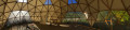
  • Just before the ski resort’s reservoir, there is a pretty, tarpaulin-covered wooden structure shaped like a hemisphere, with a picnic table inside.

Season: the ascent to the Pas de Berrièves takes place along a scree gully that never sees the sun. The last patches of snow melt late here. Signs indicate that the Pas de Berrièves is strongly discouraged in winter conditions.

Orientation: within the Hauts Plateaux Nature Reserve, to minimise human impact, the paths are poorly marked: few coloured markings, a few cairns, and very few signposts. They may seem difficult to follow for someone with little experience. Nevertheless, in clear weather, with a little experience, it is easy to find your way around the Hauts Plateaux: huts, the Grand Veymont and other passes and summits. It is a pleasure and a great feeling of freedom to be able to stray from the official paths. It is a completely different matter in fog, where a good sense of direction and a compass can prove a great help.

Pastoralism: in summer, the Hauts Plateaux are used as mountain pastures. Shepherds, their flocks and their dogs may be encountered on the path. The beauty of the landscape is down to their age-old way of life. Provided you follow the guidelines to be observed in such situations, everything usually goes very smoothly.

Difficulty: the ‘difficult’ rating is mainly due to the length and elevation gain of the route. There are no sections that are particularly exposed. The climb to the Pas de Berrièves through the scree gully beneath the cliffs is somewhat exposed (risk of falling rocks) and may be daunting for a novice. In good weather conditions, there should be no problems with navigation, although there are few coloured markings on the paths, particularly within the Reserve

This route passes through a protected area, which may be subject to special regulations:

Worth a visit

Ibex are quite common at the Pas de la Ville, and even more so on the Grand Veymont ridge.

From (13) to (16), the route passes through the pleasant ski resort of Gresse-en-Vercors, known as ‘la Ville’. On the ascent of the Dolomites, you’ll pass a grocery shop open all year round.

Excellent organic goat’s cheeses, amongst other things, are available to buy directly from the Ferme du Grand Veymont between (16) La Croix de Serre Monet and (17) Les Grands Deux. Services, opening hours, prices and further information can be found at lafermedugrandveymont.com/.

Always be cautious and plan ahead when you're outdoors. Visorando and the author of this route cannot be held responsible for any accidents occurring on this route.

The GR® and PR® markings are the intellectual property of the Fédération Française de Randonnée Pédestre.

Reviews and comments

4.2 / 5
Based on 4 reviews

Reliability of the description
4.3 / 5
Ease of following the route
3.8 / 5
Route interest
4.5 / 5
Marnhutte
Marnhutte

Overall rating : 4.7 / 5

Date of your route : Jun 27, 2026
Reliability of the description : ★★★★★ Very good
Ease of following the route : ★★★★★ Very good
Route interest : ★★★★☆ Good
Very busy route : No

The descent to Gresse via the Pas de la Ville is stony and seems very long towards the end of the route.

Machine-translated

Jopo
Jopo

I'm delighted that you enjoyed the course so much, and thank you for your encouragement

Machine-translated

LaurentDehors
LaurentDehors
• Edited:

Overall rating : 4.7 / 5

Date of your route : Sep 28, 2025
Reliability of the description : ★★★★★ Very good
Ease of following the route : ★★★★☆ Good
Route interest : ★★★★★ Very good
Very busy route : Yes

Great route!
I set off in the middle of the afternoon and arrived at Jasse du Play in two and a half hours, where I spent the night.
The start is steep, especially the switchbacks on scree to reach Pas de Berrièves.
But I was lucky enough to see some chamois up close as a reward when I got to the top.
The start of the descent from this point 5 is a bit tricky, and I strayed from the trail several times, but that was the only unclear moment.
At the beginning of autumn, the Play and Chau springs were both flowing.
The climb to Pas de la Ville is challenging but less so than the previous one, in my opinion.
The duration is consistent with my experience.
Thank you very much for this route, which allowed me to see beautiful panoramas, my first chamois and a small deer in the early morning

Machine-translated

jfperinel
jfperinel

Overall rating : 4.7 / 5

Date of your route : Dec 02, 2024
Reliability of the description : ★★★★★ Very good
Ease of following the route : ★★★★☆ Good
Route interest : ★★★★★ Very good
Very busy route : No

It can be difficult to spot certain changes in direction on the plateau and during the crossing of Gresse-en-Vercors: keep an eye on your GPS position!

Machine-translated

Jopo
Jopo

Hello Meco,

I’m truly sorry that you weren’t entirely satisfied with the guide.

- I’d like to clarify that, apart from a short section that can be avoided just after point 5, the entire route follows a marked trail, with white and red markings on the GR91, or yellow markings elsewhere.

- There are signposts indicating the direction to take at key points (1), (3), (4) (though this one is half-buried under scree), (10), (11), (12) and at other locations too

- I should also point out that in good weather, there are crossing points that are easily visible from a great distance: the scree couloir at Pas de Berrièves (5) (photo), visible from the car park; the Jasse du Play (7), visible from Pas de Berrièves; Pas de la Ville (11) (photo), visible from the Plaine de la Chau; and La Ville (14) (photo), visible from Pas de la Ville.

- It’s true that there are few coloured markings in the Réserve des Hauts Plateaux. Human impact has been deliberately minimised there to preserve its magnificent wilderness. The paths are sometimes marked by cairns. They may not be easy to follow for someone who isn’t used to them. You were right to use the IGN map instead of the Visorando app. Following your feedback – for which I thank you – I’m adding this point to the ‘Difficulty’ and ‘Navigation’ sections of the guide.

- As for the estimated time of 8 hours, provided you don’t get lost, this seems entirely reasonable for a 16 km circular route with 1,100 m of elevation gain.

Kind regards

Machine-translated

meco
meco

Overall rating : 2.7 / 5

Date of your route : Oct 29, 2023
Reliability of the description : ★★☆☆☆ Disappointing
Ease of following the route : ★★☆☆☆ Disappointing
Route interest : ★★★★☆ Good
Very busy route : No

The guidebook is very imprecise, vague and not detailed enough. The time estimates are inaccurate: given the lack of marked trails away from the GR 91, you end up feeling your way and looking for clues… there’s not enough information on distances.
It’s a lovely hike but one that requires some training. In the end, it was the IGN map that helped us find our way and get back on track, not the guidebook.

Machine-translated

Other walks in the area

For more walks, use our search engine .

The GPS track and description are the property of this route's author. Please do not copy them without permission.