


OT Mont des Avaloirs

 Tourist office
PRO  Premium user
Premium user Sign up:
Published route(s)
 Bellevue Trail starting from Crennes-sur-Fraubée
 5.92 mi
 +597 ft
 -587 ft
 3h 15
3h 15
 Easy
Easy
 Departure from Crennes-sur-Fraubée (Mayenne)
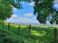
The village of Crennes-sur-Fraubée, situated on the southern slope of the Corniche de Pail, offers magnificent views of the surrounding countryside. This route, 88% of which is on dirt tracks, is one of the most beautiful walks in the Mont des Avaloirs area.
Circular route starting from the Mont des Avaloirs viewpoint
 4.54 mi
+479 ft
-479 ft
2h 30
Easy
Departure from Pré-en-Pail (Mayenne)
4.54 mi
+479 ft
-479 ft
2h 30
Easy
Departure from Pré-en-Pail (Mayenne)
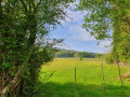
A hike starting from the iconic Mont des Avaloirs viewpoint, offering a beautiful route through the Multonne forest. Before or after the hike, be sure to climb the 108 steps of the building for an exceptional 360° view and, as you ascend, discover the brightly coloured street art by Seb Toussaint, a Franco-British graffiti artist.
Route of the Mont des Avaloirs Community of Communes.
The “Circular Tour of Herbages” from Saint-Aignan-de-Couptrain
7.39 mi
+243 ft
-243 ft
3h 35
 Moderate
Departure from Saint-Aignan-de-Couptrain (Mayenne)
Moderate
Departure from Saint-Aignan-de-Couptrain (Mayenne)
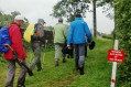
The village of Saint-Aignan-de-Couptrain is the starting point for two circular walks that will take you through unspoilt hedgerow countryside. Both routes follow dirt tracks for 90 per cent of the way. Here is one of these circular walks.
Circular Route of the Streams from Saint-Aignan-de-Couptrain
 6.85 mi
+285 ft
-292 ft
3h 25
Moderate
Departure from Saint-Aignan-de-Couptrain (Mayenne)
6.85 mi
+285 ft
-292 ft
3h 25
Moderate
Departure from Saint-Aignan-de-Couptrain (Mayenne)
The village of Saint-Aignan-de-Couptrain is the starting point for two circular walks that will take you through unspoilt hedgerow countryside. Both routes follow dirt tracks for 90 per cent of the way. Here is one of these circular walks. The second: The ‘Boucle des herbages’ circular walk from Saint-Aignan-de-Couptrain
The Notre-Dame de Bon-Secours Chapel Trail from Villepail
 8.89 mi
+584 ft
-584 ft
4h 35
Moderate
Departure from Villepail (Mayenne)
8.89 mi
+584 ft
-584 ft
4h 35
Moderate
Departure from Villepail (Mayenne)
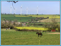
The Chapelle de Bon Secours trail consists of no less than 89 per cent dirt tracks. It follows the ancient Roman road that linked Gué Saint-Léonard to Mayenne. A short detour is recommended to the Tourbière des Égoutelles, a regional nature reserve. This two-hectare site, situated in a former Armorican sandstone quarry, is home to over a hundred rare plant species, including carnivorous plants such as sundews, round-leaved sundews and the Portuguese butterwort.
Averton circular route via Merdereau
5.79 mi
+587 ft
-600 ft
3h 10
Easy
Departure from Averton (Mayenne)
A very pretty trail in the Merdereau valley, through the forest and over the hills of Averton, with some panoramic views and good dirt tracks covering 73% of the route.
Discovery trail around the Mont des Avaloirs Reserve in Pré-en-Pail
 5.18 mi
+604 ft
-614 ft
2h 55
Moderate
Departure from Pré-en-Pail (Mayenne)
5.18 mi
+604 ft
-614 ft
2h 55
Moderate
Departure from Pré-en-Pail (Mayenne)
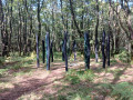
Immerse yourself in nature at the heart of the Mont des Avaloirs Regional Nature Reserve!
At 416 metres high, Mont des Avaloirs, the highest point in western France, takes you to the summit of the Armorican Massif. You are in the heart of the Normandy-Maine Regional Nature Park and Geopark. On the poor soil of Armorican sandstone, the dominant habitats are heathland and deciduous woodland. In this gentle, low-lying landscape, you’ll also find meadows, peat bogs and scree slopes. Current inventories list over 2,000 species, several of which are heritage species such as the European Nightjar and the Montagu’s Harrier.
Numerous routes set off from this particularly well-preserved natural environment, dotted with magnificent sites.
This trail offers a total immersion in nature, with themed stops to trace the thread of history, discover the wildlife and flora, and understand how the landscapes have evolved. Along the way, new views unfold!