Refine your search for walks in Sauto
Sauto walks


 Circular route around Sauto
 Visorando Member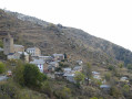
 4.69 mi
 +715 ft
 -712 ft
 2h 45
2h 45
 Easy
Easy
 Departure from Sauto (Pyrénées-Orientales)
This balcony route, with its many panoramic views, will allow you to discover the little-known village of Sauto and its surroundings.
Coll Mitjà as seen from Prats Balaguer
 9.52 mi
+3,560 ft
-3,530 ft
7h 30
9.52 mi
+3,560 ft
-3,530 ft
7h 30
 Difficult
Departure from Fontpédrouse (Pyrénées-Orientales)
Difficult
Departure from Fontpédrouse (Pyrénées-Orientales)
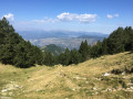
A lovely walk to the famous and distinctive Col Mitjà, visible from many points in Cerdagne and even from Capcir. A significant elevation gain (1,000 m) but no particular difficulty. The route partly follows the GR®10. There is also a forest track leading up to it, for those who prefer not to tackle too steep a climb, or for a mountain bike or horse ride. From Col Mitjà, the more adventurous can climb Pic Gallinàs (2,624 m) or Puig Rodon (2,677 m), which surround it.
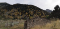
The Orri Valley by Planès
 10.49 mi
+2,976 ft
-2,963 ft
7h 25
Difficult
Departure from Fontpédrouse (Pyrénées-Orientales)
10.49 mi
+2,976 ft
-2,963 ft
7h 25
Difficult
Departure from Fontpédrouse (Pyrénées-Orientales)
This is a magnificent hike in the hills above Fontpédrouse (66) and more specifically in Prats-Balaguer (a hamlet of the latter) where you will find a haven of peace from start to finish. You will discover one of the most beautiful valleys in the Pyrénées-Orientales, namely the beautiful Vallée de l'Orri.
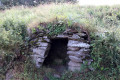
The trees of Haut Conflent
 4.72 mi
+1,066 ft
-1,056 ft
3h 05
4.72 mi
+1,066 ft
-1,056 ft
3h 05
 Moderate
Departure from Pyrénées-Orientales
Moderate
Departure from Pyrénées-Orientales
This is a pleasant, easy hike, mostly through the woods. The trail is dotted with signs identifying the tree species commonly found in Conflent.
Orri de Planès - Étang de Planès
6.49 mi
+2,306 ft
-2,306 ft
5h 00
Moderate
Departure from Pyrénées-Orientales
This circular hike is short but involves a significant elevation gain relative to the distance covered. It does not follow any roads and climbs gradually through the Planès Communal Forest, then out into the open along the edge of the Cambre d’Aze to the small Étang de Planès and its small shelter for hikers
Ovansa Tower
0.86 mi
+164 ft
-167 ft
0h 30
Easy
Departure from Mont-Louis (Pyrénées-Orientales)
A pleasant walk to discover the Ovansa Tower, an iconic site where the location of the Mont-Louis citadel – now a UNESCO World Heritage Site – was decided.
The walk starts at the Mont-Louis Tourist Information Office.
La Llagonne State Forest
5.68 mi
+561 ft
-535 ft
3h 05
Easy
Departure from La Llagonne (Pyrénées-Orientales)
A beautiful, bucolic walk in the Haut Conflent region of the Pyrénées Orientales that will delight young and old alike.
The Mackintosh Trail from La Llagonne to Fetges
6.05 mi
+863 ft
-863 ft
3h 30
Moderate
Departure from La Llagonne (Pyrénées-Orientales)
Accessible to all, this trail offers the chance to discover several murals installed along the way, inspired by the landscapes that Charles Rennie Mackintosh immortalised during his time in the Pyrénées-Orientales. The route crosses the Mont-Louis area and offers a walk combining nature, art and heritage.
La Llagonne – Lac d’en Calvet – Pla de Barrès – Mont-Louis
10.22 mi
+778 ft
-787 ft
5h 25
Moderate
Departure from La Llagonne (Pyrénées-Orientales)
This pleasant walk through woodland, along the banks of the River Têt and through the fortifications is a synthesis of the walks in the Catalan Pyrenees that follow thePR®®10,PR®®19andPR®®20routes. This route starts from the village of La Llagonne but could just as easily begin at the Citadel of Mont-Louis or Lac d’en Calvet.
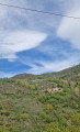
From La Cabanasse to Planès
 5.23 mi
+1,142 ft
-1,148 ft
3h 25
Moderate
Departure from La Cabanasse (Pyrénées-Orientales)
5.23 mi
+1,142 ft
-1,148 ft
3h 25
Moderate
Departure from La Cabanasse (Pyrénées-Orientales)
A beautiful getaway around two villages in Haut Conflent with a good chance of seeing the Yellow Train (Industrial Heritage of the Pyrénées Orientales) and the option of taking it from La Cabanasse or Planès.
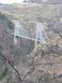
The Balcons de la Têt and the Yellow Train
 6.59 mi
+873 ft
-2,398 ft
3h 45
Moderate
Departure from La Cabanasse (Pyrénées-Orientales)
6.59 mi
+873 ft
-2,398 ft
3h 45
Moderate
Departure from La Cabanasse (Pyrénées-Orientales)
A climb on the Train Jaune from Fontpédrouse to La Cabanasse, followed by a beautiful, tree-lined descent along the River Têt.A lovely walk, partly through the forest; this is a different route from La Cabanasse to Planès suggested by PO Express, with the chance to find a few porcini mushrooms depending on the season, and to pass under the Gisclard Bridge, a true engineering marvel for its time.
Pla de Barrès
 4.66 mi
+128 ft
-128 ft
2h 15
Moderate
Departure from Bolquère (Pyrénées-Orientales)
4.66 mi
+128 ft
-128 ft
2h 15
Moderate
Departure from Bolquère (Pyrénées-Orientales)
This hike to Pla de Barrès, known as Little Canada, is a lovely circular loop along the La Têt river in the municipality of Bolquère.
Circular forest loop between the Col de Quillane and La Llagonne
10.18 mi
+886 ft
-886 ft
5h 25
Moderate
Departure from La Llagonne (Pyrénées-Orientales)
This hike, mostly through forest, will introduce you to a wild, mountainous landscape. You will enjoy this shaded hike in summer and winter on snowshoes, following part of the Voie Blanche (groomed and free).
The elevation gain is low and the trails are wide enough to enjoy the scenery in complete tranquillity.
You can take shortcuts to give your legs a rest at point (3) or point (10).
Le Cambre d'Aze
5.65 mi
+3,212 ft
-3,202 ft
5h 25
Difficult
Departure from Eyne (Pyrénées-Orientales)
A challenging climb leading to one of the most beautiful panoramas in the Cerdagne region of the Eastern Pyrenees.Please note: the hike is not signposted but the path is well marked (you should still have a basic sense of direction).