Country:

 City:
City:


Access to Prats-Balaguer via the D28 road from Fontpédrouse:please note that the road is narrow and closed to vehicles over 7.5 m in length. Cars can park in the car park in the village centre or on the road, but parking for motorhomes and vans is very limited; it is impossible in Prats-Balaguer itself, where the height restriction is 2.10 m.
Yellow PR® signposting
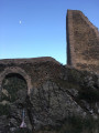
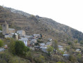
(S/E) From the car park, head due south towards the ruined castle, which can be seen above. Pass the fountain and the public library area, which is situated under a sort of covered courtyard. Continue along a sunken path, then emerge onto a track near el Castell.
(1) Take this track, which is suitable for vehicles, as it climbs to the right for about 300 m, until you reach a fork.
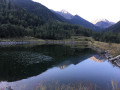
(2) Leave the track and follow the path which climbs steeply to the left.This is a very old cobbled path which once led to the Col des Neufs Fontaines (Coll de les Nou Fonts), a pass towards Spain (well worth a visit). It is in very good condition and runs alongside the stream bed. Follow it until you reach the reservoir.
(3) Walk alongside the reservoir, come out onto a track closed to vehicles at a bend, and follow it straight ahead until you reach the junction with the GR®10 and GR®36.
Red and white markings: GR®10 – GR®36
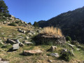
(4) Follow them to the left as you climb: from this point, the walk follows the GR® routes to Coll Mitjà. Continue to the enclosure and enter the pastoral area,which is permitted provided you take the usual precautions. Pass in front of a shepherd’s hut (Cabane d’Aixeques).
(5) Cross the enclosure and head up the slope. Then veer left and climb very steeply along a rugged path to the summit of the ridge, which you’ll reach at an unnamed pass on the edge of a forest.
(6) Continue climbing, now less steeply, through the forest, pass the Fontaine des Collets and arrive at a bend in a track.
(7) Carry on straight ahead along the track, which remains level, then continue to the right, climbing until you reach a flat stretch. Leave the track here and look for an orri (dry-stone hut).
(8) Head south-east up through a high-altitude meadow, staying on the GR® route and cutting across all the bends in the track to reach Coll Mitjà.
(9) Take in the view of the Carançà Valley (the track descends into it), then turn back to the bend in the track at the Fontaine des Collets.
(7) Leave the route you’ve already taken and head down the track on the right. This offers a bird’s-eye view of the reservoir. You’ll reach the junction at Cabane d’Aixeques, which you passed on the way there.
(5) Turn right to head straight towards the reservoir.
(3) Return along the same route you took on the way out to Castell.
(1) Follow the track until you reach a reverse three-way junction.
(10) Turn left onto a track that leads straight back to the car park (S/E).


 Visorando Member

 Easy
Easy 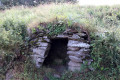
 Moderate