Ovansa Tower

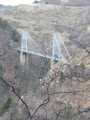
A pleasant walk to discover the Ovansa Tower, an iconic site where the location of the Mont-Louis citadel – now a UNESCO World Heritage Site – was decided.

The walk starts at the Mont-Louis Tourist Information Office.

Details

101679629
Creation:
Last update:
Last review:
  • Walking
    Activity: Walking
  • ↔
    Distance: 0.86 mi
  • ◔
    Average duration: 0h 30 
  • ▲
    Difficulty: Easy

  • ⚐
    Back to start: Yes
  • ↗
    Ascent: + 164 ft
  • ↘
    Descent: - 167 ft

  • ▲
    Highest point: 5,157 ft
  • ▼
    Lowest point: 4,990 ft

Description of the walk

(S) From the Mont-Louis Tourist Information Point, leave the village via the arched passageway and the Porte de France, and head for the RD66.

(1) Cross the road carefully and continue straight ahead, walking alongside the cemetery. Continue left along Rue Frank Haviland until you reach the end of the road, where there is a junction.

(2) Take the path leading down to the right. Further on, pass two murals on the Mackintosh Trail. Continue along the path to reach the Ovansa Tower.

(3) Return via the same route (S/E).

Waypoints

  1. S/E : mi 0 - alt. 5,157 ft - Mont-Louis Tourist Information Office - Citadelle de Mont-Louis
  2. 1 : mi 0.13 - alt. 5,121 ft - RD 66
  3. 2 : mi 0.32 - alt. 5,072 ft - Mackintosh Trail junction
  4. 3 : mi 0.43 - alt. 4,990 ft - Ovansa Tower
  5. S/E : mi 0.87 - alt. 5,154 ft - Mont-Louis Tourist Information Office - Citadelle de Mont-Louis

Other walks in the area

For more walks, use our search engine .

The GPS track and description are the property of this route's author. Please do not copy them without permission.