


Refine your search for walks in Saint-Point
Saint-Point walks


 Saint-Point, Col des Enceints via Corcelle Castle
 Visorando Member
 11.80 mi
 +1,988 ft
 -1,969 ft
 7h 10
7h 10
 Moderate
 Departure from Saint-Point (Saône-et-Loire)
A circular walk offering numerous beautiful views over the Charolais valleys and wooded countryside in the spirit of Alphonse de Lamartine, notably the Grosne valley, and, before the Col des Enceints, views of Berzé-la-Ville.
A short tour of the village of Sologny
1.11 mi
+164 ft
-164 ft
0h 40
 Easy
Departure from Sologny (Saône-et-Loire)
Easy
Departure from Sologny (Saône-et-Loire)
A short circular walk through the vineyards near the village of Sologny.
The summit of Signal de la Mère Boitier from Serrières
 10.18 mi
+1,988 ft
-1,991 ft
6h 25
Moderate
Departure from Serrières (Saône-et-Loire) (Saône-et-Loire)
10.18 mi
+1,988 ft
-1,991 ft
6h 25
Moderate
Departure from Serrières (Saône-et-Loire) (Saône-et-Loire)
Hike from Serrières to the summit of Signal de la Mère Boitier
This hike largely follows the yellow-marked Mâcon Tourisme route (14 km | 4 hours 40 minutes on foot), which can be downloaded here, and another part of the Crêtes route, marked in blue from Mère Boitier to the hamlet of Les Guérins.
Panoramic views of the rocky outcrops and châteaux of the Mâconnais vineyards
6.25 mi
+348 ft
-1,404 ft
3h 10
Moderate
Departure from Solutré-Pouilly (Saône-et-Loire)
This stage begins opposite the Roches de Solutré and Vergisson, classified as a Grand Site de France, with a panoramic view of the Jura mountain ranges and Mont Blanc. You pass through two natural areas of ecological, faunistic and floristic interest (ZNIEFF) and renowned vineyards (Pouilly-Fuissé, Pouilly-Vinzelles), overlooking the châteaux of Chasselas and Vinzelles.
In uncle’s footsteps
 4.37 mi
+945 ft
-938 ft
2h 50
Moderate
Departure from Solutré-Pouilly (Saône-et-Loire)
4.37 mi
+945 ft
-938 ft
2h 50
Moderate
Departure from Solutré-Pouilly (Saône-et-Loire)
A delightful stroll through boxwood and vineyards, with the added bonus of a splendid panoramic view from the top of the famous Roche de Solutré.The return journey, via the north, takes you off the official route and away from the tourist traffic.
Mont de Pouilly, and the Hills of Solutré and Vergisson
 11.07 mi
+2,188 ft
-2,188 ft
7h 00
Moderate
Departure from Solutré-Pouilly (Saône-et-Loire)
11.07 mi
+2,188 ft
-2,188 ft
7h 00
Moderate
Departure from Solutré-Pouilly (Saône-et-Loire)
Wonderful hike in Burgundy to discover "Solutré" (a landmark) and the "Rock of Vergisson”.
Circular route from Saint-Pierre-le-Vieux via Saint-Christophe-la-Montagne
9.93 mi
+1,316 ft
-1,286 ft
5h 45
Moderate
Departure from Saint-Pierre-le-Vieux (Saône-et-Loire) (Saône-et-Loire)
A pleasant walk with a varied route, though best avoided in hot weather, offering beautiful rural scenery on both sides of the two valleys. This route first follows ascending ridges, then crosses the small hamlet of Nuzillet before joining a descending ridge passing through Saint-Christophe-la-Montagne. In total, 6 km of ascent and 9 km of descent await you.
Walk through the valleys of the Mâconnais
6.48 mi
+1,076 ft
-1,073 ft
3h 55
Moderate
Departure from Saint-Pierre-le-Vieux (Saône-et-Loire) (Saône-et-Loire)
This walk will take you along the border between the Beaujolais, Mâconnais and Charollais regions. Passing through this charming village in Saône-et-Loire with a population of 300, this outing offers a real breath of fresh air just a stone’s throw from the city.
At the Roches de Solutré and Vergisson
 6.55 mi
+1,499 ft
-1,529 ft
4h 20
Moderate
Departure from Solutré-Pouilly (Saône-et-Loire)
6.55 mi
+1,499 ft
-1,529 ft
4h 20
Moderate
Departure from Solutré-Pouilly (Saône-et-Loire)
A shorter version of the long circular route starting from La Grange du Bois (featured on this site), done with children aged 7 to 12 who thoroughly enjoyed it!
Solutré - Vergisson - Mont de Pouilly via the Grange du Bois
 12.91 mi
+2,438 ft
-2,444 ft
8h 05
12.91 mi
+2,438 ft
-2,444 ft
8h 05
 Difficult
Departure from Solutré-Pouilly (Saône-et-Loire)
Difficult
Departure from Solutré-Pouilly (Saône-et-Loire)
At the foot of the Roches de Solutré and Vergisson, you can admire the spectacular geology of these two rocky outcrops and their peaks. You will enjoy superb panoramic views of the Beaujolais, the Saône Valley and the Val Lamartine.This long route takes you along theGR®®76 trailthrough the cool forest of the Bois des Bruyères.On the way back, you can admire Chasselas, Mâcon, the Saône Valley and even the Alps from the Grange du Bois and the summit of Mont de Pouilly.
Ascent of the Roche de Solutré
 Tourist office
 2.02 mi
+476 ft
-476 ft
1h 20
Easy
Departure from Solutré-Pouilly (Saône-et-Loire)
2.02 mi
+476 ft
-476 ft
1h 20
Easy
Departure from Solutré-Pouilly (Saône-et-Loire)
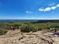
A family hike offering magnificent views of the Mâconnais vineyards and, if the sky is clear, much further afield towards the Mont Blanc Massif.
The Montmain Cross
 4.15 mi
+666 ft
-692 ft
2h 30
Easy
Departure from Verzé (Saône-et-Loire)
4.15 mi
+666 ft
-692 ft
2h 30
Easy
Departure from Verzé (Saône-et-Loire)
Marked route in the hills above Verzé, between Mâcon and Cluny.
Starting from the Rampon quarry, you will cross the woods of Verzé and then climb up to the Croix Montmain. You will follow the Chemin des Chevaliers (GR®) with a magnificent view of the Val Lamartinien and the castle of Berzé-le-Chatel. On the way back, you will cross the hamlet of Les Tardys. The circular route ends with a picturesque path offering views of the pastures.
Roche Coche, La Belouse, Escolles, Vanzé from Verzé
9.40 mi
+1,457 ft
-1,450 ft
5h 35
Moderate
Departure from Verzé (Saône-et-Loire)
From Verzé, in the Haut Mâconnais, this circular route winds its way through vineyards and woods. First, we climb towards Échanault to reach Roche Coche via Champ de la Boivine. The Roche Coche orientation table offers a beautiful view of the Val Lamartine, the Roche de Solutré and, in the distance, the Hauts du Beaujolais. Next, head back up towards Les Bruyères, then descend to Chanaud and turn north-east towards Escolles and Vanzé to return to Verzé.
Circular in the upper Mâconnais region starting from Chasselas
 9.29 mi
+1,785 ft
-1,775 ft
5h 50
Moderate
Departure from Chasselas (Saône-et-Loire)
9.29 mi
+1,785 ft
-1,775 ft
5h 50
Moderate
Departure from Chasselas (Saône-et-Loire)
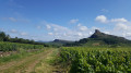
A magnificent hike starting from Chasselas. You can enjoy the magnificent view of the two rocks, Solutré and Vergisson, from Mont de Pouilly, as well as the beautiful paths of the Grange du Bois. You will discover the wine-growing landscape as well as the fields and forests of the region with the Grange du Bois. A challenging hike that will delight lovers of the great outdoors.
Circular Cluny route via the Carmel de la Paix
9.86 mi
+1,329 ft
-1,329 ft
5h 40
Moderate
Departure from Cluny (Saône-et-Loire)
This walk will take you in the footsteps of the Cluniac monks, through deaneries and the ‘sacred ban’, across wide plateaus and past breathtaking viewpoints that invite contemplation. It requires a bit of effort, certainly, but with plenty of rewards in store.
The Green Beaujolais
 11.56 mi
+1,985 ft
-1,985 ft
7h 05
Moderate
Departure from Jullié (Rhône)
11.56 mi
+1,985 ft
-1,985 ft
7h 05
Moderate
Departure from Jullié (Rhône)
This hike allows you to discover the upper Beaujolais region. The route is varied, passing through vineyards around the village and woods. It leads to the Rontécolon orientation table, the highest point of the route, and passes through the Col de la Sibérie, where there is a memorial to the martyrs of the Resistance.
Butte de Suin, starting from Buffières
11.21 mi
+1,457 ft
-1,457 ft
6h 25
Moderate
Departure from Buffières (Saône-et-Loire)
Setting off from Buffières, we head for Suin and its famous “butte” via theGR®76Cand then theGR®7. The Butte de Suin rises to around 600 m. From the orientation table, there is a 360° view. You can see the Charolais region to the west, Mont Saint-Vincent and Montceau-les-Mines to the north-west, the Chalon region to the north-east, the Cluny region to the east, and Mont Saint-Cyr and the foothills of the Beaujolais to the south. The return journey is via Sivignon.
More walks in Saint-Point
Select a point of interest below: