


Refine your search for walks in Roumengoux
Roumengoux walks


 The Roumengoux Fountains Route
 Visorando Member
 5.10 mi
 +427 ft
 -466 ft
 2h 45
2h 45
 Easy
Easy
 Departure from Roumengoux (Ariège)
A very easy walk suitable for everyone, where you’ll stroll past restored fountains, also following the old railway line converted into a greenway.
Panoramic and historical loop in the Moulin-Neuf region
 11.19 mi
+1,240 ft
-1,224 ft
6h 15
11.19 mi
+1,240 ft
-1,224 ft
6h 15
 Moderate
Departure from Moulin-Neuf (Ariège)
Moderate
Departure from Moulin-Neuf (Ariège)
An exceptional panoramic view from the ridge, picturesque villages (Cazal des Faures, Tréziers, Roumengoux) and historic villages (Lagarde), a gigantic feudal castle, a short greenway and the sparkling clear waters of the River Hers. This loop is magnificent from Moulin-Neuf: enjoy!Remember to follow your GPS: this is a new route and the first part is not signposted!
Around Cazals-des-Bayles
 11.23 mi
+1,050 ft
-1,043 ft
6h 05
Moderate
Departure from Moulin-Neuf (Ariège)
11.23 mi
+1,050 ft
-1,043 ft
6h 05
Moderate
Departure from Moulin-Neuf (Ariège)
A short family walk without too much elevation gain. However, the route goes up and down constantly. The trail is mostly unmarked, so a map and description are necessary.It is possible to shorten the walk by starting from Cazals des Bayles (church).moderator's note: See reviews, many trails are difficult to navigate, route changes made in 2024.
Pays de Mirepoix - Lagarde-Camon-Leran
 14.82 mi
+630 ft
-604 ft
7h 20
14.82 mi
+630 ft
-604 ft
7h 20
 Difficult
Departure from Saint-Quentin-la-Tour (Ariège)
Difficult
Departure from Saint-Quentin-la-Tour (Ariège)
A winter circular hike. Very beautiful places, where five exceptional architectural elements are gathered: the Château de Saint Quentin la Tour, the Château de Lagarde, the fortified village of Camon, the Château de Leran and the Château de Queille on its rocky outcrop.
Please note: the bridge over the River Hers between waypoints 3 and 4 is undergoing repairs and will be closed until the end of 2017.
La Croix de Terride and Marty from Mirepoix
 5.03 mi
+417 ft
-430 ft
2h 40
Easy
Departure from Mirepoix (Ariège)
5.03 mi
+417 ft
-430 ft
2h 40
Easy
Departure from Mirepoix (Ariège)
This family hike will allow you to discover the different landscapes of Mirepoix from two viewpoints: the Croix de Terride with a partial view of Mirepoix but with an orientation table, and before Montbruguet, with a full view. The trail is varied, sometimes open, sometimes in the woods, but always pleasant.
Circular route around Camon
 2.89 mi
+26 ft
-26 ft
1h 20
Easy
Departure from Camon (Ariège)
2.89 mi
+26 ft
-26 ft
1h 20
Easy
Departure from Camon (Ariège)
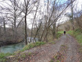
A lovely family walk that is circular and passes through the village of Camon and its surroundings. Camon is a member of the association ‘Les plus beaux villages de France’ (France’s Most Beautiful Villages) and is also known as ‘The Village of a Hundred Rose Bushes’.
Camon circular route orientation board
 2.54 mi
+325 ft
-295 ft
1h 25
Easy
Departure from Camon (Ariège)
2.54 mi
+325 ft
-295 ft
1h 25
Easy
Departure from Camon (Ariège)
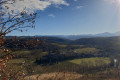
The famous village of roses! This short walk invites you to discover not only the town itself but also the beautiful setting in which it is nestled, thanks to its superb orientation board. Whilst the climb is a challenge (nearly 100 m in elevation), the view is extraordinary! We promise: it’s impossible to get lost… unless you lose yourself in your thoughts and reflections!
Escueillens - Etang de la Pène, Bellegarde-du-Razès
 Association / Club / Walk leader4.81 mi
+266 ft
-282 ft
2h 25
Easy
Departure from Escueillens-et-Saint-Just-de-Bélengard (Aude)
Association / Club / Walk leader4.81 mi
+266 ft
-282 ft
2h 25
Easy
Departure from Escueillens-et-Saint-Just-de-Bélengard (Aude)
Route proposed during Rando Razès 2025 (short loop). Easy, family-friendly circuit completed with Joëlette wheelchairs during the event. The only "difficulty" is the section along the road at points (8) and (9).
Hounoux ridge trail
 Tourist office
 5.02 mi
+545 ft
-551 ft
2h 45
Easy
Departure from Hounoux (Aude)
5.02 mi
+545 ft
-551 ft
2h 45
Easy
Departure from Hounoux (Aude)
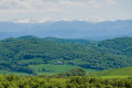
On the ridge line that marks the watershed between the Atlantic and the Mediterranean, there is a fascinating interpretive trail on the geology and formation of these rolling landscapes of Razès, Lauragais and the foothills of the Pyrenees.
Yellow + yellow and red markings for the section on theGR®®78
The countryside of today and yesterday
 7.64 mi
+866 ft
-889 ft
4h 15
Moderate
Departure from Plavilla (Aude)
7.64 mi
+866 ft
-889 ft
4h 15
Moderate
Departure from Plavilla (Aude)
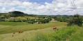
Today’s rural world is very different from that of centuries past. Whilst agriculture remains the driving force and an indelible feature of the Piège hills, the people and practices have changed. Following in the footsteps of Bertrand, the grocer from Mirepoix, this interpretive trail offers a dialogue between rural life today and in the past. You’ll learn more about the ‘traditional’ trades that once kept the heart of the countryside beating and the agriculture that still shapes the landscape.
Follow the blue markings
Cartiès (Dun) circular - St-Julien - Troye - Limbrassac
 7.51 mi
+623 ft
-614 ft
4h 00
Moderate
Departure from Dun (Ariège)
7.51 mi
+623 ft
-614 ft
4h 00
Moderate
Departure from Dun (Ariège)
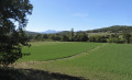
A nature route! A path through valleys and ridges with magnificent views of the Monts d'Olmes. Originally route no. 14 in the Pays de Mirepoix, the signposting is now quite old.
Chalabre: Greenway and Montbel Lake
 9.97 mi
+640 ft
-653 ft
5h 10
Moderate
Departure from Chalabre (Aude)
9.97 mi
+640 ft
-653 ft
5h 10
Moderate
Departure from Chalabre (Aude)
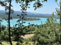
This moderately difficult route starts at the old Chalabre railway station on the line that used to connect Mirepoix to Lavelanet, now a greenway. It follows the Hers river, which feeds the Lac de Montbel, crossing two dams before returning to the old Chalabre station after passing through some woodland. It offers views of the Pyrenees and the Lac de Montbel.
The Aude foothills in the vicinity of Chalabre
 10.39 mi
+1,145 ft
-1,122 ft
5h 45
Moderate
Departure from Chalabre (Aude)
10.39 mi
+1,145 ft
-1,122 ft
5h 45
Moderate
Departure from Chalabre (Aude)
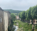
This day hike offers a variety of landscapes. First, enjoy the tranquillity of an old railway line converted into a greenway along the Hers river and the orchards of Sonnac-sur-l'Hers. Next, take in the foothill landscapes with multiple views of the Pyrenees and Monts d'Olmes mountain ranges. Finally, return to the plain, passing through the typical rural villages of Montjardin and Chalabre.
Tour of Lake Montbel
 9.56 mi
+98 ft
-98 ft
4h 30
Moderate
Departure from Montbel (Ariège)
9.56 mi
+98 ft
-98 ft
4h 30
Moderate
Departure from Montbel (Ariège)
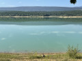
A pleasant walk around Lake Montbel. You will pass several dams with beautiful views.
Enjoy the activities around the lake: swimming, water sports, fishing.
A lovely shaded walk in the coolness of the lake during the summer months.
In the footsteps of the hermit of Calvaire in Chalabre
 6.15 mi
+751 ft
-732 ft
3h 30
Moderate
Departure from Chalabre (Aude)
6.15 mi
+751 ft
-732 ft
3h 30
Moderate
Departure from Chalabre (Aude)
Route on the Greenway and at Calvaire.
Route du Pech de Mu
 3.19 mi
+361 ft
-367 ft
1h 45
Easy
Departure from Fenouillet-du-Razès (Aude)
3.19 mi
+361 ft
-367 ft
1h 45
Easy
Departure from Fenouillet-du-Razès (Aude)
On the Chemin du Piémont, the most Pyrenean route to Santiago de Compostela, between Fanjeaux and Mirepoix, here is a fairly easy circular walk to enjoy the countryside of the Razès, amongst vineyards, fields and woods, starting from a typical hilltop village built in a circular layout.Yellow markings (particularly when walking in the opposite direction).