Circular route around Léran

A lovely family walk that is circular and takes you round the village and its surroundings.

Details

n°4373000
Creation:
Last update:
Last review:
  • Walking
    Activity: Walking
  • ↔
    Distance: 3.54 mi
  • ◔
    Average duration: 1h 45 
  • ▲
    Difficulty: Easy

  • ⚐
    Back to start: Yes
  • ↗
    Ascent: + 112 ft
  • ↘
    Descent: - 108 ft

  • ▲
    Highest point: 1,378 ft
  • ▼
    Lowest point: 1,266 ft

Photos

Description of the walk

Park in the car park in front of the town hall, on Rue du Temple / Place des Tilleuls.

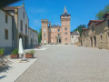
(S/E) Head north towards the River Touyre, walk past the restaurant Le Rendez-Vous on your left and carry on straight ahead. Cross the bridge over the River Touyre and walk past the beautiful Château de Léran on your left.

(1) Turn left after the château’s gardens, carry on along this road and turn left at the T-junction. Cross the bridge over the Touyre.

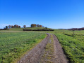
(2) After the bend, leave the tarmac road on the right and take a track which makes a first turn right then left after 30 metres. Follow the track straight on until you reach the tarmac road (D928) and turn right for about 150 metres to reach a Y-junction.

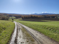
(3) Turn left towards La Bigorre, then turn left at a right angle onto the track. Continue to the right for about 150 metres until you reach a fork in the track.

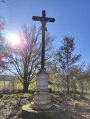
(4) Take this track to the left. After the Croix du Rouyre, follow the road straight on until you reach Léran via Avenue de Mathil.

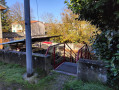
(5) Thirty metres past the Créamundo restaurant, take the steps on the right to reach the car park in front of the town hall (S/E).

Waypoints

  1. S/E : mi 0 - alt. 1,273 ft - Car park in front of the town hall
  2. 1 : mi 0.32 - alt. 1,266 ft - Turn left
  3. 2 : mi 1.77 - alt. 1,319 ft - The tarmac road ends after the - Touyre (rivière)
  4. 3 : mi 2.37 - alt. 1,312 ft - Y-junction, turn left
  5. 4 : mi 2.95 - alt. 1,319 ft - Crossroads, turn left
  6. 5 : mi 3.5 - alt. 1,276 ft - Stairs on the right
  7. S/E : mi 3.54 - alt. 1,273 ft - Car park in front of the town hall

Notes

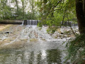
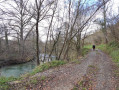
(2) Halfway along the circular route, you’ll find a rest area with a picnic table on the banks of the Touyre.

Worth a visit

Places of interest: Léran Castle (exterior), the River Touyre, the Croix du Rouyre.

Reviews and comments

4 / 5
Based on 2 reviews

Reliability of the description
4 / 5
Ease of following the route
4.5 / 5
Route interest
3.5 / 5
quayrat
quayrat

Overall rating : 4 / 5

Date of your route : Oct 16, 2024
Reliability of the description : ★★★★☆ Good
Ease of following the route : ★★★★☆ Good
Route interest : ★★★★☆ Good
Very busy route : No

Suggested alternative route: do not walk past the castle (though you can pop in for a quick look), but after the bridge, turn left onto the path along the banks of the Touyre marked ‘Chemin du Vigner’. After 600 metres, the path leaves the riverbank and climbs to the right up the hill between a field and a low wall. 1 km from the bridge, you’ll join the road that runs north of the castle. Turn left; it is another 1.1 km to the T-junction. (On Geoportail, the route is marked with pink dotted lines)

Machine-translated

MaryS
MaryS

Overall rating : 4 / 5

Date of your route : Sep 11, 2023
Reliability of the description : ★★★★☆ Good
Ease of following the route : ★★★★★ Very good
Route interest : ★★★☆☆ Average
Very busy route : No

It’s a lovely little walk in the countryside, but I did miss my bike a bit. Most of the route is on a tarmac road, which was a bit of a let-down. The section that follows a dirt track and crosses the fields would be perfectly doable on a hybrid bike… but I’m not complaining too much. I had a lovely time all the same!

Machine-translated

Other walks in the area

For more walks, use our search engine .

The GPS track and description are the property of this route's author. Please do not copy them without permission.