


Refine your search for walks in Roqueredonde
Roqueredonde walks


 From the Orb to the Escandorgue via Tibet
 Visorando Member
 10.46 mi
 +1,670 ft
 -1,644 ft
 6h 15
6h 15
 Moderate
 Departure from Roqueredonde (Hérault)
This hike starts in Roqueredonde and takes you to the Orb river and the Tibetan Buddhist temple Lerab Ling, where you can take a short meditation break. The route then enters the Escandorgue National Forest, where the charm of the forest paths contrasts with the chaotic dolomitic landscape of the Causse. Finally, the route follows ancient paths worn by passing flocks of sheep.
Plateau and forests above Labeil
 8.58 mi
+1,181 ft
-1,181 ft
5h 00
Moderate
Departure from Lauroux (Hérault)
8.58 mi
+1,181 ft
-1,181 ft
5h 00
Moderate
Departure from Lauroux (Hérault)
The hike combines sections of well-known routes (Haute Vallée de la Lergue, Corniches de Lauroux, Forêt de l'Escandorgue) with unmarked paths. A GPS is highly recommended. In clear weather, the views are superb, overlooking the Cirque de Labeil. There is a wide variety of landscapes and environments.
Les Corniches de Lauroux
 8.32 mi
+2,297 ft
-2,270 ft
5h 50
Moderate
Departure from Lauroux (Hérault)
8.32 mi
+2,297 ft
-2,270 ft
5h 50
Moderate
Departure from Lauroux (Hérault)
A beautiful walk, without major difficulty and well marked, that takes you through scrubland and forests, cliffs and limestone plateaus.
Cirque de Labeil and its cave
 8.35 mi
+2,365 ft
-2,388 ft
5h 55
8.35 mi
+2,365 ft
-2,388 ft
5h 55
 Difficult
Departure from Lauroux (Hérault)
Difficult
Departure from Lauroux (Hérault)
In a limestone circus setting, this circuit climbs to the foot of the cliffs, offering views of the Lodève countryside. After a refreshing stop in the hamlet of Labeil and its converted cave, it continues on the plateau, enters a dark forest, then crosses the limestone plateau amid a chaotic rock formation.
In the vicinity of Saint-Félix-de-l'Héras
 9.86 mi
+791 ft
-791 ft
5h 15
Moderate
Departure from Saint-Félix-de-l'Héras (Hérault)
9.86 mi
+791 ft
-791 ft
5h 15
Moderate
Departure from Saint-Félix-de-l'Héras (Hérault)
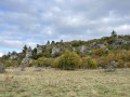
A pleasant hike in three stages. The first part crosses vast areas of pastureland, the second allows you to wander through a "lunar" landscape amid dolomitic rocks, and the third, in the undergrowth, runs alongside streams that you have to cross. This diversity of landscapes makes this hike easy and interesting.
The Jure Stream
 5.73 mi
+1,060 ft
-1,060 ft
3h 35
Moderate
Departure from Ceilhes-et-Rocozels (Hérault)
5.73 mi
+1,060 ft
-1,060 ft
3h 35
Moderate
Departure from Ceilhes-et-Rocozels (Hérault)
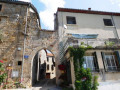
From Ceilhes-et-Rocozels, in Haut-Languedoc, near the ‘border’ with Aveyron, here’s an opportunity to head for the hills, in the Monts d’Orb State Forest, towards the Rocher du Canari on the edge of the Tesserièyres Plateau. The Ruisseau de Jure will then serve as your guide back to the village, which lies on the banks of the Orb, a coastal river regulated by the Avène Reservoir.
The Avène Reservoir
 6.86 mi
+1,043 ft
-1,043 ft
4h 05
Moderate
Departure from Ceilhes-et-Rocozels (Hérault)
6.86 mi
+1,043 ft
-1,043 ft
4h 05
Moderate
Departure from Ceilhes-et-Rocozels (Hérault)
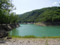
Here is a brief overview of the Avène Reservoir, starting from Ceilhes-et-Rocozels, first climbing up Mont Redon, south of the village. After the Rouvignac chapel and the holiday lodges, the route approaches the left bank of the Orb, which feeds the Bouloc lake, developed for outdoor leisure activities (water sports, camping).
⚠️ 11/05/2026:In winter and spring, and after heavy rain, when the reservoir is full, the walk may be impassable between points 8 and 10. It is possible to avoid walking along the banks by following the route shown on the IGN map between points 7 and 10.
Route of the Saint-Amans and Notre-Dame-de-Nize chapels
 11.85 mi
+1,680 ft
-1,686 ft
6h 55
Difficult
Departure from Lodève (Hérault)
11.85 mi
+1,680 ft
-1,686 ft
6h 55
Difficult
Departure from Lodève (Hérault)
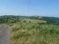
From Col de la Baraque to Chapelle de Saint-Amans via the ridges, then to Chapelle de Notre-Dame-de-Nize via a chestnut grove.
Le Pas de l'Escalette
 8.45 mi
+1,919 ft
-1,913 ft
5h 35
Moderate
Departure from Pégairolles-de-l'Escalette (Hérault)
8.45 mi
+1,919 ft
-1,913 ft
5h 35
Moderate
Departure from Pégairolles-de-l'Escalette (Hérault)
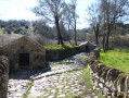
A hike in a pleasant valley with plenty of water and the Pas de l'Escalette, a spot steeped in history. The return via the plateau offers a wide view of the surrounding area.
Moderator update on 27/01/2021: some of the paths used in this itinerary have disappeared. However, there is a yellow-marked trail on site. See the reviews from January 2021.
Upper Orb Valley – From Avène to Rieussec via Peyreguille
 7.91 mi
+1,923 ft
-1,923 ft
5h 20
Moderate
Departure from Avène (Hérault)
7.91 mi
+1,923 ft
-1,923 ft
5h 20
Moderate
Departure from Avène (Hérault)
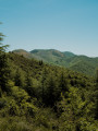
Avène is not just a cosmetics brand; it is also a thriving spa village in the upper cantons of the Hérault. Influenced by both the ocean and the Mediterranean, the Monts-d’Orb present striking contrasts from one slope to the other. From the Orb valley to the dry Rieussec valley via Peyreguille, the route—lovely and wooded, and therefore often shaded—alternates between south- and north-facing slopes. No fewer than six passes and four valleys are strung together in this way. Added to this is a well-preserved heritage (mill, Saint-André Chapel, etc.).
Laval de Nize Circular
3.77 mi
+827 ft
-827 ft
2h 25
 Easy
Departure from Lunas (Hérault) (Hérault)
Easy
Departure from Lunas (Hérault) (Hérault)
A lovely walk through the upper cantons: along the Ruisseau de Nize, then up through the boxwood trees towards the hamlet of Briandes and back via the postman’s path.
From Caylar to La Couvertoirade
8.06 mi
+571 ft
-564 ft
4h 10
Moderate
Departure from Le Caylar (Hérault)
A walk starting from Caylar and leading to La Couvertoirade. Cross the Larzac limestone plateaus to reach La Couvertoirade, a Templar town with its ramparts, and a village listed among the most beautiful villages in France.
Circular Caylar route via La Couvertoirade
 Association / Club / Walk leader
 9.07 mi
+541 ft
-564 ft
4h 40
Moderate
Departure from Le Caylar (Hérault)
9.07 mi
+541 ft
-564 ft
4h 40
Moderate
Departure from Le Caylar (Hérault)
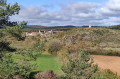
From the charming little Causse village of Caylar and its legendary carved tree, a beautiful detour onto the Causse du Larzarc takes us to the medieval village of La Couvertoirade. The vegetation, typical of the great Causses, alternates between meadows, fields, and groves of pine and white oak trees. The paths are lined with box trees. From the top of the hills, at an altitude of around 800 m, the view stretches eastwards towards the Aigoual massif. A visit to the village of La Couvertoirade, founded by the Knights Templar and the Knights Hospitaller, is a must.
Le Caylar - Le Cros circular
 7.74 mi
+305 ft
-318 ft
3h 50
Moderate
Departure from Le Caylar (Hérault)
7.74 mi
+305 ft
-318 ft
3h 50
Moderate
Departure from Le Caylar (Hérault)
For lovers of Larzac who want to limit the endless distances.
The summit of Peyreguille as seen from the hamlet of Le Coural in Avène
2.48 mi
+774 ft
-774 ft
1h 50
Moderate
Departure from Avène (Hérault)
A short walk taking you up Mont Peyreguille, where the mobile phone mast is located, from the hamlet of Le Coural, situated a few kilometres above Avène. The walk offers views of mid-mountain landscapes; the first section is fairly shaded by the forest canopy.
Saint-Amans Chapel from Villecun
10.72 mi
+1,575 ft
-1,594 ft
6h 20
Moderate
Departure from Olmet-et-Villecun (Hérault)
A beautiful hike with 360° views on very good paths. The ridge section is exposed to the wind.
Villecun route via the Col de la Défriché and Lavalette
9.80 mi
+1,312 ft
-1,306 ft
5h 40
Moderate
Departure from Olmet-et-Villecun (Hérault)
A pleasant walk, starting with unobstructed views of the highest peaks, then shaded after Lavalette. A short stretch of tarmac at the start and halfway along the route.
 The tour of Lake Salagou from Lodève
 31.43 mi
+1,575 ft
-1,575 ft
4 hrs
Moderate
Departure from Lodève (Hérault)
31.43 mi
+1,575 ft
-1,575 ft
4 hrs
Moderate
Departure from Lodève (Hérault)
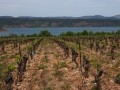
This varied route mainly follows small roads with little traffic.
The Corniches of the Cirque de Saint-Beaulize
 3.25 mi
+830 ft
-837 ft
2h 15
Moderate
Departure from Saint-Beaulize (Aveyron)
3.25 mi
+830 ft
-837 ft
2h 15
Moderate
Departure from Saint-Beaulize (Aveyron)
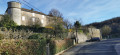
Located on the south-western slope of the Larzac Plateau at an altitude of 530 m, the village of Saint-Beaulize is dominated by a cirque formed by high limestone cliffs (reaching 860 m) commonly known as molaires.