Country:

 City:
City:


Start from the walkers’ car park on the village square.
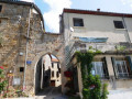
(S/E) Walk down Rue des Remparts, passing beneath the castle. At the end of the rampart, take the first street on the left (Rue du Barry) and follow it to the end. Ignore a path that branches off to your right after the railway line. A few dozen metres further on, you’ll reach the water tower (a concrete building with a grey door).
(1) Take a path on your left that runs alongside a barn, cross a track and continue along the path (heading south-south-east). This old village path, lined with low stone walls, is regularly flanked by a ‘buissière’ (a path bordered by boxwood hedges, forming a veritable green corridor characteristic of the Causses).
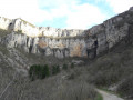
(2) 400 m further on, leave this main track and take the path that veers to your left and leads back down towards the village. As you make your way down, take in the magnificent views of the Saint-Beaulize cirque, the Causse du Larzac and the ‘avant-causse’ that unfold before your eyes.The path comes out onto a road that winds round a bend and leads onto the D93.
(3) Take this road to the left (heading north). A few dozen metres further on, turn off onto a beautiful ‘paved slanting street’ (an old stone and cobblestone path) which descends to your right. This paved slanting street leads you to La Fousette, a stream which you follow along its right bank. 30 metres further on, cross the footbridge and head back up another paved slanting street, which continues to your left along a path through the boxwood trees, leading onto a small tarmac road (Chemin de la Farette).
(4) Follow this road to your left for 200 metres, cross the Fousette again, and you’ll reach the hamlet of Les Fangas.
(5) Follow the Route du Fangas on your left until you rejoin the D93. Turn right onto it, walk for about a hundred metres, then enter the village of Saint-Beaulize via Rue des Aires on your left. At the end of this street, you’ll come back to the walkers’ car park (S/E).
 Visorando Member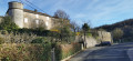
 Moderate
 Very difficult