Refine your search for walks in Rauret
Rauret walks


 The hills of Jonchères
 Visorando Member
 5.33 mi
 +745 ft
 -725 ft
 3h 05
3h 05
 Average
 Departure from Rauret (Haute-Loire)
Explore the Allier Gorges and its railway line via a very rural route. The scenery is extremely varied, alternating between meadows, cultivated fields and wild areas, with an elevated walkway over the river and a view of the ruins of Jonchères Castle.
Starting point at the Gorges de l'Allier in Pomeyrols
 2.84 mi
+479 ft
-472 ft
1h 45
2.84 mi
+479 ft
-472 ft
1h 45
 Easy
Departure from Naussac (Lozère) (Lozère)
Easy
Departure from Naussac (Lozère) (Lozère)
You can discover the beauty of the Allier Gorges in Pomeyrols, a hamlet in the commune of Naussac-Fontanes, situated 8 km north of Langogne.
Le Bouchet-Saint-Nicolas - Pradelles
 12.89 mi
+1,001 ft
-1,237 ft
6h 50
12.89 mi
+1,001 ft
-1,237 ft
6h 50
 Difficult
Departure from Le Bouchet-Saint-Nicolas (Haute-Loire)
Difficult
Departure from Le Bouchet-Saint-Nicolas (Haute-Loire)
This route is the third stage of a complete journey on the Chemin de Stevenson between Le Puy-en-Velay and Alès. This is undoubtedly the easiest stage of the tour. The route follows the GR®70 (follow the well-known GR® markings). Please note the route may have been slightly modified from what is shown on the map, in particular to avoid a few short stretches of busy road.
Pradelles - Cheylard-l'Évêque
 13.88 mi
+1,302 ft
-1,398 ft
7h 30
Difficult
Departure from Pradelles (Haute-Loire)
13.88 mi
+1,302 ft
-1,398 ft
7h 30
Difficult
Departure from Pradelles (Haute-Loire)
This is the 4th stage of a complete journey on the Chemin de Stevenson between Le Puy-en-Velay and Alès. This stage marks the transition from the Pays des Puys du Velay, with its open, hilly landscapes, to the Gévaudan, with its more enclosed landscapes and deep woodlands. The route follows the GR®70 (Red and White waymarkers).
The path around Lac du Bouchet
 1.62 mi
+13 ft
-16 ft
0h 45
Easy
Departure from Cayres (Haute-Loire)
1.62 mi
+13 ft
-16 ft
0h 45
Easy
Departure from Cayres (Haute-Loire)
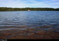
An ideal place for a walk, Lac du Bouchet is reminiscent of a Canadian lake. A real gem in its forest setting, this circular lake of volcanic origin occupies the site of an ancient crater.
The suggested route allows you to walk around it. It is a very easy walk that can be enjoyed by the whole family.
Lake Langogne and Donozau Waterfall
 Association / Club / Walk leader
 7.69 mi
+427 ft
-427 ft
3h 55
Average
Departure from Langogne (Lozère)
7.69 mi
+427 ft
-427 ft
3h 55
Average
Departure from Langogne (Lozère)
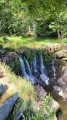
This hike offers beautiful views of the Naussac Reservoir and the Rac de Langogne, and you can discover the small Donozau waterfall along beautiful paths.
Ancient Roman road and the Devès Plateau
7.18 mi
+479 ft
-509 ft
3h 45
Average
Departure from Ouides (Haute-Loire)
A hike with completely unobstructed views, at an altitude of 1,200 m, offering a beautiful view of the Margeride plateaus, via the old track running alongside the Forêt du Devès. Return via the hamlets and farm tracks of the plateau.
Route du Langouyrou in Langogne
 4.43 mi
+400 ft
-394 ft
2h 25
Easy
Departure from Langogne (Lozère)
4.43 mi
+400 ft
-394 ft
2h 25
Easy
Departure from Langogne (Lozère)
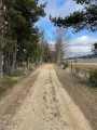
Discover, in a single hike and in turn, the upper Allier valley and then the torrential Langouyrou valley, following in the footsteps of the writer and traveller Robert Louis Stevenson. Open to all, this walk is also accessible with a pushchair or wheelchair.
From Arlempdes to Saint-Arcons-de-Barges
 8.86 mi
+1,568 ft
-1,598 ft
5h 25
Average
Departure from Arlempdes (Haute-Loire)
8.86 mi
+1,568 ft
-1,598 ft
5h 25
Average
Departure from Arlempdes (Haute-Loire)
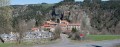
This excursion takes you from Arlempdes, listed as one of the Most Beautiful Villages in France since 1999, to Saint-Arcons-de-Barges... for a particularly pleasant stroll.
The rock of Arlempdes
 3.87 mi
+709 ft
-699 ft
2h 25
Easy
Departure from Arlempdes (Haute-Loire)
3.87 mi
+709 ft
-699 ft
2h 25
Easy
Departure from Arlempdes (Haute-Loire)
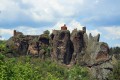
This walk offers a beautiful view of the hilltop village of Arlempdes (pronounced "Arlende"). Listed as one of "The Most Beautiful Villages in France", it occupies a stunning site on a rocky spur overlooking the wild gorges of the Loire.
Margeride and its hamlets
 5.98 mi
+466 ft
-446 ft
3h 10
Average
Departure from Grandrieu (Lozère)
5.98 mi
+466 ft
-446 ft
3h 10
Average
Departure from Grandrieu (Lozère)
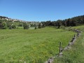
Starting from the village of Grandrieu, this hike allows you to discover the small Margeride massif (formerly Gévaudan) and its typical granite villages. The route described was completed in half a day by young people (aged 7 to 11) from the Sentiers en Margeride hiking club. Difficulty: E2/T2/R1 (according to FFrandonnée classification).
Lac du Bouchet via Cayres
11.88 mi
+1,322 ft
-1,316 ft
6h 35
Average
Departure from Saint-Jean-Lachalm (Haute-Loire)
Starting with a short circular route in the Devès, near Cayres, a visit to Lac du Bouchet, well known to volcanology enthusiasts, is a must.
Goudet – Le Monastier-sur-Gazeille
 14.49 mi
+2,116 ft
-1,565 ft
8h 30
Difficult
Departure from Goudet (Haute-Loire)
14.49 mi
+2,116 ft
-1,565 ft
8h 30
Difficult
Departure from Goudet (Haute-Loire)
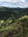
Third stage of the ‘Between Mézenc and the Loire Valley’ route.The route broadly follows theGR®®3to the fortified farm of La Valette, offering numerous panoramic views of the Loire Valley before reaching Le Monastier-sur-Gazeille via a high-altitude path which also offers some very fine views.
Exploring the area around La Fouillouse
 Tourist office
 7.22 mi
+781 ft
-761 ft
4h 00
Average
Departure from Saint-Jean-la-Fouillouse (Lozère)
7.22 mi
+781 ft
-761 ft
4h 00
Average
Departure from Saint-Jean-la-Fouillouse (Lozère)
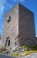
This route will take you on a journey of discovery through the local heritage (the Cellier Tower, the bread oven, the cross) and the wild, unspoilt landscapes around the Ruisseau de la Fouillouse.
The Patus Forest
 9.31 mi
+755 ft
-745 ft
4h 55
Average
Departure from Saint-Jean-la-Fouillouse (Lozère)
9.31 mi
+755 ft
-745 ft
4h 55
Average
Departure from Saint-Jean-la-Fouillouse (Lozère)
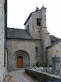
This route takes you through several typical villages of the Margeride region with their rich and varied heritage, as well as the wonderful Patus Forest where you can enjoy unspoilt nature.
Route from Goudet via Camp d'Antoune
 7.27 mi
+1,391 ft
-1,381 ft
4h 35
Average
Departure from Goudet (Haute-Loire)
7.27 mi
+1,391 ft
-1,381 ft
4h 35
Average
Departure from Goudet (Haute-Loire)
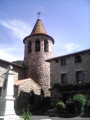
Goudet is a crossing point on the Stevenson Trail (GR®70), which intersects with theGR®40, which we took for our departure.
Two notable points of interest: the Moulin du Rocher mill and its organ pipes, and the Camp d'Antoune with its bird's eye view of the Loire.
Circular walk of the castles and fortified towns of Alleyras
 12.92 mi
+2,569 ft
-2,543 ft
8h 10
Difficult
Departure from Alleyras (Haute-Loire)
12.92 mi
+2,569 ft
-2,543 ft
8h 10
Difficult
Departure from Alleyras (Haute-Loire)
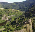
Starting from Pont d’Alleyras station, a crossing point over the Allier for over 2,000 years, the Vabres plain has always been dotted with numerous castles and watchtowers to control the passage of travellers. This route follows one of the two Roman roads designed to link Bordeaux, the capital of Aquitaine, with Lyon, the capital of Gaul, passing through the southern part of the Massif Central towards Rodez and Cahors. In the Middle Ages, the River Allier formed the boundary between the Velay and the Gévaudan regions.
The upper Langouyrou valley via Cheylard-l'Évêque
 12.50 mi
+1,549 ft
-1,565 ft
7h 05
Average
Departure from Cheylard-l'Évêque (Lozère)
12.50 mi
+1,549 ft
-1,565 ft
7h 05
Average
Departure from Cheylard-l'Évêque (Lozère)
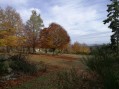
A very pleasant hike through meadows and woods, the latter being very diverse. There are many landscapes and viewpoints, notably over the Mercoire forest and the Moure de la Gardille. All seasons are interesting: spring with its rushing rivers, summer with its refreshing forests, autumn marked by a symphony of colours.
Beaume Waterfall
 1.33 mi
+220 ft
-220 ft
0h 50
Easy
Departure from Solignac-sur-Loire (Haute-Loire)
1.33 mi
+220 ft
-220 ft
0h 50
Easy
Departure from Solignac-sur-Loire (Haute-Loire)
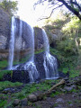
Short circuit to visit the Beaume waterfall. Wear good shoes for the descent to the waterfall. Avoid pushchairs. In summer, you can swim.
Stroll around Saint-Jean-Lachalm
0.98 mi
+112 ft
-108 ft
0h 35
Easy
Departure from Saint-Jean-Lachalm (Haute-Loire)
A short hike to discover this village in the Devès region, a Cluniac site.
The Loire Gorges from Onzillon
 8.45 mi
+1,227 ft
-1,240 ft
4h 55
Average
Departure from Chadron (Haute-Loire)
8.45 mi
+1,227 ft
-1,240 ft
4h 55
Average
Departure from Chadron (Haute-Loire)
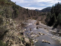
This route, which takes you up the Loire Gorges for several kilometres, follows a few unmarked paths in a wild and unspoilt environment. Several descents to the banks of the Loire are possible (swimming, fishing) and are indicated in the description. The return via the plateau offers beautiful views.
Chapelle Saint-Étienne from Monistrol-d'Allier
6.33 mi
+1,079 ft
-1,089 ft
3h 50
Average
Departure from Monistrol-d'Allier (Haute-Loire)
Circular route on the heights of the Allier, around Monistrol, to discover a chapel overlooking the valley. See the variation in the Practical Information section for a round trip to Château de la Beaume.
According to one review, it seems thatthe Visorando app is necessary to follow the route properly.