


 Country:

 City:
City:


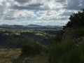
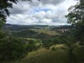
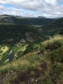
(S) In Goudet, head uphill from the town hall, following theGR®®3and 70 (red and white markings) towards Saint-Martin-de-Fugères. The path climbs steeply and crosses the road. You’ll soon reach the first hairpin bend on the right.
(1) Leave theGR®® trails, which wind their way up through the broom, turn right and take a more shaded path opposite which passes the riding centre. On the plateau, rejoin theGR®® trails you left behind further down. Continue straight ahead and reach Saint-Martin-de-Fugères. Head up to the right in the village, pass the church, ignore the street on the right and continue straight ahead. The street turns into a path. Before reaching the road, let theGR®®70continue straight ahead.
(2) Turn left onto theGR®®3. Cross the road and reach a second one at a three-way junction. Take the left-hand branch, which descends and leads to the hamlet of La Pénide. Walk through the hamlet and follow a path overlooking the Loire Valley.
(3) Follow this balcony-like path and reach Les Salles at a junction.
(4) Follow theGR®® along the small road on the left. At the end of the hamlet, the road turns into a track and soon descends through meadows. Reach the woods and continue downwards, following theGR®®. You’ll come to a path that descends straight towards the hamlet of Vazeilles. Begin the descent and you’ll reach a first junction.
(5) Leave theGR®® on the steep slope and turn right onto a less steep grassy path. After a good hundred metres, this path rejoins theGR®® you have just left, when you reach a wide track (the access route to the hamlet).
Take this track to the right and head for the hamlet of Onzillon. Cross the hamlet along theGR®®, then descend towards Colempce-Haut and join the D37. Cut across this road, turn left, cross the hamlet and rejoin the D37. Follow it to the right to cross the bridge over the Gazeille, then leave it to the left.
(6) Walk through the hamlet of Colempce-Bas, home to the nature school. Leave the hamlet via a small road and, when it climbs to the right along theGR®® route, leave it to take an unmarked path opposite.
Further up, the path joins a road; follow this to the right for about 100 metres to reach a stone cross.
(7) Join theGR®® 3 coming from Chadron and follow it along the track, which starts on the left. Follow the track andthe GR®® to the fully restored fortified farm of La Valette.
(8) Just before the farm’s entrance gate, leave theGR®® and head up to the right along a path marked in yellow. After a hairpin bend to the right, the path leads to the hamlet of Archinaud. Once you reach the hamlet, follow the road to the right, which joins the D37. At this junction, follow the D37 to the left for about 50 m.
(9) Leave the D37 by taking a small road that climbs uphill, just past a stone cross. This road joins another road and theGR®®430(marked in red and white), which, if followed to the right, leads to the hamlet of Bois Rouillier. Continue along this road, which turns into a track and leads to a junction before reaching the woodland.
(10) Let theGR®® continue straight on and follow the track, marked in yellow, which descends to the right. These yellow markings will guide you all the way to Le Monastier. Reach the hamlet of Tallobre and climb up the road opposite.
(11) Leave the road via a path on the left (marked in yellow) before it starts to descend again. You’ll come to a three-way junction near a drinking trough.
(12) Take the left-hand fork (slightly faint yellow markings) which, after a narrow section, widens and leads to the hamlet of Chabreyres. Head up through the hamlet, turning left, then leave the road following the yellow markings. The path climbs steeply and winds round a bend.
(13) Just after the hairpin bend, leave this track, which is suitable for vehicles, and take a path that climbs steeply to the right. This will take you to the edge of the plateau and then to the hamlet of Le Mont.
Continue along the edge of the plateau and reach Le Monastier-sur-Gazeille after a steep descent.
In this town, head straight on along Avenue du Puy, then take Rue Langlade until you reach the chemist’s (E).
 Visorando Member
 Moderate
 Easy
Easy 
 Very difficult
