Country:

 City:
City:


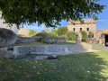
The starting point is in the centre of the hamlet of Malmont, on the hills above the village of Auroux. You can park in the centre of the village, taking care not to disturb the residents; if in doubt, do not hesitate to ask them for advice on where to park.
(S/E) The starting point is in the centre of the hamlet, by the fountain. With your back to the fountain, take the path on your right which runs alongside the large building opposite you, heading south-west. Continue to the first junction.
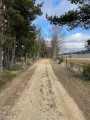
(1) Turn left and head towards Le Spat. The entrance to the path is likely to be blocked by a gate. If so, open it to get through and make sure you close it again to prevent the cows in the fields bordering the path from escaping. Follow the path until you reach the junction in the centre of the village of Le Sapt.
(2) Turn right towards Roubillets (towards the woods). Continue straight on along this path until you come out onto the D226 road.
(3) Turn right onto this road and follow it for about 300 m, then turn right again to take the path towards L’Herm / Malmont. You’ll come to a junction (elevation 1202).
(4) Turn left towards L’Herm. After a straight stretch of several hundred metres, turn right and continue on theGR®4, still heading towards L’Herm. Carry on like this until the next junction in a wide bend (elevation 1110).
(5) Leave theGR®1and turn left towards L’Herm. Carry on like this until the next junction opposite a farm building.
(6) Turn right towards Malmont / Auroux and carry on straight ahead. You’ll come out onto the road leading to Malmont; follow it straight on for a few tens of metres.
(7) Turn left to rejoin theGR®4towards Auroux. This time, you’ll come out onto the road leading to Auroux. Continue along this road for a few dozen metres until you reach the end of the long bend.
(8) Turn right onto a new path heading towards the telecoms mast. Stay on the main path, which takes you back towards Malmont, and ignore the two paths branching off to your right. After a gentle climb, you’ll come out onto the road leading to Malmont again (elevation 1082).
(9) Take the path leading uphill opposite and follow it until you rejoin the road leading to the village of Malmont. Turn right and you’ll return to the car park (S/E).

 Tourist office
 Moderate
 Association / Club / Walk leader
 Visorando Member