

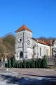
From Autigny to Autigny

A short walk on the Sartie plateau, with views over the Marne valley.

Details

n°5186
Creation:
Last update:
Last review:
  • Walking
    Activity: Walking
  • ↔
    Distance: 4.14 mi
  • ◔
    Average duration: 2h 20 
  • ▲
    Difficulty: Moderate

  • ⚐
    Back to start: Yes
  • ↗
    Ascent: + 456 ft
  • ↘
    Descent: - 463 ft

  • ▲
    Highest point: 1,043 ft
  • ▼
    Lowest point: 581 ft

Photos

Description of the walk

(S/E) From the church square, take Rue de la Mairie eastwards and pass between the town hall and the cemetery. Take the first street on the right, Rue du Château, which leads into the courtyard of the old castle (admire the residential buildings on your right and the dovecote on your left). Turn left twice.

(1) At the start of a left-hand bend, turn right up the Route (path) de la Ferme de Saint-Nicolas. Walk up the valley beneath the Bois de la Vallée.

(2) At the crossroads, turn right twice and continue uphill (south-east).

(3) At the junction, turn right (west-south-west). After about 500 metres, carry on straight ahead along the unpaved track.

(4) Before the Ferme Saint-Nicolas (hunting lodge), veer left and head down through the woods.

(5) Turn right and take the path leading to the village of Autigny-le-Grand. Walk down into the village along Rue Antoine Labreuveux, passing the war memorial and the town hall.

(6) Turn right onto the Sentier Champ Prieur. Continue straight on (north) to Autigny-le-Petit (S/E).

Waypoints

  1. S/E : mi 0 - alt. 587 ft - Autigny-le-Petit – Place de l’Église
  2. 1 : mi 0.16 - alt. 600 ft - Start of the trail
  3. 2 : mi 1.29 - alt. 732 ft - Crossroads
  4. 3 : mi 1.88 - alt. 1,033 ft - Hunting lodge
  5. 4 : mi 2.38 - alt. 994 ft - Junction
  6. 5 : mi 3.21 - alt. 623 ft - Junction
  7. 6 : mi 3.55 - alt. 587 ft - Autigny-le-Grand - Canal entre Champagne et Bourgogne
  8. S/E : mi 4.14 - alt. 591 ft - Autigny-le-Petit – Place de l’Église

Notes

Also suitable for mountain bikes.

Reviews and comments

4.7 / 5
Based on 1 review

Reliability of the description
4 / 5
Ease of following the route
5 / 5
Route interest
5 / 5
POULIN Gérard
POULIN Gérard ★
• Edited:

Thank you, Denis B1, for this constructive comment. It has enabled us to revisit this 2012 walk and update it. It is highly likely that, at that time, the street names had not yet been introduced.

Machine-translated

Denis B1.
Denis B1.

Overall rating : 4.7 / 5

Date of your route : Jun 27, 2015
Reliability of the description : ★★★★☆ Good
Ease of following the route : ★★★★★ Very good
Route interest : ★★★★★ Very good

Hello

A very good route

2 updates on the village of AUTIGNY LE GRAND

- The route down into the village follows Rue Antoine LABREVEUX
- The lane on the right is called the ‘Sentier du Champ Prieur’ (information from Google Earth and Cadastre.gouv)

Kind regards

Machine-translated

Other walks in the area

For more walks, use our search engine .

The GPS track and description are the property of this route's author. Please do not copy them without permission.