Country:
 City:


Start from the car park at Place de la Liberté.
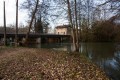
(S/E) Leave the car park to the right and follow the blue/yellow signposting. Follow the main road (D179) for about 100 m and, at the first junction, turn right opposite the church. Cross the river, the Osne, and turn left onto Chemin de Pansey, following the river upstream through the village to see the wash houses. At the end of the street, turn left onto Rue du 8 Mai 1945 without crossing the Osne.
(1) Turn right to walk alongside the river. After the second wash house, turn right onto the path that follows the riverbank and join Rue du Four, which climbs at a gradient of about 10 per cent. Pass close to Baudray Farm and continue towards the top of the plateau.
(2) On reaching the boundary between the municipalities of Osne-le-Val and Thonnance-les-Joinville (boundary markers), turn left, follow the boundary of the agricultural district, cross a road, and reach the second path on the left.
(3) Follow this north-facing track until you reach a wide dirt track in a valley. Head up to the right and continue to the edge of the forest.
(4) On leaving the forest, turn immediately left onto a white track heading north-east, then continue the climb, heading north-west, towards the Plateau de Limon. At its far end, head down towards the village along a fairly steep slope until you reach the D179.
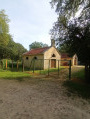
(5) Follow it to the left, passing a wayside cross, cross a road and head right into the centre of the village via Rue Haute to admire the old buildings (town hall, former hospital and hospice) and the church. Return to the D179, turn right onto it and follow it for 100 metres to reach Place de la Liberté (S/E).
 Visorando Member
 Moderate