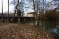
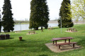
La Genièvre and Le Tremblot from Chevillon

A short walk along the Ruisseau de Chevillon, a small Category1 stream for anglers, then through the forest on the slopes of Chevillon. Easy to follow, it becomes a bit of a physical challenge when you leave the valley and start the climb. Some lovely views lie ahead.

Details

n°24474627
Creation:
Last update:
Last review:
–
  • Walking
    Activity: Walking
  • ↔
    Distance: 5.22 mi
  • ◔
    Average duration: 2h 55 
  • ▲
    Difficulty: Moderate

  • ⚐
    Back to start: Yes
  • ↗
    Ascent: + 561 ft
  • ↘
    Descent: - 551 ft

  • ▲
    Highest point: 1,040 ft
  • ▼
    Lowest point: 627 ft
  • ⚐ Country: France
  • ⚐ City: Chevillon (52170)
  • ⚑
    Start/End: N 48.527743° / E 5.133769°
  • ❏
    IGN map(s): Ref. 3116SB
  • Hour-by-hour weather

Description of the walk

Start at Place de l’Ariet.

(S/E) Head to the eastern end of Place de l’Ariet, go round the social housing block, cross the stream and take the path on the left to Rue de Tugnéville. Follow it to the right and, at the foot of the hill, continue left onto the farm track.

(1) Follow the valley track, which then turns into a footpath. At the next junction, take the path on the right until you reach a clearing where four paths meet.

(2) Take the main road on the left which joins the D9 and follow it to the left for about 300 m.

(3) Turn right and head up the Moncoulinval valley until you reach the Route de La Landre.

(4) Follow it to the left, then take the first white track on the right, heading due north.

(5) When you reach the top of the hill (elevation 317), at the junction, take the left-hand track for 800 m.

(6) At the Y-junction, follow the left-hand track to the left and head towards Val Saint-Hilaire. Follow the tarmac road down to Chevillon church, cross the D 9 with care and head to Place de l’Ariet (S/E).

Waypoints

  1. S/E : mi 0 - alt. 627 ft - Place de l’Ariet
  2. 1 : mi 0.56 - alt. 676 ft - Path at the foot of the hill
  3. 2 : mi 1.59 - alt. 741 ft - Small square/junction, on the roadside
  4. 3 : mi 1.84 - alt. 705 ft - Entrance to the valley
  5. 4 : mi 2.81 - alt. 1,001 ft - Crossroads at the top of the hill/tarmac road
  6. 5 : mi 3.3 - alt. 1,030 ft - Crossroads at the top of the hill, 2 dirt tracks
  7. 6 : mi 3.79 - alt. 1,024 ft - Y-junction
  8. S/E : mi 5.22 - alt. 627 ft - Place de l’Ariet

Other walks in the area

For more walks, use our search engine .

The GPS track and description are the property of this route's author. Please do not copy them without permission.