


Refine your search for walks in Puy de Dôme
Puy de Dôme walks


 Puy-de-Dôme passing through the col de Ceyssat
 Visorando Member
 3.39 mi
 +1,286 ft
 -1,257 ft
 2h 40
2h 40
 Moderate
 Departure from Orcines (Puy-de-Dôme)
Just above Clermont-Ferrand, the inescapable climb to Puy-de-Dôme through the col de Ceyssat is a short but intense hike with an astonishing view over Clermont-Ferrand, the chaîne des Puys, paragliders and Millevaches.
Caution, it's a very popular walk so be sure to do it during week days for a bit of peace and quiet.
Round the base of Pariou and half-way round Puy de Dôme
 8.66 mi
+1,785 ft
-1,775 ft
5h 30
Moderate
Departure from Orcines (Puy-de-Dôme)
8.66 mi
+1,785 ft
-1,775 ft
5h 30
Moderate
Departure from Orcines (Puy-de-Dôme)
A classic in the Chaîne des Puys to admire Puy de Dôme and Le Puy de Pariou, amongst others.
The Puy de Dôme via the Chemin des Chèvres
 4.86 mi
+1,368 ft
-1,368 ft
3h 25
Moderate
Departure from Orcines (Puy-de-Dôme)
4.86 mi
+1,368 ft
-1,368 ft
3h 25
Moderate
Departure from Orcines (Puy-de-Dôme)
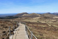
The view is as lovely as ever at the top of this legendary route. A longer climb, but more enjoyable and varied than the ascent via the Sentier des Muletiers.
Puy de Dôme from the North face
7.81 mi
+1,834 ft
-1,834 ft
5h 10
Moderate
Departure from Orcines (Puy-de-Dôme)
A very accessible ascent of the Puy de Dôme, despite the elevation gain. After the beautiful 'Chemins de la Roche Pertuisade and des Gravouses', which winds through pastures and woods at the foot of the puy, climb the Chemin des Chèvre, then the old road now used by the cog railway. Descent to the South via the Chemin des Muletiers, then back via the Chemin des Gouris.
Le Puy de Dôme via the Muletiers, Chèvres and Gouris trails
6.99 mi
+1,814 ft
-1,788 ft
4h 50
Moderate
Departure from Orcines (Puy-de-Dôme)
A magnificent hike to the summits of the iconic Puy-de-Dôme. This route, which follows very well-maintained paths, is mainly on flat ground and offers numerous panoramic views. The ascent via the mule track is steep but fairly short.
The loop of domes - Northern section
 17.19 mi
+2,395 ft
-2,392 ft
10h 00
17.19 mi
+2,395 ft
-2,392 ft
10h 00
 Difficult
Departure from Ceyssat (Puy-de-Dôme)
Difficult
Departure from Ceyssat (Puy-de-Dôme)
After a moderate day's hiking, you are now in the most demanding part of the loop of domes, with magnificent views of the Puy de Côme, the Grand Knoll, the Petit Knoll and the Puy de Dôme. You will pass through beautiful forests of beech, conifer and hazel trees, a feast for the eyes!
The Puy de Dôme from Laschamps
8.42 mi
+1,850 ft
-1,854 ft
5h 30
Moderate
Departure from Saint-Genès-Champanelle (Puy-de-Dôme)
At the end of the Second Empire, when thermal spas were booming in Auvergne, Puy de Dôme became the place to visit. Tourist guides of the time stated that "it is not permissible to leave Auvergne without having climbed Puy de Dôme"!
Puy de Dôme and Puy Pariou via the mule and goat trails
 10.89 mi
+2,703 ft
-2,697 ft
7h 20
Difficult
Departure from Orcines (Puy-de-Dôme)
10.89 mi
+2,703 ft
-2,697 ft
7h 20
Difficult
Departure from Orcines (Puy-de-Dôme)
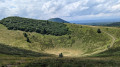
A magnificent hike to the summits of the iconic Puy-de-Dôme and Puy Pariou. This route, on very well-maintained paths, is mainly on flat ground and offers numerous panoramic views.Warning! Immediate danger – Rock falls. Due to rock falls from the cliffs, the Chemin des Muletiers is STRICTLY closed until further notice by municipal decree of the commune of Orcines.
Puy de Dôme - Petit knoll - Le Cliersou - Puy Pariou
6.46 mi
+1,775 ft
-2,113 ft
4h 30
Moderate
Departure from Ceyssat (Puy-de-Dôme)
A pleasant, easy walk in the Chaîne des Puys. There are magnificent views of the Puy de Dôme to admire.This walk requires two cars.
From the Kilian Crater to the Temple of Mercury, the trachyte route
9.26 mi
+1,955 ft
-1,959 ft
6h 00
Moderate
Departure from Saint-Genès-Champanelle (Puy-de-Dôme)
Circular loop, starting from Laschamps, which allows you to climb to the summit of Puy de Dôme via the Chemin des Muletiers and descend via the Sentier des Chèvres.In the footsteps of Roman builders: on the slopes of Puy de Grosmanaux, the route skirts Kilian Crater, the remains of a powerful volcano that was exploited by the Romans to build the Temple of Mercury, which you will discover further along the route.
The two-day dome loop
 33.14 mi
+4,088 ft
-4,085 ft
2 days
Difficult
Departure from Ceyssat (Puy-de-Dôme)
33.14 mi
+4,088 ft
-4,085 ft
2 days
Difficult
Departure from Ceyssat (Puy-de-Dôme)
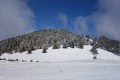
A two-day loop hike with accommodation in a camper van in Allagnat.
The Blaise Pascal ascent via the Montée des Chèvres
10.46 mi
+3,694 ft
-331 ft
8h 00
Difficult
Departure from Clermont-Ferrand (Puy-de-Dôme)
On 19 September 1648, Blaise Pascal stood before his Torricelli tube in the Jardin des Minimes – now Place de Jaude – in Clairmont (Clermont). His brother-in-law, Florin Périer, had set off earlier with his own Torricelli tube for the summit of the Puy de Dôme. Over the course of the day, 17 experiments were carried out to measure the level of mercury in the tubes, which had been placed at different altitudes; these experiments would go on to confirm the hypothesis of the ‘weight of the mass of air’, which would later become known as atmospheric pressure. At both locations, once filled to the brim, the tube was turned upside down so that its open base was in contact with the mercury contained in a vessel. Due to its weight, the liquid inside the tube sank under the force of gravity. In Clermont, the mercury remained at a height of 71.2 cm. At the summit of the Puy de Dôme, it dropped to 62.70 cm. This difference of a few centimetres is the result of a height difference of 1,078 metres, which I invite you to appreciate for what it is.
The Blaise Pascal ascent via the Chemin des Muletiers
10.84 mi
+3,570 ft
-207 ft
8h 05
Difficult
Departure from Clermont-Ferrand (Puy-de-Dôme)
On 19 September 1648, Blaise Pascal stood before his Torricelli tube in the Jardin des Minimes – now Place de Jaude – in Clairmont (Clermont). His brother-in-law, Florin Périer, had set off earlier with his own Torricelli tube for the summit of the Puy de Dôme. Over the course of the day, 17 experiments were carried out to measure the mercury level in the tubes, which had been placed at different altitudes; these experiments would go on to confirm the hypothesis of the “weight of the air”, which would later become known as atmospheric pressure. At both locations, once filled to the brim, the tube was turned upside down so that its open base was in contact with the mercury contained in a vessel. Due to its weight, the liquid inside the tube dropped under the effect of gravity. In Clermont, the mercury remains at a height of 71.2 cm. At the summit of the Puy de Dôme, it drops to 62.70 cm. This difference of a few centimetres is the result of a height difference of 1,078 metres, which I invite you to appreciate for what it is.
How to tackle a 1,500-metre climb in the Chaîne des Puys
19.83 mi
+5,236 ft
-4,675 ft
13h 40
 Very difficult
Departure from Saint-Ours (Puy-de-Dôme)
Very difficult
Departure from Saint-Ours (Puy-de-Dôme)
How do you cover a bit over 1,500 metres of elevation gain in the Chaîne des Puys, which, to true mountaineers, are nothing more than hills? By walking just over 30 km from the Louchadière hikers’ car park to the Col de Ceyssat, passing via the summits of eight puys: Louchadière, Jume, Coquille, Gouttes, Goules, Pariou, Cliersou and Dôme. This is therefore a one-way hike, requiring you to leave a vehicle at the Col de Ceyssat before returning to the starting car park. The route is challenging due to its length and elevation gain, but presents no technical difficulties. Some sections on unmarked forest paths require the use of the Visorando app. It would be unwise to get lost over such a long distance.
The Puy de Dôme and Puy Pariou via the Chemin des Chèvres
7.23 mi
+1,955 ft
-1,936 ft
5h 00
Moderate
Departure from Orcines (Puy-de-Dôme)
A stunning view of two of the Puys’ most iconic peaks. The climb is longer from this side, but more pleasant and varied than the ascent via the Sentier des Muletiers.
From Place de Jaude to the summit of Puy de Dôme, in a circular route and at a leisurely pace
48.66 mi
+8,196 ft
-8,202 ft
7 days
Moderate
Departure from Clermont-Ferrand (Puy-de-Dôme)
In the Clermont-Ferrand metropolitan area, the Transport à la Demande (TAD) service, in addition to regular bus and tram lines, allows you to travel quite far around the city. This seven-stage itinerary takes advantage of this. Each stage begins and ends at a bus or TAD stop. In between, the routes allow you to discover the villages of the metropolitan area's green belt and the foot of the Puy de Dôme: the built heritage of their old wine-growing or mountain villages, their spa resorts, their natural environments and a few geological curiosities. The first stages follow the course of the Artière, and the last ones follow the course of the Tiretaine, two pretty little rivers, tributaries of the Allier, which originate at the foot of the puys.See "Practical information" for a 4-stage variant with accommodation.
Laschamps - Orcines via Puy de Dôme
8.03 mi
+1,663 ft
-2,129 ft
5h 10
Moderate
Departure from Saint-Genès-Champanelle (Puy-de-Dôme)
And finally, here is the fifth stage, marked by the ascent of Puy de Dôme. The route takes the Chemin des Muletiers for the ascent, then the Sentier des Chèvres to descend towards Orcines. There is, of course, a vast panorama from the highest point of this stage, overlooking the city of Clermont-Ferrand, the chain of puys, the Combrailles, the Plateau des Dôme and the Massif du Sancy.