


Refine your search for walks in Pugny-Chatenod
Pugny-Chatenod walks


 Le Revard and Le Pertuiset via the Golet de la Pierre from Pugny-Chatenod
 Visorando Member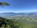
 9.24 mi
 +3,261 ft
 -3,251 ft
 7h 05
7h 05
 Difficult
 Departure from Pugny-Chatenod (Savoie)
A lovely walk, mainly through woodland, which takes you up the slopes and across the Revard plateau. Throughout this route, there are beautiful views over the Aix-les-Bains basin and Lake Bourget.
The Chemin du Golet de la Pierre, the most direct route to Mont Revard, can be challenging, with an elevation gain of nearly 1,000 metres over the first three kilometres. Make sure you’re wearing suitable footwear and are fit enough to tackle this walk.
On the route of the old rack railway between Mouxy and Pugny Chatenod
 Tourism professional
 2.33 mi
+748 ft
-741 ft
1h 50
2.33 mi
+748 ft
-741 ft
1h 50
 Easy
Departure from Mouxy (Savoie)
Easy
Departure from Mouxy (Savoie)
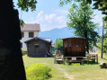
This walk follows the route of the Crémaillère, a railway line that opened on 15 August 1892 and once linked the spa town of Aix-les-Bains to Mont-Revard. It’s a very pleasant walk in summer, as it mainly passes through woodland and the mountain pastures of Mont-Revard.
It was in 2001 that the ‘Association Tourisme et Culture Autour de la Crémaillère’ began developing the Sentier de la Crémaillère, starting from Mouxy. Originally, the first station was situated in the centre of the spa town, very close to the Hôtel Bernascon. This walk covers the first section, between Mouxy and Pugny-Chatenod.
Circular of Chapelle Saint-Victor
 3.68 mi
+1,490 ft
-1,496 ft
3h 00
3.68 mi
+1,490 ft
-1,496 ft
3h 00
 Moderate
Departure from Mouxy (Savoie)
Moderate
Departure from Mouxy (Savoie)
A half-day walk to discover the tourist heritage, a chapel and panoramic views. The yellow-marked route runs below Mont Revard. This circular walk can be practiced in either direction.
From Mouxy to the Saint-Maurice Chapel
4.83 mi
+673 ft
-679 ft
2h 50
Easy
Departure from Mouxy (Savoie)
A country walk between Lac du Bourget and the foothills of Le Revard. Along the way, you will discover wash houses, a bread oven, a number of metal crosses perched on stone blocks, the slightly secluded Saint-Maurice Chapel, the old village of Clarafond, etc. And, weather permitting, more distant panoramic views.
There are no specific markings, but there are a few mountain bike markers here and there.
Le Revard via Pas de Rebollion and Col du Pertuiset
 8.35 mi
+3,241 ft
-3,232 ft
6h 40
8.35 mi
+3,241 ft
-3,232 ft
6h 40
 Very difficult
Departure from Mouxy (Savoie)
Very difficult
Departure from Mouxy (Savoie)
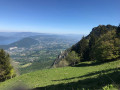
Le Revard is a plateau offering magnificent views of both the Northern Alps around Mont Blanc and Lake Bourget at its feet. This circular route climbs from the edge of the old cable car station, ascending the very steep Pas du Rebollion off-trail, then, after a route passing through several bumps on the plateau, descends via the classic Pertuiset trail.Route modified on 3/07/2023 between (6) and (9) to avoid private land, then on 20/10/2025 between (4) and (5) to take into account changes in the equipment.
Le Revard from Mouxy
 Association / Club / Walk leader
 10.90 mi
+3,573 ft
-3,573 ft
8h 05
Difficult
Departure from Mouxy (Savoie)
10.90 mi
+3,573 ft
-3,573 ft
8h 05
Difficult
Departure from Mouxy (Savoie)
This circuit takes you to Le Revard via the Chemin de la Crémaillère and back down via the Pas du Rebollion and the Col du Pertuiset. There are a few variations that add extra difficulty to this circuit. This circuit can be done in the opposite direction to the description.
Viewpoints and ridges of Le Revard
5.47 mi
+1,325 ft
-1,329 ft
3h 40
Moderate
Departure from Les Déserts (Savoie)
A pleasant route on the heights of Le Revard, combining a variety of points of interest.
Panoramic view of Aix-les-Bains and the lake, reminiscent of the old cable car and rack railway connections.
Poets' trail in summer. Panoramic views, mountain pastures and cheese...
Tour des Ébats and Tour de l'Angle Est from La Meunaz
 7.88 mi
+2,362 ft
-2,349 ft
5h 40
Moderate
Departure from Trévignin (Savoie)
7.88 mi
+2,362 ft
-2,349 ft
5h 40
Moderate
Departure from Trévignin (Savoie)
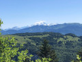
Walk through the forest, sometimes on a trail, sometimes on a forest track, then emerge in the mountain pastures of the Chalets de la Clusaz and reach the sublime viewpoint of the Tour des Ébats, where you can admire Lake Bourget, the Chaîne de l'Épine, the Bauges, the Tournette and, in the distance, Mont Blanc. Then, follow the ridge to reach the highest point of Le Revard, the Tour de l'Angle Est, with its magnificent panorama.
Return via the Crémaillére trail.
Creusates bog and Croix des Bergers from Crolles
 7.91 mi
+948 ft
-951 ft
4h 30
Moderate
Departure from Montcel (Savoie) (Savoie)
7.91 mi
+948 ft
-951 ft
4h 30
Moderate
Departure from Montcel (Savoie) (Savoie)
This hike through the mountain pastures allows you to discover the Creusates peat bog and its educational trail, as well as the Croix des Bergers, offering magnificent panoramic views of the Bauges Massif and the surrounding mountains and Mont Blanc
The Shepherds' Cross
 4.07 mi
+180 ft
-180 ft
2h 00
Easy
Departure from Montcel (Savoie) (Savoie)
4.07 mi
+180 ft
-180 ft
2h 00
Easy
Departure from Montcel (Savoie) (Savoie)
A short family walk that leads to a beautiful view from the Croix des Bergers. No problem for children in good weather, of course. Allow 2½ hours for the round trip.
The Fairy Cave from Brison-Saint-Innocent
 2.49 mi
+906 ft
-932 ft
1h 55
Moderate
Departure from Brison-Saint-Innocent (Savoie)
2.49 mi
+906 ft
-932 ft
1h 55
Moderate
Departure from Brison-Saint-Innocent (Savoie)
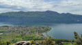
A family walk taking around two hours there and back, including a visit to the cave. An easier alternative to the existing hike, the Combe aux Moines and the Grotte des Fées, which is a bit long for young children. Starts from the last accessible car park on the Chemin de la Grotte des Fées
Following comments, the difficulty has been changed to "Medium", which wasn’t my initial impression as the walk was done with young children. Take particular care on the Chemin du Singe.
⚠️ To reach the car park at the start of the Grotte des Fées, from Aix-Les-Bains, follow the “Chemin du Ponsonnet” to the left of the D48, then turn right onto the “Chemin de la grotte des fées”.
La Féclaz le Revard round trip
 6.86 mi
+1,217 ft
-1,188 ft
4h 15
Moderate
Departure from Les Déserts (Savoie)
6.86 mi
+1,217 ft
-1,188 ft
4h 15
Moderate
Departure from Les Déserts (Savoie)
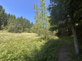
This is a family hike that can be enjoyed in any season between two resorts in the Massif des Bauges.
With snow, a winter atmosphere is guaranteed, especially if you encounter dog sled teams.
In summer, it is a refreshing, shaded route.
Moderator's note added on 09/06/2021: as some sections of the route are now private, it is useful to have a map to find alternatives
 Snowshoeing - Orionde circuit.
 7.39 mi
+1,250 ft
-1,280 ft
5 hrs
Easy
Departure from Les Déserts (Savoie)
7.39 mi
+1,250 ft
-1,280 ft
5 hrs
Easy
Departure from Les Déserts (Savoie)
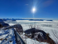
L'Orionde is not the best known or most popular spot on this circuit, but it offers panoramic views to the east and west.
The most famous site is, of course, the Croix du Nivolet, which, for once, happens to be on the route.
All in all, a beautiful loop with a succession of panoramic views.
Circular route south of Saint-Offenge-dessous
 6.09 mi
+1,119 ft
-1,102 ft
3h 45
Moderate
Departure from Saint-Offenge-Dessous (Savoie)
6.09 mi
+1,119 ft
-1,102 ft
3h 45
Moderate
Departure from Saint-Offenge-Dessous (Savoie)
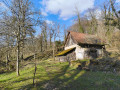
From the car park at the church in Saint Offenge-dessous, this circular route leads south through countryside, forest and hamlets. Alternating between roads with very little traffic, paths and trails, it offers some beautiful views.
La Féclaz les fermes circular
 5.13 mi
+719 ft
-705 ft
3h 00
Difficult
Departure from Les Déserts (Savoie)
5.13 mi
+719 ft
-705 ft
3h 00
Difficult
Departure from Les Déserts (Savoie)
This route is for experienced hikers, as it includes a few topographical challenges and requires a map and compass in addition to a GPS. However, it is also good practice for orientation without any risk, as the road from La Féclaz to Le Revard is never far away.