Le Revard and Le Pertuiset via the Golet de la Pierre from Pugny-Chatenod

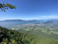
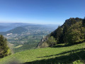
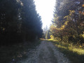
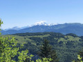
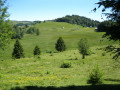
A lovely walk, mainly through woodland, which takes you up the slopes and across the Revard plateau. Throughout this route, there are beautiful views over the Aix-les-Bains basin and Lake Bourget.
The Chemin du Golet de la Pierre, the most direct route to Mont Revard, can be challenging, with an elevation gain of nearly 1,000 metres over the first three kilometres. Make sure you’re wearing suitable footwear and are fit enough to tackle this walk.

Details

48367843
Creation:
Last update:
Last review:
  • Walking
    Activity: Walking
  • ↔
    Distance: 9.24 mi
  • ◔
    Average duration: 7h 05 
  • ▲
    Difficulty: Difficult

  • ⚐
    Back to start: Yes
  • ↗
    Ascent: + 3,261 ft
  • ↘
    Descent: - 3,251 ft

  • ▲
    Highest point: 5,052 ft
  • ▼
    Lowest point: 2,041 ft

Photos

Description of the walk

From Aix-les-Bains, take the D913 Route du Revard to Pugny-Chatenod. In the centre of the village, you can park opposite the town hall or a little further down, towards the church, where there is another small car park.

(S/E) Opposite the entrance to the town hall is the old school, now used for community activities. Just to the left of the school, between the school grounds and a residential villa, look out for and take a small path. This is the start of the Chemin du Golet de la Pierre. The path climbs straight away, heading straight on, with a moderate gradient for the first kilometre. Stay on the path as you cross two small tarmac roads before reaching a tunnel.

(1) Go through the small tunnel that takes you under the Chemin de la Crémaillère, then carry on straight ahead. The gradient gradually steepens all the way to the summit of Le Revard, with little respite. Follow the well-marked, easily identifiable path right to the summit.

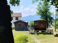
(2) As you make your way up, a gap in the canopy reveals your first panoramic view of Lake Bourget. A little further on, you’ll walk between large boulders before continuing your ascent to the left. You may occasionally need to use some steel cable handrails. You’ll arrive at a small, open outcrop. Enjoy this magnificent view of the valley and the tranquillity of the spot. You’ll find yourself facing a chalet near the Boucle de Bellevue.

(3) You have now completed the most challenging part of the ascent. Turn right at the chalet and continue along the path, now signposted as theGR® de Pays du Massif des Bauges. You’ll come out onto a small tarmac road; turn right. You are now on the Revard plateau and, as you pass the paragliding launch site, you can enjoy various panoramic views from the viewing platforms. Walk along these popular footpaths until you reach the restaurant.

(4) Leave the restaurant on your right and walk down the road for a few metres to find the start of a small path that leads down into the meadow to the left of the toboggan run. At the bottom of the toboggan run, cross the ‘Circular Observation Trail’ to rejoin the path that winds through the pastures.

(5) After passing a ski-lift departure point, cross the road to rejoin the path that climbs opposite. Follow this well-defined track, which leads first through woodland and then out into the open across the Revard plateau. The path brings you out onto the road.

(6) Cross the road and head towards Le Pertuiset. There are more lovely views over the Aix-les-Bains valley.

(7) At the T-junction, leave the Massif des BaugesGRP® route by turning right. The path leads you to the Col du Pertuiset. On arrival, the path tends to fan out like a delta. Keep well to the right.

(8) Col du Pertuiset: enjoy the panoramic views, and look out for the path on the far right which takes you back to the left, beneath the cliff, for the descent. The slope is steep at first, with a descent over rocky ground, but quickly becomes easier.

(9) Ignore a path on the left and, further on, a track on the right.

(10) At the next Fork in the road, turn right onto the path towards the Chapelle Saint-Victor. The start of the path can be difficult to spot: when you reach a round concrete table, retrace your steps for a few metres to find the path, which is just visible in the tall grass.

(11) Visit the small Saint-Victor Chapel, which is situated a little to the right in the woods and is easily accessible via a signposted path. Then return to the path and continue downhill. This narrow path will soon turn into a track. You will arrive at the old cable car station, which is now derelict.

(12) Take the road on the right. Follow this road for 2 km to reach Pugny-Chatenod (S/E).

Waypoints

  1. S/E : mi 0 - alt. 2,041 ft - Pugny-Chatenod Town Hall
  2. 1 : mi 0.61 - alt. 2,644 ft - Tunnel beneath Chemin de la Crémaillère
  3. 2 : mi 1.5 - alt. 4,311 ft - Clearing and viewpoint
  4. 3 : mi 1.76 - alt. 4,911 ft - Opposite a chalet
  5. 4 : mi 2.14 - alt. 5,036 ft - Path below the restaurant - Mont Revard
  6. 5 : mi 2.58 - alt. 4,764 ft - Crossing the road
  7. 6 : mi 3.49 - alt. 4,728 ft - Crossing the road
  8. 7 : mi 4.5 - alt. 4,623 ft - Junction
  9. 8 : mi 4.6 - alt. 4,596 ft - Col du Pertuiset (1415m)
  10. 9 : mi 5.59 - alt. 3,589 ft - Junction
  11. 10 : mi 6.21 - alt. 3,120 ft - Junction
  12. 11 : mi 6.62 - alt. 2,927 ft - Chapelle Saint-Victor (Mouxy)
  13. 12 : mi 8 - alt. 2,247 ft - Disused cable car station
  14. S/E : mi 9.24 - alt. 2,041 ft - Pugny-Chatenod Town Hall

Notes

The route can be challenging at times. Make sure you are fit enough and wearing suitable footwear.
There is a restaurant and a shop on the plateau, but they may not be open depending on the time of day or the season. Make sure you take enough water and provisions with you at the start to last for the entire route.

Worth a visit

During the hike,
- the Revard Plateau and its sports and tourist facilities
- the Saint-Victor Chapel, a small building open to passing walkers
- the former Mouxy cable car station, now disused

Always be cautious and plan ahead when you're outdoors. Visorando and the author of this route cannot be held responsible for any accidents occurring on this route.

The GR® and PR® markings are the intellectual property of the Fédération Française de Randonnée Pédestre.

Reviews and comments

4.7 / 5
Based on 2 reviews

Reliability of the description
5 / 5
Ease of following the route
4 / 5
Route interest
5 / 5
Franç0
Franç0

Overall rating : 4.3 / 5

Date of your route : May 02, 2025
Reliability of the description : ★★★★★ Very good
Ease of following the route : ★★★☆☆ Average
Route interest : ★★★★★ Very good
Very busy route : Yes

The route was completed in the direction described, ascending via the old rack-and-pinion railway track, which is easy to follow.
At the top, there’s a magnificent view; the observatory is really lovely.
Afterwards, it was a bit tricky to follow the route exactly as described, with its variations along the GR.
A technical descent (the Col de Pertuiset is impressive!).

All in all, thank you for this walk )

Machine-translated

Belloulya
Belloulya

Overall rating : 5 / 5

Date of your route : Aug 24, 2024
Reliability of the description : ★★★★★ Very good
Ease of following the route : ★★★★★ Very good
Route interest : ★★★★★ Very good
Very busy route : No

A very pleasant walk in dry, warm weather, but in the shelter of the beautiful forests. The first 3 kilometres are quite a challenge (walking poles are a good idea). Stunning views over Lake Bourget and the surrounding mountains. Fairly quiet. Obviously, there are quite a few people at Le Revard.
To avoid the very last few kilometres of road – sections which aren’t always straightforward (use the app to locate and follow the route) – take the footpaths from point 7 towards La Châtaigneraie and Pré Bérard until you rejoin the original route, adding 2 km and an extra 100 metres of elevation gain, and

Machine-translated

Other walks in the area

For more walks, use our search engine .

The GPS track and description are the property of this route's author. Please do not copy them without permission.