Walk along the canals of Pont-de-Vaux

A lovely walk along the canals of Pont-de-Vaux, partly to reach the lock near the campsite, from where you can return to the village via tarmac and stony paths.

Details

3588329
Creation:
Last update:
Last review:
  • Walking
    Activity: Walking
  • ↔
    Distance: 5.19 mi
  • ◔
    Average duration: 2h 25 
  • ▲
    Difficulty: Easy

  • ⚐
    Back to start: Yes
  • ↗
    Ascent: + 13 ft
  • ↘
    Descent: - 13 ft

  • ▲
    Highest point: 577 ft
  • ▼
    Lowest point: 561 ft
  • ⚐ Country: France
  • ⚐ City: Pont-de-Vaux (01190)
  • ⚑
    Start/End: N 46.43513° / E 4.933154°
  • ❏
    IGN map(s): Ref. 3027SB, 3028OT
  • Hour-by-hour weather

Description of the walk

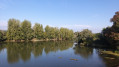
(S/E) Park in the car park opposite IPM Mondia or in the car park nearby. Take the small bridge on the left to join the Chemin de la Petite Levée, which runs alongside the Reyssouze. You’ll find yourself between two canals and under a hedge of lovely trees. Follow this tarmac path, which crosses a road, to reach the lock on the right.

(1) Go through the lock; with a bit of luck, you might see the boats manoeuvring as they pass through. Cross the D933A with care to reach a stony track.

(2) Turn right onto a tarmac track called ‘Charrières des moutons’ and stay on it.

(3) At the three-way junction, follow the road on the left which runs alongside a small stream and passes in front of the sewage treatment works.

(4) At the junction by the sewage treatment plant, take the road on the right, the ‘Chemin de Nizerel’, which continues as Rue Notre-Dame des Champs.

(5) At the end of the street, turn right onto Route de Fleurville, then leave this road to reach the Tourist Office.

(6) Continue along the small stony path on the right and follow it to the car park (S/E)

Waypoints

  1. S/E : mi 0 - alt. 574 ft - Car park opposite IPM Mondia
  2. 1 : mi 1.96 - alt. 571 ft - Lock - Canal de Pont-de-Vaux
  3. 2 : mi 2.76 - alt. 568 ft - T-junction on tarmac path - La Saône
  4. 3 : mi 3.85 - alt. 568 ft - Three-way junction, take the left-hand road
  5. 4 : mi 4.45 - alt. 574 ft - Junction near the sewage treatment works
  6. 5 : mi 4.97 - alt. 577 ft - Route de Fleurville
  7. 6 : mi 5.06 - alt. 571 ft - Stony path - Reyssouze (rivière)
  8. S/E : mi 5.19 - alt. 574 ft - Car park opposite IPM Mondia

Worth a visit

(1) Lock

(6) Water and Nature Centre / Tourist Office / Harbour Master’s Office.

Reviews and comments

4.5 / 5
Based on 2 reviews

Reliability of the description
5 / 5
Ease of following the route
5 / 5
Route interest
3.5 / 5
User 23078516

Overall rating : 4.3 / 5

Date of your route : Aug 23, 2025
Reliability of the description : ★★★★★ Very good
Ease of following the route : ★★★★★ Very good
Route interest : ★★★☆☆ Average
Very busy route : No

Please note before setting off on your hike that the route follows a motocross track...
To enjoy nature and the melodious sounds of wildlife, avoid days when a competition is taking place on the track.

unless you are a FAN, in which case you will be very close to the vehicles.

Machine-translated

legoeland
legoeland

Overall rating : 4.7 / 5

Date of your route : Mar 01, 2021
Reliability of the description : ★★★★★ Very good
Ease of following the route : ★★★★★ Very good
Route interest : ★★★★☆ Good
Very busy route : Yes

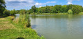
A really lovely, easy walk. The first section is shaded, running alongside the canal as far as the lock, whilst the second section is less sheltered – perhaps a bit exposed in very hot weather… You can take short breaks by the banks of the Saône, where the dogs can have a swim.

Machine-translated

Other walks in the area

For more walks, use our search engine .

The GPS track and description are the property of this route's author. Please do not copy them without permission.