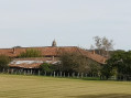
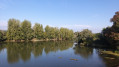
Meeting with Michel Poisat in Saint-Bénigne

This route will allow you to explore the village of Saint-Bénigne, characterised by scattered settlements grouped into numerous hamlets and divided in two by the D2 departmental road, the Route de Saint Trivier.

The walk starts at the town hall in Saint-Bénigne. The Church of Saint-Bénigne was built thanks to Michel Poisat (1802–1869) and his wife, whose tombs are located within this Neo-Romanesque church. Opposite the church, the half-timbered ‘house haute et basse’ is well worth a visit.

Details

n°45303934
Creation:
Last update:
Last review:
  • Walking
    Activity: Walking
  • ↔
    Distance: 4.62 mi
  • ◔
    Average duration: 2h 10 
  • ▲
    Difficulty: Easy

  • ⚐
    Back to start: Yes
  • ↗
    Ascent: + 30 ft
  • ↘
    Descent: - 30 ft

  • ▲
    Highest point: 705 ft
  • ▼
    Lowest point: 656 ft

Description of the walk

The route starts from the town hall in Saint-Bénigne.

(S/E) With your back to the town hall, set off to the left and walk past the school. At the junction on the corner of the school, turn left, then left again as you come out of the bend. Cross a road to reach the D2.

(1) Cross carefully and carry on straight ahead. At the junction, turn left onto the Route des Stades. Carry on straight ahead until you reach the junction with the cross, near the church of Saint-Bénigne. Ignore a road on the left to reach another Fork in the road.

(2) Turn left, then right onto a path between the houses. Carry on straight ahead until you reach the next road. Cut across this road and continue straight ahead until you reach the next road.

(3) Turn left, then first turn right then left, carefully crossing the main road.

(4) At the first junction, turn left towards Les Rippettes.

(5) Stay on the same path, passing through the hamlet until you reach a four-way junction. Turn right, pass through Léal and its houses, and arrive at a junction in the hamlet of Les Teppes Baudet.

(6) Turn left, pass a street on your right and, further on, reach a junction with a track.

(7) Head down this track to the left. At the road, keep to the right. Follow it as far as the next houses. Pass a path on the left, then take the next one coming from that direction and return to the town hall (S/E).

Waypoints

  1. S/E : mi 0 - alt. 676 ft - Town Hall
  2. 1 : mi 0.59 - alt. 692 ft - D2
  3. 2 : mi 1.2 - alt. 692 ft - Fork in the road near the Church of Sainte-Bénigne
  4. 3 : mi 1.75 - alt. 686 ft - Road
  5. 4 : mi 2.05 - alt. 696 ft - Junction
  6. 5 : mi 2.27 - alt. 702 ft - Les Rippettes
  7. 6 : mi 3.26 - alt. 686 ft - Les Teppes Baudet
  8. 7 : mi 3.58 - alt. 656 ft - Track
  9. S/E : mi 4.62 - alt. 676 ft - Town Hall

Worth a visit

- (2) Church of Sainte-Bénigne

Reviews and comments

4.2 / 5
Based on 2 reviews

Reliability of the description
4.5 / 5
Ease of following the route
4 / 5
Route interest
4 / 5
User 28139754

Overall rating : 5 / 5

Date of your route : Nov 27, 2025
Reliability of the description : ★★★★★ Very good
Ease of following the route : ★★★★★ Very good
Route interest : ★★★★★ Very good
Very busy route : No

The perfect route for this beautiful day!

Machine-translated

delirand
delirand

Overall rating : 3.3 / 5

Date of your route : Apr 07, 2025
Reliability of the description : ★★★★☆ Good
Ease of following the route : ★★★☆☆ Average
Route interest : ★★★☆☆ Average
Very busy route : No

The route description is clearly explained, except that the route is very poorly signposted: no colour coding and very few signposts, except towards the end of the route. Map: the route is fine, but it’s baffling that the hamlets are labelled differently . Despite all this, it’s a very peaceful route.

Machine-translated

Other walks in the area

For more walks, use our search engine .

The GPS track and description are the property of this route's author. Please do not copy them without permission.