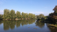
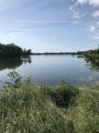
From mill to mill in Saint-Étienne-sur-Reyssouze

A pleasant walk taking you along a variety of paths – tarmac, stony and grassy – with sections crossing small streams and passing through small hamlets.

Details

3832040
Creation:
Last update:
Last review:
  • Walking
    Activity: Walking
  • ↔
    Distance: 8.53 mi
  • ◔
    Average duration: 4h 10 
  • ▲
    Difficulty: Moderate

  • ⚐
    Back to start: Yes
  • ↗
    Ascent: + 299 ft
  • ↘
    Descent: - 299 ft

  • ▲
    Highest point: 679 ft
  • ▼
    Lowest point: 581 ft

Description of the walk

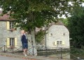
Start from the car park in the village square.

(S/E) From the car park, turn right towards the centre, then, at the hiking signposts on the right, take the stony path. Follow this until you reach the tarmac path, then turn left; you’ll come to a three-way junction.

(1) Turn onto the road on your left and continue towards the two football pitches.

(2) At the stadium, turn right onto a stony path leading tothe second football pitch. At the junction, turn left, follow this path to the farm and stay on the main path until you reach some houses.

(3) At the houses, take the tarmac path on the right (Route du Moulin) and continue due south

(4) At the junction, follow the tarmac path opposite.

(5) Cross the Route de Chavagnat (D80c) to reach the Chemin des Preusets and carry on straight ahead.

(6) Turn right onto the stony track, which bends left at a place called l’Enfer, and reach the D26.

(7) Cross it carefully to reach the grassy path opposite and arrive at an active quarry. Follow the grassy path between the two fences to reach the road, then turn right onto it.

(8) Before the ‘Caution: Animals’ sign, turn onto the track on the right to reach the last house on the track.

(9) Take the path on the left opposite the last house and continue due west.

(10) Turn right onto the tarmac road (Route du Villat), which leads back onto a path further along.
Carry on along this path to cross over the Leat des Brands.

(11) At the crossroads, turn left onto the path to join a tarmac road, which you’ll leave again at the bend. Carry on along another path until you come out onto the D26.

(12) At the Stop sign, cross the road carefully and carry on straight ahead along the tarmac path for a short distance until you reach another path. Follow this path until you reach the D80c, which you must cross to rejoin a tarmac path for a short distance.

(1) At the building, turn onto the track on the left until you reach the main road to Saint-Étienne-sur-Reyssouze, then turn left towards the car park at the village square (S/E).

Waypoints

  1. S/E : mi 0 - alt. 646 ft - Village square car park
  2. 1 : mi 0.41 - alt. 627 ft - Junction of the circular loop
  3. 2 : mi 0.67 - alt. 584 ft - Football pitches
  4. 3 : mi 2.16 - alt. 600 ft - Haute Serve. Near the - Reyssouze (rivière)
  5. 4 : mi 3.07 - alt. 673 ft - Junction
  6. 5 : mi 3.23 - alt. 676 ft - Crossing the Route de Chavagnat
  7. 6 : mi 3.85 - alt. 663 ft - Turn right at the fork
  8. 7 : mi 4.96 - alt. 676 ft - Crossing the D26
  9. 8 : mi 5.62 - alt. 646 ft - Sign: Beware of animals.
  10. 9 : mi 5.68 - alt. 656 ft - On the left, at the last house
  11. 10 : mi 6.19 - alt. 666 ft - Take the Chemin des Varvottes on the right.
  12. 11 : mi 6.77 - alt. 604 ft - On the left: Chemin de la Perriere.
  13. 12 : mi 7.63 - alt. 653 ft - Stop on the D26
  14. S/E : mi 8.53 - alt. 646 ft - Village square car park.

Notes

The starting point is in the village square car park, behind a hiking sign; the route is marked No. 10 and the signposts are purple.

The route can be completed on foot or by mountain bike.

Reviews and comments

3.8 / 5
Based on 3 reviews

Reliability of the description
4 / 5
Ease of following the route
4.3 / 5
Route interest
3 / 5
tenebre6683
tenebre6683

Hello, thank you for your feedback. Unfortunately, I followed the route of the walking trail, which wasn’t exactly a walk in the park to create.
When you’re out hiking, you need to venture a bit further afield to see things before heading back.
See you soon

Machine-translated

RandoM4ever
RandoM4ever

Overall rating : 2.7 / 5

Date of your route : May 29, 2021
Reliability of the description : ★★★☆☆ Average
Ease of following the route : ★★★★☆ Good
Route interest : ★☆☆☆☆ Very disappointing
Very busy route : No

I was expecting to see more windmills, given the name of the walk, and spaced out along the route.
This wasn’t the case; the mills are at points 2 and 3. Point 2: carry on straight ahead, passing the football pitch on your right, and the mill (in a sorry state) is a little further on after a bend. Point 3: turn left before following the route markers. The mill is a little further on, and a small stone bridge just after it is a good spot to sit and take a break in the shade of the bamboo.
It’s a shame these details weren’t specified.
As for the rest of the walk, don’t do it in the height of summer as there are few wooded sections. A very monotonous circular loop, in my opinion.

Machine-translated

Michannie
Michannie

Overall rating : 4 / 5

Date of your route : May 09, 2021
Reliability of the description : ★★★★☆ Good
Ease of following the route : ★★★★☆ Good
Route interest : ★★★★☆ Good
Very busy route : No

The signposting could do with a bit of a refresh, but with visorando’s explanations we’re managing quite well.

Machine-translated

AscleKef
AscleKef

Overall rating : 4.7 / 5

Date of your route : Apr 24, 2021
Reliability of the description : ★★★★★ Very good
Ease of following the route : ★★★★★ Very good
Route interest : ★★★★☆ Good
Very busy route : No

A very pleasant and easy walk through the Bresse countryside. At points 2 and 3, do feel free to take a short detour to visit the nearby mills on the River Reyssouze.

Machine-translated

Other walks in the area

For more walks, use our search engine .

The GPS track and description are the property of this route's author. Please do not copy them without permission.