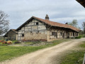
The flavours of the Bresse region in Chevroux

This route allows you to explore the village of Chevroux with its traditional Bresse architecture, the hedgerows, the poultry farms, and the ‘poypes’ of Curtetrelle and La Bourchardière.

Details

n°45303229
Creation:
Last update:
Last review:
  • Walking
    Activity: Walking
  • ↔
    Distance: 7.66 mi
  • ◔
    Average duration: 3h 40 
  • ▲
    Difficulty: Moderate

  • ⚐
    Back to start: Yes
  • ↗
    Ascent: + 135 ft
  • ↘
    Descent: - 144 ft

  • ▲
    Highest point: 679 ft
  • ▼
    Lowest point: 591 ft
  • ⚐ Country: France
  • ⚐ City: Chevroux (01190)
  • ⚑
    Start/End: N 46.38101° / E 4.94793°
  • ❏
    IGN map(s): Ref. 3028OT
  • Hour-by-hour weather

Photos

Description of the walk

Start at Chevroux Town Hall

(S/E) From the town hall car park, with the town hall on your left, continue along the Route de la Fougère. Then pass the cul-de-sac of the same name and the football pitches on your left. At the junction, carry straight on and head for the crossroads marking the end of the circular route.

(1) Turn left onto the Route de la Croix. Take the first turn right then left to walk alongside the houses in Les Mouilles. Follow the road to La Fayolle.

(2) Here too, first turn left then right. Pass a tarmac path on your left. Further on, turn right onto the road, then carry on straight ahead with the buildings of the Ancien Château on your right. At the sewage treatment works, head straight on towards Fromental. Pass the houses to reach a crossroads.

(3) Follow the track on the right. At the next Fork in the road, turn right and walk alternately alongside a wood on the left, then another on the right, until you reach the edge of the Bois Fillau.

(4) Turn left and, at the next crossroads, turn right. Then carry on straight ahead until you reach the houses at Liocher.

(5) Take the tarmac road. Cross La Bouchardière and, at the end of the road, turn left onto the Route de la Bresse. Then take the first right. Continue along a track until you reach a four-way junction.

(6) Turn right towards Les Vernes.

(7) Take the road, keeping to the right twice, until you rejoin the Route de la Bresse.

(8) Carry on almost straight ahead towards Curtetrelle. Pass a cul-de-sac on the right by a pond, then carry on straight ahead at the bend. Further on, turn onto the track on the left towards the stream.

(9) Cross the stream and take a left-hand bend, then another right-hand bend. Join the road at Mollard. Head uphill to the Mont farm.

(10) Turn 90° to the right, then right again at the crossroads. Take the first track on the left and, at its end on the right, rejoin the crossroads from the outward journey.

(1) Return to the starting point by following the route in reverse. (S/E)

Waypoints

  1. S/E : mi 0 - alt. 669 ft - Town hall
  2. 1 : mi 0.39 - alt. 669 ft - Junction of the circular loop
  3. 2 : mi 1.13 - alt. 666 ft - Fayolle
  4. 3 : mi 2.28 - alt. 617 ft - Crossroads after Fromental
  5. 4 : mi 2.99 - alt. 604 ft - Bois Fillau
  6. 5 : mi 3.69 - alt. 663 ft - Liocher
  7. 6 : mi 4.58 - alt. 673 ft - Four-way crossroads
  8. 7 : mi 5.04 - alt. 679 ft - Les Vernes
  9. 8 : mi 5.52 - alt. 673 ft - Route de la Bresse
  10. 9 : mi 6.14 - alt. 597 ft - Stream
  11. 10 : mi 6.72 - alt. 666 ft - Ferme du Mont
  12. S/E : mi 7.66 - alt. 669 ft - Town hall

Worth a visit

The village of Chevroux.

The Romanesque church (off the route), with its interior frescoes, was built between the 13th and 14th centuries.

Reviews and comments

4 / 5
Based on 2 reviews

Reliability of the description
4 / 5
Ease of following the route
4.5 / 5
Route interest
3.5 / 5
Bobby Socks
Bobby Socks

Overall rating : 3.7 / 5

Date of your route : Mar 25, 2024
Reliability of the description : ★★★★☆ Good
Ease of following the route : ★★★★☆ Good
Route interest : ★★★☆☆ Average
Very busy route : No

Please take care in wet weather; avoid the path through Bois Fillau between points 4 and 5: it is muddy and the ruts are filled with water.
Take the path at the edge of the woods instead to reach Liocher

Machine-translated

PASCALE c
PASCALE c

Overall rating : 4.3 / 5

Date of your route : Mar 09, 2024
Reliability of the description : ★★★★☆ Good
Ease of following the route : ★★★★★ Very good
Route interest : ★★★★☆ Good
Very busy route : No

A lovely walk, but best done when the ground is dry: we did it the day after it had rained and had to turn back and take a different route between points 4 and 5 because the walking route was impassable (lots of mud and water).
We used a GPS to follow the route.
The estimated time given is more than enough.

Machine-translated

Other walks in the area

For more walks, use our search engine .

The GPS track and description are the property of this route's author. Please do not copy them without permission.