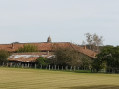
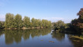
The mill and ponds as seen from Vescours

A lovely walk that allows you to discover the farm with its Saracen chimney in the hamlet of Montalibord, with its pond, by taking a short detour of 1 km there and back.
Along the route, there are other ponds and a sign mentioning an old mill on Étang Morel.

Details

16202968
Creation:
Last update:
Last review:
  • Walking
    Activity: Walking
  • ↔
    Distance: 8.75 mi
  • ◔
    Average duration: 4h 05 
  • ▲
    Difficulty: Moderate

  • ⚐
    Back to start: Yes
  • ↗
    Ascent: + 43 ft
  • ↘
    Descent: - 43 ft

  • ▲
    Highest point: 702 ft
  • ▼
    Lowest point: 633 ft
  • ⚐ Country: France
  • ⚐ City: Vescours (01560)
  • ⚑
    Start/End: N 46.472485° / E 5.025013°
  • ❏
    IGN map(s): Ref. 3027SB, 3127O
  • Hour-by-hour weather

Photos

Description of the walk

(S/E) Park in the car park opposite Vescours church, then head towards the houses in front of the church gates. Follow the yellow signposts, take the cul-de-sac and cross a small wooden bridge to reach a field. Go round the field and follow the edge of a meadow, which will lead you to the Route du Mont.

(1) At the road, follow the 14 km route which turns left towards Étang de Montalibord.

(2) At the fork in the road, follow the tarmac path on your left, which will take you to the Montalibord lodge, where you can see the farm with its Saracen chimney and, as you pass, the pond; then turn back to return to the junction. Continue along the road until you reach the path on your right, which you should follow to rejoin the Route du Mont. The 12 km route joins yours at this junction.

(3) Follow the road to the left until you reach the junction with the D 58.

(4) Turn left, then right, to reach a junction. Do not follow the path opposite, but turn right towards Les Vernays and continue along the Route des Vernays. You must keep going straight on, ignoring any other junctions along the way.

(5) In the hamlet of Les Communes, carry on straight ahead along the Route de Communes, then veer slightly to the left to follow the Route des Sermoyer until you reach the junction leading to the hamlet of La Vavre.

(6) At the junction, turn right to reach the hamlet of La Vavre. Ignore the first path on your left and carry on along the road.

(7) Atthe second track on the left, turn onto it. It will take you across a ford leading to a pond. At the end of the track, turn right onto the Route des Bourdons until you reach the next junction.

(8) Follow the stony track straight ahead, then turn right to join the Route des Romenay (D 58), which you’ll need to cross carefully to reach the other side.

(9) Turn left towards the hamlet of Les Barbiers, following the Chemin de la Gate.

(10) At the junction, turn right twice towards the hamlet of Les Varennes, which you will pass through.

(11) Continue along the Impasse des Varennes, which leads onto a dirt track.

(12) Follow the dirt track to the right, then turn right again at the hamlet of Maison Blanche. You’ll see the Étang Morel in front of you. Turn left to reach the old Étang Morel mill.

(13) At the mill, carry straight on and ignore the paths on either side; stay on the Route du Moulin.

(14) At a crossroads, turn left, then keep to the right to reach the hamlet of Locel, where you should turn right and carry on straight ahead towards Vercours to return to the starting point (S/E).

Waypoints

  1. S/E : mi 0 - alt. 676 ft - Car park - Église Notre-Dame de l'Assomption (Vescours)
  2. 1 : mi 0.45 - alt. 696 ft - Route du Mont
  3. 2 : mi 0.81 - alt. 673 ft - Access to the - Étang de Montalibord
  4. 3 : mi 1.87 - alt. 689 ft - Junction with the Route du Mont
  5. 4 : mi 2.23 - alt. 696 ft - Junction with the D58
  6. 5 : mi 3.21 - alt. 696 ft - The Villages
  7. 6 : mi 3.67 - alt. 696 ft - T-junction towards La Vavre
  8. 7 : mi 4.07 - alt. 689 ft - Junction on the herb trail
  9. 8 : mi 4.8 - alt. 692 ft - Crossroads
  10. 9 : mi 5.36 - alt. 689 ft - Junction towards the hamlet of Les Barbiers
  11. 10 : mi 6.09 - alt. 689 ft - Junction
  12. 11 : mi 6.56 - alt. 689 ft - The hamlet of Les Varennes
  13. 12 : mi 6.95 - alt. 686 ft - Dirt track on the right
  14. 13 : mi 7.57 - alt. 653 ft - Étang Morel Mill - Étang Morel
  15. 14 : mi 8.01 - alt. 692 ft - Crossroads
  16. S/E : mi 8.75 - alt. 676 ft - Car park - Église Notre-Dame de l'Assomption (Vescours)

Worth a visit

(13) Étang Morel Mill and its pond.

Reviews and comments

4.3 / 5
Based on 2 reviews

Reliability of the description
4.5 / 5
Ease of following the route
4.5 / 5
Route interest
4 / 5
User 22328572

Overall rating : 4 / 5

Date of your route : Mar 02, 2026
Reliability of the description : ★★★★☆ Good
Ease of following the route : ★★★★☆ Good
Route interest : ★★★★☆ Good
Very busy route : No

We set off from the church car park and chose the route around Morel Pond and Montsymond Castle, returning to our starting point. A lovely 7 km walk.

Machine-translated

cuzcodom
cuzcodom
• Edited:

Overall rating : 4.7 / 5

Date of your route : Jul 02, 2023
Reliability of the description : ★★★★★ Very good
Ease of following the route : ★★★★★ Very good
Route interest : ★★★★☆ Good
Very busy route : No

A lovely walk, best avoided during a heatwave...
No more Morel Pond (it’s dry) and no more Saracen’s Chimney... What a shame...

Machine-translated

Other walks in the area

For more walks, use our search engine .

The GPS track and description are the property of this route's author. Please do not copy them without permission.